Frequent readers may have observed that I have not updated this blog for some time. Due to changes in my personal arrangements I have run out of spare time! My computer has also died! I have therefore had to put this blog on hold until I can find some more time and purchase a new computer. I envisage this will probably be late December. Until then, there may be an isolated post or two but I can't promise anything. Sorry all.
I have had some opportunity to update the rocks of the region page.
Monday, 24 October 2016


Sunday, 21 August 2016
Cutting Through Mysterious Granite on a Country Highway
Australia is known for its remoteness. There are some quite remote areas in the Northern Rivers too. Along the escarpment there are rugged areas and visitors are rare. This means that sometimes rocks even though mapped broadly have geological units that have not been researched enough to relate them to surrounding units. It is a rare thing though, and rarely have rock units not been named, and categorised, even rarer is when a rock is found by the side of one of the national highways!
The picture shows a granite that is currently mapped as "unassigned Permian intrusive - felsic". There may have been some investigations here in the past. I just can't believe some place so obvious like this one has not been investigated in detail.
 |
| un-categorized granite on the New England Highway, Glencoe |
The picture shows a granite that is currently mapped as "unassigned Permian intrusive - felsic". There may have been some investigations here in the past. I just can't believe some place so obvious like this one has not been investigated in detail.
Monday, 25 July 2016
Blog Update #8
The Rocks of the Region page has been a big success and will continue to be expanded on. Unfortunately I've had very little time to do some actual blog posts recently. This is not for want of material (there is a huge range of topics and places just asking to be covered) but due to a change in my work commitments. I have taken up a new job with much longer days and therefore my free time is very limited. I have also relocated away from Lismore to Armidale and taken my family with me. We are still very much settling in.
Thank you to all the readers out there. I hope that I can continue to build a blog that is a good resource for the community to use. I guess there are people still reading this blog since there are more than 150 000 page views!
Coming up soon... what is going on with this rock?
Thank you to all the readers out there. I hope that I can continue to build a blog that is a good resource for the community to use. I guess there are people still reading this blog since there are more than 150 000 page views!
Coming up soon... what is going on with this rock?
 |
| Coming up |
Wednesday, 6 July 2016
Geology of the Big Scrub Rainforest (Part 4)
Tasman Sea to the Alstonville Plateau
Following the
Cretaceous during the Paleogene and possibly as a result of the action of the
Tasman Sea formation, volcanic systems began to form throughout parts of
eastern Australia. In the New England, the Hunter and Sydney areas swiftly flowing lavas
erupted from long vents and covered large areas with basalt. The same
thing happened in our region and until now it is one of the relatively unknown
parts of our history. At around 43Ma during the Eocene
Epoch basalt lava flowed from vents somewhere in the area now known as the
Alstonville Plateau (The area between Lismore to Lennox Head). The lava flow
(called the Alstonville Basalt) tended to flow towards the North and West
because the hills of the Blackhall Range formed a barrier to the South. The old
Wilsons River seems to have been deflected from its southerly course and sent
inland to join the Richmond River as lava flows dammed off the rivers original
course. Small lakes were formed where the lava flows dammed streams and created
little areas of sedimentary rock known as diatomite and even poor quality opal.
It is interesting to note that during the 20th century diatomite was
even been mined for use as a filter medium from layers between basalt at
Tintenbar and Wyrallah.
Layers of diatomite
were subsequently covered by new layers of lava and during the time between
lava flows rich red soils developed and were subsequently covered by new lava. The
rate of soil formation was high during this time because the world climate was
the warmest (more than 10 degrees C hotter than the average today) it had been
for 400 million years and be when combined with atmospheric moisture this time
was known as the Mid-Eocene Climate Optimum. The lava covered soils (known as
paleosols) are important today because they are conduits for groundwater (aquifers)
which create long lasting springs resulting continually running streams and
ecosystems dependent upon them. The aquifers are also drilled into for
groundwater for some of the livestock, irrigation and town water supply on the
Alstonville Plateau today. Eventually, the eruptions stopped and lovely fertile
deep red soils developed and continue to develop today.
Thursday, 30 June 2016
Rocks of the Region Page
Sometimes pictures say more than words can. I have created a reference web page that has
links to my Flickr pictures of most of the major stratigraphic units of
the region. Here you can see pictures of rocks, minerals, landscapes and
unusual features that within each of the rock units. Locations of each
picture are provided in Flickr so that you can check these out for
yourself if you are that eager!
In addition I've provided a link to the stratigraphic unit description in Geoscience Australia's Stratigraphic Name Database.
The whole exercise will never end. It is a work forever in progress. Let me know if you have a wish list of photographs. Click the photograph below to go to the reference page.

In addition I've provided a link to the stratigraphic unit description in Geoscience Australia's Stratigraphic Name Database.
The whole exercise will never end. It is a work forever in progress. Let me know if you have a wish list of photographs. Click the photograph below to go to the reference page.
http://nrgeology.blogspot.com.au/p/rocks-of-region.html
Monday, 30 May 2016
Geology of the Big Scrub Rainforest (Part 3)
Gondwana
The late Jurassic and
Cretaceous marks a very important geological time. It is the time that the huge
supercontinent of Pangea broke up. This when Gondwana became its own continent
with present day Australia and Antarctica being a large part of a new smaller,
but still impressive super-continent. Our region was actually quite close to
the pole but, yet temperatures in our area were quite warm because the climate
of whole of the earth was warmer and wetter than it is today. Life was abundant
because summer days were nearly 24 hours long and the concentration of carbon
dioxide in the atmosphere along with the warmth and moisture super-charged
plant growth (in fact permanent ice did not exist anywhere on earth at this
time). It was at this time that many of the plants synonymous with Australia
and more specifically the ‘Bigscrub’ began their evolution (including the plant
order Myrtales which includes eucalypts, bottlebrushes and lillypillys).
As the Jurassic gave
way to the Cretaceous period big changes continued. India followed by
Antarctica began to separate from Gondwana and finally at around 80Ma the
Tasman Sea started to form. Prior to the Tasman Sea formation the landmass
extended hundreds or even thousands of kilometers to the east before reaching
the sea. The Tasman Sea caused major changes to the landscape. This area is
known as Zealandia and as separation occurred it sank below the sea and is now
known as the Lord Howe submarine rise. A bit like the mythical land of
Atlantis, a huge land submerged under the ocean. The Australian continent now
finishing only several of kilometres off the coast from the future Cape Byron. The
detachment of Zealandia reduced the weight on the eastern side of Australia
which then began to rise and form many of the inland ranges that now make up
the Great Dividing Range. This continental crust “rebound” would progress over
a long time and by the end of the Cretaceous the physical form of Eastern
Australia was set for its last major changes through the actions of volcanoes.
Tuesday, 17 May 2016
Science, Philosophy and Politics
It is popular these days to start with a narrative and make the data fit in. Rarely do we think about alternative hypotheses other than our own already established professional narrative. Because researchers today rely on their reputation they must defend their theories or apparently loose credibility. Ironically, the most credible scientists are those willing to admit they may be incorrect.
Scientists today often delve into the areas of political intrigue. When this happens the scientists pet narrative becomes a fortress that must be protected. No one can criticize it because the scientist will see it as a personal affront since his whole credibility has been placed on the line. This in turn turns peers off from suggesting alternative hypotheses because they know if they make such a suggestion the whole thing will become a fight. Even suggesting an alternative that is not as popular as the politically expedient one can result in aggression, ostracism and public ridicule. No wonder scientists often find hiding in their laboratories the most rewarding experience!
When scientific concepts are backed by politics you know that you are onto ground that is not necessarily scientific. So with that in mind, here is a diagram that covers all the issues today that arise during scientific inquiry. This includes the moral, philosophical and political reasons for undertaking scientific research.
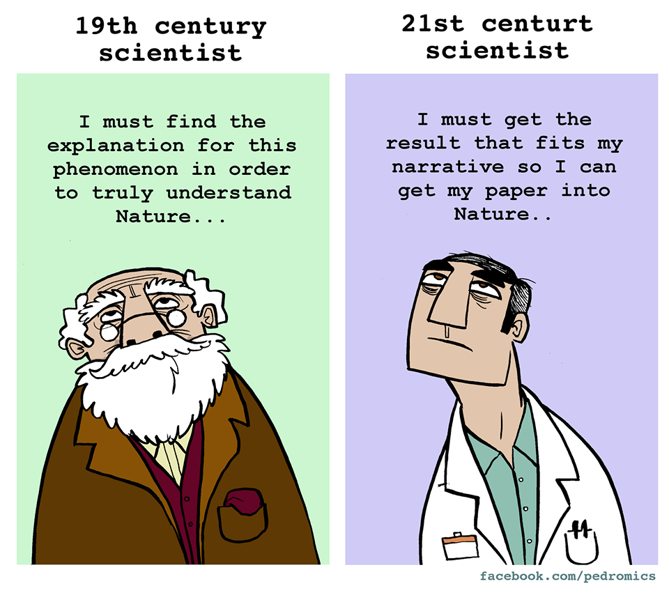
As a geological example that was publicized a couple of years ago in Nature on the problems with the mantle plume hypothesis. Even though the article recognizes many problems with the theory it demeans a group of scientists who have proposed alternatives that fit a wider range of data. It gently denegrates an alternative hypothesis by suggesting only a small number and therefore fringe group have advanced the hypothesis:
"No matter what the Réunion study finds, its results are unlikely to convince the few critics of the plume hypothesis."
Essentially, it is the anti-scientific idea of "consensus science" that is beginning to pervade all areas of inquiry. Some of these scientists responded here is a link to a letter to the journal Nature. Unfortunately for the general public even to view this correspondence requires $18 just to read it (such is the nature of journals these days).
Subscribe to:
Posts (Atom)