Antimony is a metal that is very well represented in our region. Many people have not heard of antimony as it is one of those elements that is ‘hidden away’ in many metal alloys and plastics and therefore often outshone by the more well known ones such as Iron, Nickel, Cobalt etc. It is a very important element for use in electronics and to modify the properties of rubber and plastics. It is even used in the cosmetics industry and HIV treatment medication (Wilson et al 2010). The main antimony mineral is called stibnite, an antimony sulphide mineral with the chemical formula Sb2S3, though there are many other less common antimony minerals.
The geographical distribution of antimony mineralisation in the Northern Rivers and New England closely follows certain geological units intruded by granite type plutons during the Permian (Ashley & Craw 2004). Essentially these deposits fall into the category of mesothermal mineral deposits meaning that they were formed through the action of hot fluids under pressure within the earth. The heat source is from regional heat increase due to the intrusion of many granites and sometimes from the actual contact zone of individual intrusions. The source of the fluids can be existing water in sedimentary rock pore space and/or derived from the breakdown of hydrous minerals such as clays. This hot water (often accompanied by elevated salts) can dissolve elements such as antimony as well as others such as gold and silver and then as they cool these elements are redeposited. In practice this tends to mean that the elements are located within veins of quartz or carbonate.
Probably the best known deposit of antimony is the Hillgrove Mine east of Armidale. The mine is in the headwaters of the Macleay River and was first mined for gold at the end of the nineteenth century. Indeed Hillgrove had a gold rush of such size that it was much bigger than Armidale (now its population is less than a hundred, I think). But many other areas have extensive mineralisation of antimony such as the area to the west of Bowraville in the headwaters of the Nambucca River catchment, areas north of Dorrigo in the headwaters of the Nymboida River catchment and even areas as far north as Tooloom which is to the north of Drake in the upper portions of the Clarence River catchment. Some of these deposits have been mined historically, though in the main gold has been the target and antimony just a by-product.
Antimony is an interesting element because it is chemically closely related to arsenic and therefore behaves in a similar way. This means it can also be dangerous in high concentrations and its environmental impact can be significant at even moderate to low levels, however, the nature of antimony has not been as extensively researched as arsenic and therefore the drinking water and environmental limits in Australia have been set lower than arsenic to increase the safety margin in assessing whether there is likely to be an adverse impact (Ashley et at 2004).
Interestingly, unlike many other elements that can be mobilised by the creation of sulphuric acid during the oxidation of the parent sulphide mineral, antimony tends not to remain in solution for long because the nature of the mineralisation model is such that carbonates are often present which neutralises the acids and leads to settling out of the antimony from the water column with iron and other metals. However, if the sediment is transported then this can be deposited a huge distance from its source and in some situations can be re-mobilized because of local stagnant water during dry periods combined with the presence of natural humic acids. This behaviour has been observed in the Macleay River catchment as suspended sediment from the areas around Hillgrove has been deposited on the flood plains as far away as Kempsey, very low concentrations of antimony are usually found in clear, clean water in the region. However, Wilson et al (2010) has shown that sometimes high antimony contents of alluvial soils can lead to uptake by flora and therefore this contaminant can then be accumulated in animals that graze on these plants.
References/bibliography:
*Ashley, P.M. & Craw, D. 2004. Structural controls on hydrothermal alteration and gold-antimony mineralisation in the Hillgrove area, NSW, Australia. Mineralium Deposita v39.
*Ashley, P.M., Craw, D., Graham, B.P. & Chappell, D.A. 2003. Environmental mobility of antimony around mesothermal stibnite deposits, New South Wales, Australia and southern New Zealand. Journal of Geochemical Exploration v77
*Craw, D, Wilson, N. & Ashley, P.M. 2004. Geochemical controls on the environmental mobility of Sb and As at mesothermal antimony and gold deposits. Applied Earth Science (Transactions of the International Mineralogy and Metallurgy Bulletin). v 113.
*Wilson, S.C., Lockwood, P.V., Ashley, P.M., & Tighe, M. 2010. The chemistry and behaviour of antimony in the soil environment with comparisons to arsenic: a critical review. Environmetnal Pollution v158.
Wednesday, 26 December 2012
Thursday, 20 December 2012
Shaping the Australian Nation
 A free ebook was published by the Australian National University Press in August this year. It is the geological history of the Australian Continent by numerous authors and edited by Richard Blewett. The book is titled called Shaping a Nation: A Geology of Australia. If you are keen (or old fasioned like me) you can buy a hard cover copy of the book for $70. Have a quick look at the PDF first and you'll see how good it is and worth the expense.
The electronic copy of the book can be obtained at the following site:
http://epress.anu.edu.au/titles/shaping-a-nation
Thursday, 13 December 2012
A southern solitary island
How do you find out about something you can’t visit? From time to time I’ve wanted to visit sites that were on private land but I was unable to contact the landholder. More recently I find that the landholders do not want me on their land because of fears that I’m something to do with a gas company exploring for coal seam gas reserves (which I’m not). However, there is one place that is nearly impossible to get to because of its remoteness and the level of control that a government department have (for good reasons). I’d dearly like to visit this place because of the history, biology and of course the geology. The place is South Solitary Island off the coast of Coffs Harbour and Woolgoolga.
South Solitary Island has a lighthouse and an old lighthouse keepers residence which is disused and slowly deteriorating. It is perched on a rock that just sticks straight out of the sea. A few small islands are part of the island group but they are all really just rocks sticking out of the ocean. I understand that the National Parks and Wildlife Service licence visits by tourists to the island lighthouse once a year by helicopter. I’d love to go but unfortunately I don’t think I could afford such a trip.
The Solitary Islands (and the South Solitary Island in particular) is known to be rock comprised of turbidites (marine mass wasting derived sediments) derived from volcanic parent rock and ash-fall tuff (Korsch 1993). This same assemblage is present on the mainland throughout the area called the Coffs Harbour Block or Coffs Harbour Association and is considered Carboniferous in age. The stratigraphic unit is probably the Coramba beds which mean there is also the possibility that chert, jasper and metabasalt are present as they are elsewhere on the mainland.
I had no idea about the geology of South Solitary Island until I read Korsch (1993) in which he was permitted to visit all of the solitary islands to determine whether the concept of a giant fold (called an orocline) was present off the coast. If the orientation of the rock strata was right it would demonstrate that the area between Brooms Head and Coffs Harbour and then inland up through the Orara region and eventually looping back up into Queensland was a giant fold in the earth. Korsch (1993) did observe just such features and this has resulted in much further interest and research (including papers published in the last 12 months) about the tectonic history of the New England and Northern Rivers. I will go into more details about the extraordinary folding and tectonic history in future posts as there is an incredible amount of detail and unknowns when it comes to our area.
Oddly, Weber et al (1978) mentioned that a report from 1945 that there is an area of molybdenum mineral deposit on the South Solitary Island. The size of the island (and being a national park) is such that it could never be mined but it is such an unknown curiosity. Webber et al (1978) describes the deposits:
References/bibliography:
Korsch, R.J. (1993) Reconnaissance geology of the Solitary Islands: constraints on the geometry of the Coffs Harbour Orocline. New England Orogen Conference 1993, University of New England.
Weber, C.R., Paterson, I.B.L & Townsend, D.J. (1978) Molybdenum in New South Wales. Geological Survey of New South Wales 43.
 |
| North Solitary Island is also considered part of the Coramba Beds |
The Solitary Islands (and the South Solitary Island in particular) is known to be rock comprised of turbidites (marine mass wasting derived sediments) derived from volcanic parent rock and ash-fall tuff (Korsch 1993). This same assemblage is present on the mainland throughout the area called the Coffs Harbour Block or Coffs Harbour Association and is considered Carboniferous in age. The stratigraphic unit is probably the Coramba beds which mean there is also the possibility that chert, jasper and metabasalt are present as they are elsewhere on the mainland.
I had no idea about the geology of South Solitary Island until I read Korsch (1993) in which he was permitted to visit all of the solitary islands to determine whether the concept of a giant fold (called an orocline) was present off the coast. If the orientation of the rock strata was right it would demonstrate that the area between Brooms Head and Coffs Harbour and then inland up through the Orara region and eventually looping back up into Queensland was a giant fold in the earth. Korsch (1993) did observe just such features and this has resulted in much further interest and research (including papers published in the last 12 months) about the tectonic history of the New England and Northern Rivers. I will go into more details about the extraordinary folding and tectonic history in future posts as there is an incredible amount of detail and unknowns when it comes to our area.
Oddly, Weber et al (1978) mentioned that a report from 1945 that there is an area of molybdenum mineral deposit on the South Solitary Island. The size of the island (and being a national park) is such that it could never be mined but it is such an unknown curiosity. Webber et al (1978) describes the deposits:
Worthy of passing mention is an occurrence of molybdenite at the eastern extremity of the Demon Block. Narrow, molybdenite-bearing quartz veins have been reported from South Solitary Island, 16.5km northeast of Coffs Harbour, by Fisher (1945, p10). The host rock is unknown.The reason this is a little odd in my mind is because molybdenite is not very common in the Coffs Harbour Block. Some molybdenum formed in areas related to specific types of intrusions to the south in the nearby Nambucca Block (e.g. see my earlier post on the Valla Monzogranite) but to my knowledge this has not occurred to any significant extent in the Coffs Harbour Block. Just another slightly out of place geological feature in our region.
References/bibliography:
Korsch, R.J. (1993) Reconnaissance geology of the Solitary Islands: constraints on the geometry of the Coffs Harbour Orocline. New England Orogen Conference 1993, University of New England.
Weber, C.R., Paterson, I.B.L & Townsend, D.J. (1978) Molybdenum in New South Wales. Geological Survey of New South Wales 43.
Wednesday, 5 December 2012
Drake mining: managing a muddy mess
Sorry it has taken some time for me to post. I have had very little time of late because of some health problems my daughter has been having. But she is better than ever so time to get some time back into geology matters again.
Drake has a history of gold mining spanning back to 1886 when gold was dredged from Plumbago Creek. Since then the source of much of the alluvial gold was found just to the north of Drake. Many pits were created in the search for gold since the 1920s. These pits were relatively large mines in themselves and were given names such as White Rock, Carrington, Strauss, Lady Hampden and others. The mines were a source of wealth (during the good times) and a source of debt (during the bad times) with the mining operations completely ceasing in the 1990’s.
The formation of gold in the gold fields just north of Drake are a little difficult to put together as there seems to be more than one period of mineral formation in the rock. The parent rock is lavas and pyroclastic deposits including tuff which is of andesite to rhyolite in chemical composition. These rocks are called the Drake Volcanics which are part of the spatially significant Wandsworth Volcanic Suite. It appears that a caldera once developed in the area and fluids heated by magma transported gold and other metals and concentrated them. This is called an epithermal mineral deposit. However, Houston (1999) demonstrated that overprinting much of this epithermal stage is another chemically different period of mineralisation possibly related to different intrusive introducing mineralised fluids. And finally much of the area has been affected by supergene enrichment, which is enrichment caused by natural transport of minerals in groundwater and the percolation of rainwater.
Because financial stresses encourage people to take shortcuts to save money several things have happened at Drake that has caused elevated metal contamination to the environment of Plumbago Creek, a tributary of the Clarence River. Though sometimes people are just lazy or even ignorant of the possible impacts of incorrectly disposing of waste materials (Just like at home). Mineral deposits of the type at Drake contains minerals called sulphides, these include pyrite (iron sulphide), chalcopyrite (copper-iron sulphide) and sphalerite (zinc-iron sulphide). When exposed to air and water these minerals break down creating acids (called acid mine drainage) that cause the metals to be dissolved in any waters and therefore easily discharged into the environment. This is what has happened at the old pits near Drake and also at the waste dumps and even the access roads which were surfaced with waste rock.
But the story of the Drake mines also involve another waste material deliberately brought in from central Queensland. This material is referred to as Red Mud and is caustic (highly alkaline) waste material from aluminium refineries. But this is actually a good news story! Basic chemistry demonstrates that when you add acid and alkaline material together the material becomes neutral and metal contaminants precipitate out meaning any discharged water is decontaminated. Essentially an environmentally serious problem (disposal of aluminium refinery waste) has actually proven to be a resource. The trials and remediation of the pits was so successful that the technique was patented and a commercial product developed out of the Red Mud and given the name TerraB.
Application of the Red Mud was both as slurry pumped by ‘sprinkler’ directly into contaminated water left at the site or incorporated into waste rock or used as treatment liners. The picture shows one of the pits that I visited more than a decade ago when this technique was being trialled. It may look bad but really it is just suspended sediment that will settle out, while the acid and heavy metals have been neutralised. Some trials in waste rock have even found that Red Mud can actually reduce the uptake of heavy metals by plants, better than traditional rehabilitation techniques such as lime (Maddocks et al 2009).
The area around drake is interesting for many a geological reason, from its formation, the minerals found, the historical mining, contamination and rehabilitation. Who would have thought that adding two waste products together would fix both problems?! Two wrongs do make a right!
References/bibliography:
*Clark, M.W., Walsh, S.R. & Smith, J.V. 2001. The distribution of heavy metals in an abandoned mining area; a case study of Strauss Pit, the Drake mining area, Australia: implications for the environmental management of mine sites. Environmental Geology v40.
*Houston, M.J. 1999. The Geology and Mineralisation of the Drake Mine Area, Northern New South Wales. Papers, New England Orogen Conference, Armidale 1999.
*Maddocks, G., Lin, C. & McConchie, D. 2009. Field scale remediate of mine wastes at an abandoned gold mine, Australia II: Effects on plant growth and groundwater. Environmental Geology
Drake has a history of gold mining spanning back to 1886 when gold was dredged from Plumbago Creek. Since then the source of much of the alluvial gold was found just to the north of Drake. Many pits were created in the search for gold since the 1920s. These pits were relatively large mines in themselves and were given names such as White Rock, Carrington, Strauss, Lady Hampden and others. The mines were a source of wealth (during the good times) and a source of debt (during the bad times) with the mining operations completely ceasing in the 1990’s.
 |
| One of the old pits at Drake shortly after treatment with red mud |
Because financial stresses encourage people to take shortcuts to save money several things have happened at Drake that has caused elevated metal contamination to the environment of Plumbago Creek, a tributary of the Clarence River. Though sometimes people are just lazy or even ignorant of the possible impacts of incorrectly disposing of waste materials (Just like at home). Mineral deposits of the type at Drake contains minerals called sulphides, these include pyrite (iron sulphide), chalcopyrite (copper-iron sulphide) and sphalerite (zinc-iron sulphide). When exposed to air and water these minerals break down creating acids (called acid mine drainage) that cause the metals to be dissolved in any waters and therefore easily discharged into the environment. This is what has happened at the old pits near Drake and also at the waste dumps and even the access roads which were surfaced with waste rock.
But the story of the Drake mines also involve another waste material deliberately brought in from central Queensland. This material is referred to as Red Mud and is caustic (highly alkaline) waste material from aluminium refineries. But this is actually a good news story! Basic chemistry demonstrates that when you add acid and alkaline material together the material becomes neutral and metal contaminants precipitate out meaning any discharged water is decontaminated. Essentially an environmentally serious problem (disposal of aluminium refinery waste) has actually proven to be a resource. The trials and remediation of the pits was so successful that the technique was patented and a commercial product developed out of the Red Mud and given the name TerraB.
Application of the Red Mud was both as slurry pumped by ‘sprinkler’ directly into contaminated water left at the site or incorporated into waste rock or used as treatment liners. The picture shows one of the pits that I visited more than a decade ago when this technique was being trialled. It may look bad but really it is just suspended sediment that will settle out, while the acid and heavy metals have been neutralised. Some trials in waste rock have even found that Red Mud can actually reduce the uptake of heavy metals by plants, better than traditional rehabilitation techniques such as lime (Maddocks et al 2009).
The area around drake is interesting for many a geological reason, from its formation, the minerals found, the historical mining, contamination and rehabilitation. Who would have thought that adding two waste products together would fix both problems?! Two wrongs do make a right!
References/bibliography:
*Clark, M.W., Walsh, S.R. & Smith, J.V. 2001. The distribution of heavy metals in an abandoned mining area; a case study of Strauss Pit, the Drake mining area, Australia: implications for the environmental management of mine sites. Environmental Geology v40.
*Houston, M.J. 1999. The Geology and Mineralisation of the Drake Mine Area, Northern New South Wales. Papers, New England Orogen Conference, Armidale 1999.
*Maddocks, G., Lin, C. & McConchie, D. 2009. Field scale remediate of mine wastes at an abandoned gold mine, Australia II: Effects on plant growth and groundwater. Environmental Geology
Thursday, 22 November 2012
Boring fossils, but fossils none-the-less
Note that the stratigraphy of the Kangaroo Creek Sandstone has been recently revised since this blog post. See the this post for details.
In a previous post I discussed some interesting finds in the Dunoon and The Channon area. I discussed how the geological maps of the area are in places incorrect because coal was found in areas that were not expected to contain any. There are two old (Jurassic aged) sedimentary formations present in the area the younger one is called the Kangaroo Creek Sandstone. The Kangaroo Creek Sandstone is mainly comprised of quartz rich sands cemented together and altered by a later period where silica was precipitated on the sand grains creating what is called a saccharoidal texture.
The slightly older formation is called the Walloon Coal Measures and although It was known to occur in the area was not expected to be as widely found. The upper most part of Walloon Coal Measures in this area is a lithic sandstone, a sandstone where the sand grains are actually pieces of rock with different minerals including quartz and feldspar. This sandstone is much duller and weathers to form more silts and clays rather than sandy soils as you’d expect to be found around weathered Kangaroo Creek Sandstone.
The lithic sandstone also contains a fair amount of woody fossil fragments. I was surprised how easy it was to find some. The photo to the right shows some of the poor quality fossil wood (technical problems mean that I cant upload the photo - will sort this out soon hopefully). These fossils were located within several metres below the boundary between the Kangaroo Creek Sandstone and the Walloon Coal Measures. It was interesting though, that I could not recognise the type of boundary between these two units even though I could recognise them a short distance apart. That is, I don’t know whether the boundary was gradational or an unconformity.
Of course as far as fossils go, there are thick units of coal in the Walloon Coal Measures and there is no exception in this formation in the Dunoon area. Coal is accumulations of organic material such as leaves and wood and algae that has not been exposed to the oxidising environment before it is compressed by the overlying strata to turn it into a rock. When I was able to be involved in digging some excavator holes in the ground looking for some clay earlier this year I was surprised to see how much coal was present. The coal found was of course very weathered and degraded by the process of recent erosion and natural soil formation, but it burns a bit if you let it dry out (you are still better off getting fire wood).
I think what was most interesting for me was the way in which fossil material could be found wherever the Walloon Coal Measures outcrop. This means that they could be just about anywhere in the valleys in the Nimbin area or near Tabulam, on the way to Wooli, Coaldale Valley, all over the place. If you are interested in finding poor quality fossils grab a geological map and look for the boundary between the Kangaroo Creek Sandstone and Walloon Coal Measures.
In a previous post I discussed some interesting finds in the Dunoon and The Channon area. I discussed how the geological maps of the area are in places incorrect because coal was found in areas that were not expected to contain any. There are two old (Jurassic aged) sedimentary formations present in the area the younger one is called the Kangaroo Creek Sandstone. The Kangaroo Creek Sandstone is mainly comprised of quartz rich sands cemented together and altered by a later period where silica was precipitated on the sand grains creating what is called a saccharoidal texture.
The slightly older formation is called the Walloon Coal Measures and although It was known to occur in the area was not expected to be as widely found. The upper most part of Walloon Coal Measures in this area is a lithic sandstone, a sandstone where the sand grains are actually pieces of rock with different minerals including quartz and feldspar. This sandstone is much duller and weathers to form more silts and clays rather than sandy soils as you’d expect to be found around weathered Kangaroo Creek Sandstone.
 |
| Woody fossil in lithic sandstone |
The lithic sandstone also contains a fair amount of woody fossil fragments. I was surprised how easy it was to find some. The photo to the right shows some of the poor quality fossil wood (technical problems mean that I cant upload the photo - will sort this out soon hopefully). These fossils were located within several metres below the boundary between the Kangaroo Creek Sandstone and the Walloon Coal Measures. It was interesting though, that I could not recognise the type of boundary between these two units even though I could recognise them a short distance apart. That is, I don’t know whether the boundary was gradational or an unconformity.
 |
| A moderately thick layer of weathered coal |
I think what was most interesting for me was the way in which fossil material could be found wherever the Walloon Coal Measures outcrop. This means that they could be just about anywhere in the valleys in the Nimbin area or near Tabulam, on the way to Wooli, Coaldale Valley, all over the place. If you are interested in finding poor quality fossils grab a geological map and look for the boundary between the Kangaroo Creek Sandstone and Walloon Coal Measures.
Thursday, 15 November 2012
Some musings on coal seam methane
I thought I’d get myself in trouble again on the coal seam gas subject by having some musings on the public presentation by two academics at Southern Cross University last night. Of course the topic relates to the potential impact to the environment by the Coal Seam Gas Industry in the Northern Rivers. Research has been conducted by Dr Isaac Santos and Dr Damien Maher from the School of Environment, Science and Engineering. The subject of the presentation was a preliminary report on the status of water and air chemistry research at Tara in the southern Queensland Darling Downs which are being conducted Dr Santos and Dr Maher. This is up my alley and so I couldn’t help have some of my own thoughts of the matter. It is important to note that the research has not yet been published in a scientific journal as yet, but when or if it is, I will return to this topic. It is even more important to note that this post has no references as it is just some personal musings on the matter.
To summarise very, very broadly what the research appears to have found is evidence of methane directly attributable to geological derived methane gas stores (called thermogenic methane) as opposed to biogenic methane sources such as animals or organic matter decay in stagnant water, etc. This methane was measured in both surface water and in the air in an active coal seam gas extraction area in southern Queensland. The isotopes (isotopes are elements with slightly different numbers of neutrons in the atom, e.g. Carbon usually has either 13 or 14 neutrons) of the carbon that makes up methane (methane is a combination of carbon and hydrogen (CH4)) were measured during this process. The slightly different masses in these isotopes means that they have different stability in different environments (e.g. heating of coal would preferentially release one isotope over another). The isotopic composition can therefore be used to give an indication of whether the methane is biogenic or thermogenic.
Where the interesting bit comes in is where Dr Santos and Dr Maher then draw on some comparisons. They had a look at the Richmond River valley and took observations. The observations were different, the Richmond River valley showed lower concentrations of thermogenic methane relative to Tara. Their suggestion then arises that it is the active gas field in Queensland has higher levels of fugitive emissions as a direct result of the coal seam gas industry operating in there. This suggestion can then be extended to presume that should the industry develop in the Richmond River Valley the levels of methane in the air and water would also increase. Now, this is a reasonable chain of assumptions but there are some things missed if the data is not interpreted properly. From my cursory understanding of the data sets gathered by Dr Maher and Dr Santos there are two (potentially contradictory) variables that could significantly affect their findings:
- The actual amount of thermogenic methane may be underestimated because CSIRO researcher John Smith has shown that during or following catagenesis (generally geological formation of gas), some methane may be converted into carbon dioxide depending on the abundance of dissolved oxygen in any formation waters, this carbon dioxide can then be naturally reconverted into methane. The process during reconversion from carbon dioxide into methane preferentially uses the biogenic indicator isotope. This can then give the false impression that the methane is biogenic and therefore actually underestimating the effect of the coal seam gas industry on gas emissions.
- The assumption that the natural levels of gas dispersal though normal processes of gas dispersal is the same in south Queensland (Surat Basin and Gunnedah Basins) is the same as that in the Northern Rivers (southern Clarence-Moreton Basin) may be erroneous. The geological units are different both in the depositional, structural, deformational, and erosional history for these basins. This is important because sources of thermogenic gas can be close to the surface in the Surat and Gunnedah Basins but in the Richmond River Valley the gas bearing layers are mostly trapped by a thick succession impermeable rocks such as the Kangaroo Creek Sandstone and Grafton Formation. This may mean a comparison is not a reasonable thing to do and therefore that the gas in Queensland is naturally occurring and not as a result of anthropogenic impacts. The low level of thermogenic methane in the Richmond River valley may simply be a reflection of the geology and any development of the industry in the northern rivers may actually not increase the amount of methane in the local water and air.
During the survey carbon dioxide levels were also measured. The weird thing is that the levels of carbon dioxide in the Tara area was higher than that in the Richmond Valley. When coal seam gas is targeted the presence of carbon dioxide sometimes means that the gas has been affected by some process that has degraded the quality of the gas and therefore carbon dioxide rich resevoirs are not as good economically as low carbon dioxide ones. As such these high CO2 reservoirs tend not to be the tapped to the same degree. The abundance of CO2 is therefore confusing as it does not seem to fit cleanly into the picture of an athropogenically affected local atmosphere.
Dr Maher and Dr Santos have both demonstrated many useful and interesting environmental studies over the years. I have no question of their ability to collect good quality data. It is important to note though that Dr Maher did caution about jumping to the immediate conclusion that the results they observed were totally due to the gas industry. Both of the researches did say that it was important that further data was required to give a more definitive answer by determining whether the geological assumptions were correct.
My view at this stage is that we should not jump to conclusions that it is actually the gas industry that is causing the measurable difference in methane from one location to another… though it may well be. When people say the science demonstrates this or that it is important to note that there are assumptions made in interpreting data and those assumptions could actually understate impacts or even the opposite, overstate them. One thing I think is important to note is that we really don’t understand much of the world around us and therefore we don’t really know if what we see is due to us or not. Slowly we learn more and this helps, but there is so still far to go.
Sunday, 11 November 2012
In the hills of Valla and Nambucca Heads
The Valla Adamellite now termed the Valla Monzogranite to reflect modern naming conventions is an interesting small to medium sized intrusion about 10km north east of Nambucca Heads. It is one of the suites of coastal granites which are mostly I-Types (melted igneous material), this means that the coastal granites show abundances of ore minerals within the granite or in the surrounding metamorphosed country rocks. A monzogranite is a granite with roughly equal proportions of (alkali-feldspar (potassium and sodium rich) and plagioclase feldspar (calcium rich)). The monzogranite is thought to have formed during the Triassic period.
The metamorphic aureole for the Valla Monzogranite is actually quite interesting as it shows a classic zonation of metamorphism (high grade at the contact grading to low grade further away) and also excellent examples of mineral zonation associated with metasomatism (hot-water or fluid alteration of rock). The Valla Monzogranite has been shown to be associated with gold, silver, arsenic and molybdenum mineralisation (as well as others). The rock that the monzogranite has been intruded into is called the Nambucca Beds which are part of the Nambucca Block. The Nambucca Beds are Permian to Carboniferous in age and are mainly comprised of the regionally metamorphic rock type called phyllite which was originally deposited on the sea floor. The Nambucca Block was accreted onto the Australian continent in the New England Orogen and this caused the regional metamorphism of the beds.
The Valla Monzogranite seems to be a Climax Molybdenum Deposit named after the Climax Mine in North America. This means that when the Monzogranite was cooling the upper portion of the pluton became residually enriched with fluids, metals and silica. These fluids cause alteration of the upper portion of the pluton forming what is called greisen and also are injected into the surrounding rock through veins and sometimes aggressively through breccia pipes. One of the first minerals to form in these veins is silica, quartz with metal sulphide such as molybdenite (molybdenum ore) and wolframite (tungsten ore). Further away from the intrusion the degree of alteration becomes less grading through potassic through to argillic which are defined alteration zones based on the changes in the rock forming minerals. As the degree of alteration becomes less so the types of metal ores change with increasing amounts or arsenic, gold and silver. Further out in the alteration zone minerals such as galena form (lead ore) and finally stibnite (antimony ore). These ore deposits seem to be fairly common in the New England area with Glen Eden being the most studied (Somarin 2001, Somarin & Ashley 2004) and have in some areas been extensively explored such as Kingsgate east of Glen Innes.
Some attempts of mining have occurred in the Valla Monzogranite in the past, the most significant being the Valla Gold mine which was located just to the north of Valla Beach. The mine was abandoned with very little rehabilitation and therefore has become an environmental problem for the local creek. However, rehabilitation efforts have recently been undertaken, though these will need another post to discuss in more detail.
References/bibliography:
*Somarin, A.K. 2011. Petrography, Geochemistry, and Petrogenesis of Late-Stage Granites: An Example from the Glen Eden Area, New South Wales, Australia. Earth and Environmental Sciences.
*Somarin, A.K. & Ashley, P.M. 2004. Hydrothermal Alteration and Mineralisation of the Glen Eden Mo-W-Sn deposit: A Leucogranite related hydrothermal system, southern New England Orogen, NSW, Australia. Mineralium Deposita.
The metamorphic aureole for the Valla Monzogranite is actually quite interesting as it shows a classic zonation of metamorphism (high grade at the contact grading to low grade further away) and also excellent examples of mineral zonation associated with metasomatism (hot-water or fluid alteration of rock). The Valla Monzogranite has been shown to be associated with gold, silver, arsenic and molybdenum mineralisation (as well as others). The rock that the monzogranite has been intruded into is called the Nambucca Beds which are part of the Nambucca Block. The Nambucca Beds are Permian to Carboniferous in age and are mainly comprised of the regionally metamorphic rock type called phyllite which was originally deposited on the sea floor. The Nambucca Block was accreted onto the Australian continent in the New England Orogen and this caused the regional metamorphism of the beds.
 |
| The Nambucca Beds are intruded by the Monzogranite. The Beds are extensive and extend far into the rugged Nambucca Hinterland. This photo is west of Bowraville. |
Some attempts of mining have occurred in the Valla Monzogranite in the past, the most significant being the Valla Gold mine which was located just to the north of Valla Beach. The mine was abandoned with very little rehabilitation and therefore has become an environmental problem for the local creek. However, rehabilitation efforts have recently been undertaken, though these will need another post to discuss in more detail.
References/bibliography:
*Somarin, A.K. 2011. Petrography, Geochemistry, and Petrogenesis of Late-Stage Granites: An Example from the Glen Eden Area, New South Wales, Australia. Earth and Environmental Sciences.
*Somarin, A.K. & Ashley, P.M. 2004. Hydrothermal Alteration and Mineralisation of the Glen Eden Mo-W-Sn deposit: A Leucogranite related hydrothermal system, southern New England Orogen, NSW, Australia. Mineralium Deposita.
Thursday, 1 November 2012
Softer sediments in the Wilsons River Valley
I’ve recently been observing an interesting environmental restoration programme on the Wilsons River upstream of Lismore. During this programme I started to think about the flood plain of the river and ‘recent’ geological history of the area. Cotter 1998 and in his earlier undergraduate work developed a concept of the geomorphology due to the lava flows associated with the Tweed Volcano and the earlier Alstonville Basalt. I did an earlier post on the flow direction of the Wilsons River as related to the volcanic history of the area but I’ve done just about nothing on the post volcanic sequences.
The best work done on the ‘recent’ sedimentary formations of the Wilsons River valley was a PhD thesis, Drury 1982. This was done as part of the then Water Resources Commission (now State Water) back when NSW government departments actually collected new information to guide future decision making (oops, there is a political comment in there). Drury 1982 was a huge thesis that provides a vast amount of information on the development of the Richmond Valley based mainly on the groundwater bores operating at the time supplemented by some (then) new drilling and geophysical techniques. To my knowledge no significant further published scientific assessment of the Quaternary sequences has occurred since Drury's thesis was written.
It is probably hard to follow the stratigraphy very easily so hopefully my sketch to the left which is based on Drury’s work helps. Drury 1982 indicates that the upper most layer of sediment in the Wilsons River and Leycester Creek valleys upstream from Lismore was unsurprisingly, flood plain sands, silts and clays which continue to be deposited today following floods. Conformably underlying this flood plain sediment the material encountered is called the Green Ridge formation. This formation appears to be a delta system being built at the end of the Upper Pleistocene (~12,000 years ago). Often the top of the Green Ridge Formation is cut by the Wilsons River and its tributaries, for instance at Boat Harbour Nature Reserve the lower banks of the river seem to be quite deep maybe even cutting into the even older formations (e.g. the Gundurimba Clay). Drury (1982) demonstrated that the Green Ridge formation is both contemporary with and overlies the Gundurimba Clay, which is made from estuarine clays.
The Gundurimba Clay is a unit was formed during a period of relatively high sea level (higher than the present day) and warmer conditions. Shells were common but coral was found maybe indicating the idea that the area where the Gundarimba Clay was being deposited went through a warmer spell than we experience now. Drury 1982 identified pollen spores indicating the surrounding area was dominated by rainforest with some eucalypt forest too, in my mind this creates a picture that it was possibly a proto-‘Big Scrub’ low-land rainforest with the ‘Big Scrub’ proper forming after the next cold period at the beginning of the Holocene. However worth noting that the Upper Pleistocene is recognised around the world as starting off in a warm period turning into a glacial period with the last glacial maximum occurring around 22,000 years ago.
Drury 1982 demonstrated that preceding the deposition of the Gundurimba Clay there was a period of erosion meaning that the Gundurimba Clay unconformably overlies the South Casino Gravel. The South Casino gravel in turn uncomformably overlies the Cenozoic volcanic rocks of the Lismore and/or Alstonville Basalt. The South Casino gravel is at least Middle Pleistocene in age and is derived from the erosion of the underlying volcanics. Given its coarse nature it is highly permeable and is considered a good source of groundwater in other parts of the Richmond Valley but to my knowledge is rarely used in the Wilsons River area.
I'm probably trying to combine a lot into this one post so I'll have to tease out the details a bit more in future posts, especially that relating to the Gundurimba Clay and palaeo-environmental conditions which I know at least some of my blog readers have a keen interest in. At least I hope that this provides a starting point.
References/bibliography:
*Drury, L.W. 1982. Hydrogeology and Quaternary Stratigraphy of the Richmond River Valley, New South Wales: In Two Volumes. PhD thesis, University of New South Wales.
*Cotter, S. 1997. A Geochemical, Palaeomagnetic and Geomorphological Investigation of the Tertiary Volcanic Sequence of north eastern New South Wales. MSc thesis, Southern Cross University.
The best work done on the ‘recent’ sedimentary formations of the Wilsons River valley was a PhD thesis, Drury 1982. This was done as part of the then Water Resources Commission (now State Water) back when NSW government departments actually collected new information to guide future decision making (oops, there is a political comment in there). Drury 1982 was a huge thesis that provides a vast amount of information on the development of the Richmond Valley based mainly on the groundwater bores operating at the time supplemented by some (then) new drilling and geophysical techniques. To my knowledge no significant further published scientific assessment of the Quaternary sequences has occurred since Drury's thesis was written.
 |
| Cenozoic Stratigraphy of the Lismore area |
The Gundurimba Clay is a unit was formed during a period of relatively high sea level (higher than the present day) and warmer conditions. Shells were common but coral was found maybe indicating the idea that the area where the Gundarimba Clay was being deposited went through a warmer spell than we experience now. Drury 1982 identified pollen spores indicating the surrounding area was dominated by rainforest with some eucalypt forest too, in my mind this creates a picture that it was possibly a proto-‘Big Scrub’ low-land rainforest with the ‘Big Scrub’ proper forming after the next cold period at the beginning of the Holocene. However worth noting that the Upper Pleistocene is recognised around the world as starting off in a warm period turning into a glacial period with the last glacial maximum occurring around 22,000 years ago.
Drury 1982 demonstrated that preceding the deposition of the Gundurimba Clay there was a period of erosion meaning that the Gundurimba Clay unconformably overlies the South Casino Gravel. The South Casino gravel in turn uncomformably overlies the Cenozoic volcanic rocks of the Lismore and/or Alstonville Basalt. The South Casino gravel is at least Middle Pleistocene in age and is derived from the erosion of the underlying volcanics. Given its coarse nature it is highly permeable and is considered a good source of groundwater in other parts of the Richmond Valley but to my knowledge is rarely used in the Wilsons River area.
I'm probably trying to combine a lot into this one post so I'll have to tease out the details a bit more in future posts, especially that relating to the Gundurimba Clay and palaeo-environmental conditions which I know at least some of my blog readers have a keen interest in. At least I hope that this provides a starting point.
References/bibliography:
*Drury, L.W. 1982. Hydrogeology and Quaternary Stratigraphy of the Richmond River Valley, New South Wales: In Two Volumes. PhD thesis, University of New South Wales.
*Cotter, S. 1997. A Geochemical, Palaeomagnetic and Geomorphological Investigation of the Tertiary Volcanic Sequence of north eastern New South Wales. MSc thesis, Southern Cross University.
Tuesday, 30 October 2012
Weirdest shirts I've ever seen!
I came across this website selling T-shirts the other day. I can't believe I actually want to get one... or several.
http://www.localgeographic.com/t-shirts.phtm?cat=1
Reminds me of the worst geology joke I know:
What did one mountain say to the other mountain after the earthquake?
It wasn't my fault.
http://www.localgeographic.com/t-shirts.phtm?cat=1
Reminds me of the worst geology joke I know:
What did one mountain say to the other mountain after the earthquake?
It wasn't my fault.
Saturday, 20 October 2012
Do you trust a geological map?
The NSW Geological Survey have produced the maps that we use today. They have recently placed all of them online for people to view which is... well... excellent! They can be found here. Some areas have excellent, up-to-date 1:100 000 scale maps which are exceptional. However, it is worth mentioning that the best scale you will find for most of the state is 1:250 000 older 1970's maps. These maps are good but they were mostly done through looking at aerial photographs with limited field checking and since nearly 40 years have passed our understanding of the rocks has changed and this means that geological maps can be misleading if you are not careful.
I recently had the opportunity to be involved in a project looking for
clay deposits in The Channon / Dunoon area. During
the project it became obvious that the geology was not what was mapped (to the left is the geology that was mapped in 1972). The investigation that I was lucky enought to be involved with was pretty simple it just involved an excavator digging a few holes in the ground (testpits). Importantly I had an experienced Engineering Geologist to show me what was going on.
Rock weathers to form soils but there is rarely a distinct boundary between soil and rock, a transition occurs. This transition zone is called the regolith which lies below the soil proper at the surface, it is the transition into saprolite (weathered rock) and then to unweathered rock. If the weathered rock was derived from shales, mudstones and other fine grained sediments then often these layers will become clay. It was this clay that was looked for.
What was done was to dig into the regolith and depending on the characteristics of the saprolite it would be possible to tell what the original rock would have been. From the mapping it was assumed that what we would find would be related to the Lismore Basalt or Kangaroo Creek Sandstone. What was found was neithers. Instead layers of clayey and silty material and bands of weathered coal were visible as well as lithic sandstone. Coal would certainly not occur in abundance in volcanic rocks like the Lismore Basalt and nor does it occur in the Kangaroo Creek Sandstone. Lithic sandstone is also absent from these units. What must have found was lots more of the Walloon Coal Measures.
From my understanding of the area around Dunoon and on the basis of what was found during the hole digging exercise I put together a rough new map of the area (the second map above). As you can see there is actually a fair amount of difference. So, don't take it for granted that when you look at a geological map it is exactly right. It should be used as a guide and your knowledge should be applied to check it. The amount of coal we found was so abundant that a discussion about this is probably worth another post in the future.
References/bibliography:
Brunker R.L., Cameron R.G., Tweedale G. and Reiser R., 1972, Tweed Heads 1:250 000 Geological Sheet SH/56-03, 1st edition, Geological Survey of New South Wales, Sydney
 | |
| Geology according to the current published maps (after Brunker et al 1972)- scale approximate |
Rock weathers to form soils but there is rarely a distinct boundary between soil and rock, a transition occurs. This transition zone is called the regolith which lies below the soil proper at the surface, it is the transition into saprolite (weathered rock) and then to unweathered rock. If the weathered rock was derived from shales, mudstones and other fine grained sediments then often these layers will become clay. It was this clay that was looked for.
 |
| A better interpretation following the testpit investigation scale approximate |
From my understanding of the area around Dunoon and on the basis of what was found during the hole digging exercise I put together a rough new map of the area (the second map above). As you can see there is actually a fair amount of difference. So, don't take it for granted that when you look at a geological map it is exactly right. It should be used as a guide and your knowledge should be applied to check it. The amount of coal we found was so abundant that a discussion about this is probably worth another post in the future.
References/bibliography:
Brunker R.L., Cameron R.G., Tweedale G. and Reiser R., 1972, Tweed Heads 1:250 000 Geological Sheet SH/56-03, 1st edition, Geological Survey of New South Wales, Sydney
Monday, 15 October 2012
Northern Rivers Geology Blog Update #2
It has been exactly one year since I started this blog. I have had around 15 000 page views over that time but strangely today, blogger has reset my statistics so I'm now in the dark about what was the most popular.
Thank you to everyone for your continuing visits and comments, thank you too to those that have made suggestions for improvements. I think the biggest thing is that I need to re-read what I have written before posting. My grammar and spelling can be shockingly bad! I also need to get to some long promised topics such as the Demon Fault, New England Granites and the Macley River valley.
Thanks again to all.
later edit: The statistics seem to be working again.
There has been about 15 800 pageviews
The most popular posts to date were:
Why you won't find CSG here now
Mythical geology at the mouth of the Tweed River
Walloon Coal Measures of the Southern Clarence-Moreton Basin
Geology in the air
The 'older' Rhyolite in the North East
The major referring sites were:
Google (Search Engine)
Wikipedia (Online Encyclopedia)
Clarence Valley Today (Blog)
Look and See New England (Blog)
Aussie Sapphire (Forum)
alas, about 10% of the page views seem to be bots but that is still nearly 15 000 page views.
Thursday, 11 October 2012
How to emigrate from the Northern Rivers
Most people will be surprised that once, the Northern Rivers area was not east of the Great Dividing Range. It seems likely that there was a range which Ollier & Pain (1994) refer to as the Tasman Divide. This divide was originally speculated by Jones & Veevers (1983). This divide probably meant that rivers such as the modern day Clarence actually flowed to the west, indeed, if you had of stood on Cape Byron or looked out from the headlands of Port Macquarie you’d not see the wonderful blue ocean but land and possibly hills with the sea located possibly many hundreds of kilometres further away than today. I guess a good question to ask is where did all that land go?
 |
| Looking out to the Tasman Sea may have been looking out to another mountain range |
In short, the Australian continent was much bigger than it currently is with Zealandia being the eastern edge. Approximately greater than 80 million years ago (beginning in the Cretaceous period) something happened deep below the crust under the Tasman Divide, it seems that the convecting mantle was pulling the east coast of Australia in two different directions. The area of the future Australian Continent seemed to remain fairly stable but the west, the future Zealandia, was dragged to the east. This process split the continent in two and created a mid ocean spreading ridge. The Lord Howe Rise part of Zelandia was dragged and stretched, creating huge Horst and Graben fault systems and consequently many basins. The effect of stretching and faulting thinned the Lord Howe Rises Continental Crust which meant that it began to sink below sea level.
It is unknown whether the action of the convecting mantle may have been directly associated with the hotspot/hotspots associated with the Cenozoic volcanics such as those of the Tweed Volcano and Ebor Volcano as well as Lord Howe Island itself. One thing is clear though, is that as crust thinned it would increase the ability for molten rock to approach the surface and create volcanoes. Many of the areas in the Northern Rivers such as the Central Volcanic Province, Alstonville Basalt, Maybole Volcanics etc are seem to be in some way related to this episode of rifting instead of the later hotspot volcanoes. Indeed even the latest research such as Sutherland et al (2012) can't easily fit the ages of this volcanism into a traditional hotspot model.
If you look at a bathymetric map of our coastline you will see that the continental shelf is very thin in comparison to the rest of the world. It is also very abrupt, and this structure also points to the process of rifting that occurred during the late Cretaceous and early Cenozoic. The Tasman sea was the result of all this rifting and turmoil. It seems that the Zealandia just wanted to emigrate from the Australian continent. Sometimes I feel the same with our region including the wonderful New England region, I often think that we’d be better off if we were not part of New South Wales but a separate state but hopefully we don’t need to the extreme of rifting this part of the continent away to do it. A new state is, of course, politics and so I should probably end there.
References/Bibliography:
*Jones, J.G. & Veevers, J.J. 1983. Mesozoic origins & antecedents of Australias eastern highlands. Journal of the Geological Society of Australia V30.
*Ollier, C.D. & Pain, C.F. 1994. Landscape evolution and tectonics in southeastern Australia. AGSO Journal of Geology & Geophysics V15.
*Sutherland, F.L., Graham, I.T., Meffre, S., Zwingmann, H. & Pogson, R.E. 2012. Passive-margin prolonged volcanism, Eastern Australian Plate: Outbursts, progressions, plate controls and suggested causes. Australian Journal of Earth Sciences V59.
Saturday, 6 October 2012
The New England tablelands seem to be upside down
The geomorphology of the Northern Rivers and New England region can be quite complex. There are many features around the region that have developed as a direct result of the underlying geology. Whether it be the great escarpment, the Ebor Volcano, the backward Clarence River or various other situations, there is always a geological reason for the landscape we see today. In a previous post on the Maybole Volcano near Guyra I quickly mentioned that there is an “inverted topography” which has been created following the deposition of the lava from this volcanic area. Maybole is not isolated in this situation, indeed according to Coenraads & Ollier (1992) much of the basalts in the New England region from Armidale, Walcha, Llangothlin and even places on the other side of the watershed and great dividing range of the Northern Rivers such as Nundle or Inverell show what is technically referred to as relief inversion.
The area around Armidale is actually a good example of the relief inversion, as most hills actually demonstrate the situation nicely. Take, for example, the hill that the University of New England is situated on. The Hill is capped with Cenozoic (Miocene) aged calc-alkaline olivine basalt (part of the Central Volcanic Province) just to the east of the hill (in the paddock below the university carparks) below the level of the lowest basalt flow is a fossil soil horizon, known as a palaeosol. This palaeosol has been affected by lava being deposited on it and has been turned into a material known as silcrete (soil which has been cemented with silica). The old soil was developed on rocks of the Carboniferous aged Sandon Beds. The Sandon Beds outcrop on the lower slopes and in the valleys in and around Armidale but once they were the hills themselves.
The basalts were erupted to the surface the chemical composition of the lava meant that they were quite low in viscosity, that is it was very liquid and consequently the lavas flowed down the valleys that existed at the time. The valleys tended to fill up to varying degrees, leaving only a thin layer of volcanic rock on the existing hill crests of the Sandon Beds or none at all. In the following millions of years the process of erosion would be more effective on the non-volcanic rock and the hills would eventually become incised, turning into gullies and eventually larger valleys. The basalt in the old valleys would remain relatively un-eroded and be become the modern hills.
Evidence of this process can be seen from historic mining of some of the gold around Armidale. The ‘old timers’ would dig under the basalt along ‘deep leads’ which were originally gravel and sand deposits associated with old creeks and rivers. These deep leads had been alluvial gold deposits preserved by the basalt flows. Many of these were mined in the 1800’s and early 1900’s in many areas of the New England district including one quite recently in the Tilbuster area (Ashley & Cook 1988). The silcrete deposits mentioned previously are also examples of the process.
References/bibliography:
*Ashley, P.M. & Cook, N.D.J. 1988. Geology of the Whybatong gold prospect and associated Tertiary deep lead, Puddledock, Armidale District. New England Orogen - Tectonics and Metallogenesis. Conference Papers presented at the University of New England.
*Coenraads, R.R. & Ollier, C.D. 1992. Tectonics and Landforms of the New England Region. 1992 Field Conference - New England District. Geological Society of Australia Queensland Division.
Saturday, 29 September 2012
The Dummy you'll find north of Armidale
One of the imposing landscape features on the north side of Armidale is the 1400m high Mount Duval. Some of my secondary education was in Armidale and I remember that the logo of my school actually had Mount Duval in it. Mount Duval is part of granite-like pluton called the Mount Duval Monzogranite. It was previously called the Mount Duval Adamellite; however the term Adamellite is no longer formally recognised. The intrusion actually extends in a crescent shape further to the west and includes Little Mount Duval which is roughly were the watershed for the Great Dividing Range sits, draining to the east all the way to the Macleay River. The monzogranite is considered to be middle Permian in age and intrudes several different complex rock units, one of these is a relatively small unit called the Dummy Creek Conglomerate.
The Dummy Creek Conglomerate is situated to the north of Mount Duval and extends to the east to the area of Puddledock, the northern side is intruded by the Highlands Igneous Complex. The Dummy Creek Conglomerate is comprised mainly of conglomerate but not exclusively. Lithic sandstone is a major component and it is actually what is in these sandstones that allow us to determine when the unit was formed, but more of that later. The abundance of conglomerate as well as sandstone and rarity of fine grained sediments like mudstones shows us that the sediments, gravels, etc that made up the Dummy Creek Conglomerate have not travelled far from their source. The clasts in the conglomerate show that the source rock was the underlying Carboniferous aged Sandon Beds (part of the Texas-Woolomin Block).
Korsch (1982) concludes that the original Sandon Beds was domed and uplifted by the intrusion of granite bodies of the New England Batholith such as the Mount Duval Monzogranite and the Highlands Igneous Complex. The hills formed from the deformation of the Sandon Beds began shedding rock, eroding and the sediments were deposited a short distance from these new hills. The intrusions continued to intrude shortly after the sediments were deposited which according to Holland (2001) created a complex system of overlapping zones of contact metamorphism. The intrusions were therefore emplaced in a very shallow crustal situation and volcanism was abundant and the Dummy Creek Conglomerate was quickly covered and preserved by a volcanic unit that is called the Annalee Pyroclastics which includes lavas, pyroclastic deposits and the like. It is worth noting that other models of formation by various other authors were summarized by Holland (2001) for instance some authors suggest that rock fabric studies may show a source only from the south.
A lot was happening in the Mount Duval-Tilbuster-Puddledock area during a relatively short period of geological time, indeed even during this time of change a substantial forest must have been growing in the area. The sandstone layers in the Dummy Creek Conglomerate preserve fairly common plant fossils. Most of the fossil remnants are fragments but there is enough to identify many plants with certainty. The most common fossil identified was the deciduous plant Gangopteris, a relative of the more commonly known Glossopteris, the main plant that formed the coal of the Sydney Basin. This plant existed abundantly in the middle of the Permian and so given that many of the rocks appeared to be forming at the same time these can be assumed to be close to this age too.
References/bibliography:
Holland, R. 2001. South western Margin and Contact Rocks of the Highlands Igneous Complex near Orana Falls, North of Armidale, NSW. Unpublished undergraduate research thesis, University of New England.
Korsch, R.J. 1982. The Dummy Creek Association: Rim Syncline Deposits. Journal and Proceedings of the Royal Society of New South Wales. V115.
 |
| Dummy Creek Conglomerate in the Sunnside area metamorphosed by the Highlands Igneous Complex |
Korsch (1982) concludes that the original Sandon Beds was domed and uplifted by the intrusion of granite bodies of the New England Batholith such as the Mount Duval Monzogranite and the Highlands Igneous Complex. The hills formed from the deformation of the Sandon Beds began shedding rock, eroding and the sediments were deposited a short distance from these new hills. The intrusions continued to intrude shortly after the sediments were deposited which according to Holland (2001) created a complex system of overlapping zones of contact metamorphism. The intrusions were therefore emplaced in a very shallow crustal situation and volcanism was abundant and the Dummy Creek Conglomerate was quickly covered and preserved by a volcanic unit that is called the Annalee Pyroclastics which includes lavas, pyroclastic deposits and the like. It is worth noting that other models of formation by various other authors were summarized by Holland (2001) for instance some authors suggest that rock fabric studies may show a source only from the south.
A lot was happening in the Mount Duval-Tilbuster-Puddledock area during a relatively short period of geological time, indeed even during this time of change a substantial forest must have been growing in the area. The sandstone layers in the Dummy Creek Conglomerate preserve fairly common plant fossils. Most of the fossil remnants are fragments but there is enough to identify many plants with certainty. The most common fossil identified was the deciduous plant Gangopteris, a relative of the more commonly known Glossopteris, the main plant that formed the coal of the Sydney Basin. This plant existed abundantly in the middle of the Permian and so given that many of the rocks appeared to be forming at the same time these can be assumed to be close to this age too.
References/bibliography:
Holland, R. 2001. South western Margin and Contact Rocks of the Highlands Igneous Complex near Orana Falls, North of Armidale, NSW. Unpublished undergraduate research thesis, University of New England.
Korsch, R.J. 1982. The Dummy Creek Association: Rim Syncline Deposits. Journal and Proceedings of the Royal Society of New South Wales. V115.
Saturday, 22 September 2012
Weirdly Wonderful Wongwibinda
 |
| Close angular folds in the Girakool Beds, Rockvale |
 |
| Migmatite in the Aberfoyle-Wongwibinda area. Note the ptygmatic folds and dyke on the left |
What can be seen at Wongwibinda is essentially the formation of a granite, specifically a S-type (sedimentary derived), frozen in time. Craven et al 2012 demonstrated that this time was very close to the Carboniferous-Permian age boundary, probably just in the Permian, that is around 297 million years ago. There are some fancy geological features in the New England highlands and in my mind this is one of them. If you travel up that way and see some rocks by the side of the road be sure to stop and look closely, there are so many unusual things to find.
References/bibliography:
*Danis, C.R., Daczko, N.R., Lackie, M.A. and Craven, S.J. 2010. Retrograde metamorphism of the Wongwibinda Complex, New England Fold Belt and the implications of 2.5D subsurface geophysical structure for the metamorphic history. Australian Journal of Earth Sciences V57.
*Craven, S.J. Daczko, N.R. and Halpin, J.A., 2012. Thermal gradient and timing of high-T-low-P metamorphism in the Wongwibinda Metamorphic Complex, southern New England Orogen, Australia. Journal of Metamorphic Geology V30.
*Wilkinson, J.F.G. 1969 The New England Batholith - introduction. IN Packham G.H.(ed) - The geology of New South Wales. Geological Society of Australia. Journal V16.
Friday, 14 September 2012
Walloon Coal Measures of the Southern Clarence-Morton Basin
In previous posts I’ve briefly discussed the upper most layers of the Clarence-Moreton Basin. The Grafton Formation which overlies the Kangaroo Creek Sandstone which in turn overlies the Woodenbong Beds/MacLean Sandstone Member. The MacLean Sandstone Member is a member of a larger unit called the Walloon Coal Measures and it is this unit that I will briefly comment on now.
I’ve often heard people mistakenly say that the Walloon Coal Measures is a coal seam. This is not correct because the balance of the unit is actually made up of mixed rocks. According to Wells & O’Brien (1994) the coal measures include sandstones (made from volcanic rock fragments), carbonaceous siltstone, shale, mudstone, coal and clayey siltstones. Also clayey ironstone and infrequently oil shale and limestone can be found. Apparently tree stumps remaining in their growth position have also been found, though these have become carbonised (coal). The coal layers themselves are thin (millimetre scale) to occasionally thick (30-40cm) in the Southern Basin but the whole unit of all the different rock types that make up the Walloon Coal Measures totals at least 200 metres of thickness and is variable from location to location.
The coal in the measures is formed from peat that grew in a moist but temperate environment during the early to middle Jurassic in this area (smack in the middle of the age of the dinosaurs). The depositional environment appears to have been mainly flood-plain and meandering stream environments. Boggy mires forming the peat were common, but layers of volcanic ash from occasional volcanic eruptions from close by are preserved. This makes some of the coal seams high in ash content which reduces the quality of the coal. The environment was thought to be reflective of a period of high sea level.
Interestingly, the Walloon Coal Measures are some of the most extensive and continuous sedimentary rock formations in eastern Australia. They are correlated with almost identical units in the Surat Basin and the Maryborough Basin making the potential spatial extent of the unit huge. The outcrop of the Walloon Coal Measures is fairly limited with much obscured by the Grafton Formation, Kangaroo Creek Sandstone and Woodenbong Beds as well as Cenozoic aged volcanic rock especially associated with the Focal Peak and Tweed Volcanic areas. In our region the best exposures are in the Nimbin area and further north but also at Coaldale where the Clarence-Moreton Basin has been deformed creating a bulge which has been eroded exposing the Walloon Coal Measures. Areas to the south of MacLean show some outcrop and on the other side of the Basin, the Kangaroo Creek and areas near Tabulam show good exposures. Other places have exposures of the Walloon Coal Measures because of local faulting and folding that has occurred in places like the Richmond Range.
I understand that coal mining was historically carried out near Tabulam, Kangaroo Creek and Nimbin but the size of the deposits was such that these were only small and fairly short lived enterprises, though Murwillimbah did have a power station earlier last century which was fueled on local coal transported from the area around Tyalgum. Of course now the Walloon Coal Measures has been frequently under discussion regarding its gas potential especially in the form of coal seam gas (CSG) also known as coal bed methane.
The presence of gas in the coal measures is a natural function of coal and the formation of coal when it was formed. As the rock is gently ‘cooked’ following its deposition as peat gases are given off. Peat is made from decayed plant and animal matter which when broken down into its elemental constituents is mainly hydrogen (H) and carbon (C) atoms. The hydrogen is bonded to the carbon in oxygen poor environments and forms methane (CH4) and sometimes more slightly moe complex organic molecules such as C2H6, C3H10 etc, or if conditions are right the molecules are big enough and complex enough to form oils. In the case of the Southern Clarence-Moreton Basin Walloon Coal Measures the conditions were too hot for oil to be stable so the smaller gas molecules are formed. Gas may be trapped in the layers of coal within voids and cracks (called cleats) or they may sometimes migrate to other layers where they can be trapped. This is actually the difference between ‘conventional’ gas and coal seam gas, i.e. all conventional gas was once coal seam gas. Oil shale and shale gas are also present in some areas of the Walloon Coal Measures but these are very rare and are small deposits (I might do a post on these in the future but given their insignificance I might not get there). Russell 1994 noted that the best quality gas, mature or 'dry gas' was likely to be found abundantly in the eastern portion of the basin, whereas wetter gas and oils were likely to be more prevalent in the west. Interestnigly it is thought that the maturity is a response to the thermal changes in the Earths crust during the formation of the Tasman Sea.
The Walloon Coal Measures contains both conventional and coal seam gas and very little oil. Indeed, I understand that substantial amounts of conventional gas was first discovered in the Hogarth Ranges about 40 years ago and that more recently Metgasco have discovered significant amounts at Kingfisher which I think is to the south of Casino. As far as coal seam gas goes, if Walloon Coal Measures are present there is coal and so there is also a chance that gas may also be present.
References/bibliography:
*O’Brien, P.E., Korsch, R.J., Wells, A.T., Sexton, M.J. Wake-Dyster, K. (1994) Structure and Tectonics of the Clarence-Morton Basin. In Wells, A.T. and O'Brien, P.E. (eds.) Geology and Petroleum Potential of the Clarence-Moreton Basin, New South Wales and Queensland. Australian Geological Survey Organisation. Bulletin 241.
*O'Brien, P.E., Powell, T.G. & Wells, A.T. (1994). Petroleum Potential of the Clarence-Moreton Basin in Wells, A.T. and O'Brien, P.E. (eds.) Geology and Petroleum Potential of the Clarence-Moreton Basin, New South Wales and Queensland. Australian Geological Survey Organisation. Bulletin 241.
*Russell, N.J. 1994. A Palaeogeothermal study of the Southern Clarence Moreton Basin in Wells, A.T. and O'Brien, P.E. (eds.) Geology and Petroleum Potential of the Clarence-Moreton Basin, New South Wales and Queensland. Australian Geological Survey Organisation. Bulletin 241.
*Wells, A.T. and O'Brien, P.E. 1994. Lithostratigraphic framework of the Clarence-Moreton Basin. In Wells, A.T. and O'Brien, P.E. (eds.) Geology and Petroleum Potential of the Clarence-Moreton Basin, New South Wales and Queensland. Australian Geological Survey Organisation. Bulletin 241.
I’ve often heard people mistakenly say that the Walloon Coal Measures is a coal seam. This is not correct because the balance of the unit is actually made up of mixed rocks. According to Wells & O’Brien (1994) the coal measures include sandstones (made from volcanic rock fragments), carbonaceous siltstone, shale, mudstone, coal and clayey siltstones. Also clayey ironstone and infrequently oil shale and limestone can be found. Apparently tree stumps remaining in their growth position have also been found, though these have become carbonised (coal). The coal layers themselves are thin (millimetre scale) to occasionally thick (30-40cm) in the Southern Basin but the whole unit of all the different rock types that make up the Walloon Coal Measures totals at least 200 metres of thickness and is variable from location to location.
The coal in the measures is formed from peat that grew in a moist but temperate environment during the early to middle Jurassic in this area (smack in the middle of the age of the dinosaurs). The depositional environment appears to have been mainly flood-plain and meandering stream environments. Boggy mires forming the peat were common, but layers of volcanic ash from occasional volcanic eruptions from close by are preserved. This makes some of the coal seams high in ash content which reduces the quality of the coal. The environment was thought to be reflective of a period of high sea level.
 |
| The Walloon Coal Measures in Bexhill Brick Pit at Bexhill |
I understand that coal mining was historically carried out near Tabulam, Kangaroo Creek and Nimbin but the size of the deposits was such that these were only small and fairly short lived enterprises, though Murwillimbah did have a power station earlier last century which was fueled on local coal transported from the area around Tyalgum. Of course now the Walloon Coal Measures has been frequently under discussion regarding its gas potential especially in the form of coal seam gas (CSG) also known as coal bed methane.
The presence of gas in the coal measures is a natural function of coal and the formation of coal when it was formed. As the rock is gently ‘cooked’ following its deposition as peat gases are given off. Peat is made from decayed plant and animal matter which when broken down into its elemental constituents is mainly hydrogen (H) and carbon (C) atoms. The hydrogen is bonded to the carbon in oxygen poor environments and forms methane (CH4) and sometimes more slightly moe complex organic molecules such as C2H6, C3H10 etc, or if conditions are right the molecules are big enough and complex enough to form oils. In the case of the Southern Clarence-Moreton Basin Walloon Coal Measures the conditions were too hot for oil to be stable so the smaller gas molecules are formed. Gas may be trapped in the layers of coal within voids and cracks (called cleats) or they may sometimes migrate to other layers where they can be trapped. This is actually the difference between ‘conventional’ gas and coal seam gas, i.e. all conventional gas was once coal seam gas. Oil shale and shale gas are also present in some areas of the Walloon Coal Measures but these are very rare and are small deposits (I might do a post on these in the future but given their insignificance I might not get there). Russell 1994 noted that the best quality gas, mature or 'dry gas' was likely to be found abundantly in the eastern portion of the basin, whereas wetter gas and oils were likely to be more prevalent in the west. Interestnigly it is thought that the maturity is a response to the thermal changes in the Earths crust during the formation of the Tasman Sea.
The Walloon Coal Measures contains both conventional and coal seam gas and very little oil. Indeed, I understand that substantial amounts of conventional gas was first discovered in the Hogarth Ranges about 40 years ago and that more recently Metgasco have discovered significant amounts at Kingfisher which I think is to the south of Casino. As far as coal seam gas goes, if Walloon Coal Measures are present there is coal and so there is also a chance that gas may also be present.
References/bibliography:
*O’Brien, P.E., Korsch, R.J., Wells, A.T., Sexton, M.J. Wake-Dyster, K. (1994) Structure and Tectonics of the Clarence-Morton Basin. In Wells, A.T. and O'Brien, P.E. (eds.) Geology and Petroleum Potential of the Clarence-Moreton Basin, New South Wales and Queensland. Australian Geological Survey Organisation. Bulletin 241.
*O'Brien, P.E., Powell, T.G. & Wells, A.T. (1994). Petroleum Potential of the Clarence-Moreton Basin in Wells, A.T. and O'Brien, P.E. (eds.) Geology and Petroleum Potential of the Clarence-Moreton Basin, New South Wales and Queensland. Australian Geological Survey Organisation. Bulletin 241.
*Russell, N.J. 1994. A Palaeogeothermal study of the Southern Clarence Moreton Basin in Wells, A.T. and O'Brien, P.E. (eds.) Geology and Petroleum Potential of the Clarence-Moreton Basin, New South Wales and Queensland. Australian Geological Survey Organisation. Bulletin 241.
*Wells, A.T. and O'Brien, P.E. 1994. Lithostratigraphic framework of the Clarence-Moreton Basin. In Wells, A.T. and O'Brien, P.E. (eds.) Geology and Petroleum Potential of the Clarence-Moreton Basin, New South Wales and Queensland. Australian Geological Survey Organisation. Bulletin 241.
Sunday, 9 September 2012
A big pluton cut by the Clarence River
 |
| Yulgibar Bridge on the Clarence River |
The road cutting and the stream bank expose boulders of ‘granite’ rock which make up part of the New England Batholith. Right there at the bridge is a great spot to see one of rocks that make up what is called the Clarence Supersuite, a suite of ‘granites’ that have been derived from the melting of older igneous rocks. According to Bryant et al (1997) the Clarence River Supersuite for which this rock is a member is a type of ‘granite’ called an I-type. The ‘I’ stands for melted igneous in origin (as apposed to S-type for melted sedimentary). There is a lot to say about the New England batholith, its different granite types and its models of formation, such that I will do several blog posts in the future to cover this topic better.
The actual pluton in this area is called the Dumbudgery Granodiorite and it extends a few more kilometres to the north and for many kilometres to the south. Good outcrops can be seen in the hills on the southern side of Lionsville Road if you continue to the west a bit further. Indeed quartz veins in this area also contain small amounts of cinnabar (mercury ore), others contain some gold. If you want to take a sample or have a look at a fresh piece, a hammer (preferably a big one) with appropriate safety goggles is required. It is hard rock! But a fresh piece of granodiorite reveals a lovely white, pink and black speckled appearance. It can be so pretty that is is worth going on display.
 |
| Dumbudgery Granodiorite, fresh samples are very bright coloured |
Oddly the mass of granodiorite is actually bisected by the Clarence River. This is surprising given the prominent hills (and very hard rock) that the Dumbudgery Granodiorite is made from compared with the relative softness of the Clarence-Moreton Basin sedimentary rocks a short distance to the east. I’ve discussed why it is likely and surprising that the river has created this route in a previous post. Additonally, I’ve quickly discussed in another post the nearby unusual rock called the Gordonbrook Serpentinite which was mined at Baryulgil for asbestos. The Gordonbrook Serpentinite forms the eastern contact with the Dumbugery Granodiorite in Baryulgil area.
The Clarence river here is quite wide with large sand and gravel deposits moving every time it floods and altering its course. Historically some gold was found in this sand and gravel and is thought to be mainly sourced from gold in mineralised granitic rocks further up the river and in its tributaries. Some of the little deposits in the hills and much of the river itself was mined by the old timers, around the end of the 19th Century.
The area around Baryulgil is off the beaten track and Baryulgil itself is a bit of a delapidated little community but the area is worth a visit for its wonderful scenery and geological significance given its location at the edge of the mountainous New England region and the edge of the Clarence-Moreton Basin. Apparently the swimming and fishing are lovely too.
References/bibliography:
*Bryant, C.J., Arculus, R.J., & Chappell, B.W. 1997. Clarence River Supersuite: 250Ma Cordilleran Tonalitic I-type Intrusions in Eastern Australia. Journal of Petrology V38.
Saturday, 1 September 2012
Who has heard of the Belmore Volcano?
Most of us know about the two large remnants of volcanic provinces in the region, one the Tweed Volcano and the other the Ebor Volcano. Many too will know that the Tweed Volcano erupted first (23 million years old) and as the Earths crust moved over the mantle the probable hot-spot that caused this volcano migrated further south and formed the Ebor Volcano (19 million years old). Few people will have heard of the Belmore Volcano, this is a volcanic area that is located roughly midway between the Tweed and Ebor volcanic provinces and it also erupted in the interval between the other two (21 million years).
Before I go on I should point out that the term volcano is used very loosely here as it may also consist of many active cones and vents which erupted at a similar time period and are related to each other. Indeed the definition of what a volcano is defined as (such as the terms central volcano and volcanic province) has been an on-going argument for a long period of time anyway!
The area of the Belmore Volcano is away from the main travelled routes and for that reason it has probably been relatively unnoticed for a period of time. It lies to the east of the village of Baryulgil in the southern areas of the Belmore State Forest and Mount Neville Nature Reserve which is about halfway to Coaldale as you head towards Grafton. It is near the southern extents of the Richmond Range. The volcanics have produced some very interesting and rugged landforms such as Dobie Mountain, Mount Mookima, Mount Neville and Dome Mountain.
Most of the lavas have been eroded away but many eruptive sources for the volcano have been identified including plugs, pipes, dykes and possibly some sills. The lavas and intrusion preserved were erupted through the rocks of the Mesozoic aged Clarence-Moreton Basin which outcrop in the area as the Kangaroo Creek Sandstone and Walloon Coal Measures (probably including the MacLean Sandstone Member), but get older as you head west towards the edge of the Basin. The Mesozoic rocks in the area is actually quite deformed (as far as the Clarence-Moreton Basin goes) with large north-south trending folds and several faults nearby. The folds are visible as ridges and valleys (except those landforms associated with the more recent Belmore volcanics).
The Belmore Volcano is interesting because it shows the migration path of the hot-spot that formed the volcanoes that occur along the northern rivers area. There are actually four recognised volcanoes/volcanic provinces. These are all evenly spaced both in distance and time of eruption. From north to south these are the Tweed (23Ma), Belmore (21Ma), Ebor (19Ma) and Comboyne (16Ma) with the migratory trail of the hot-spot lost after this point. Sutherland et al. (2005) demonstrates that the Belmore Volcano is also curious because of the lava type erupted, whereas the other volcanoes erupted mainly more mafic volcanics (basalts and andesites) with later minor more felsic phase (rhyolite, dacite and trachyte ), the Belmore had very little basalt but lots of trachyte. But Isotope analysis by Sutherland et al (2005) has shown that the Belmore Volcanics were associated with the same mantle plume that generated the other volcanoes listed above.
Like most other recognised volcanoes in the region there is an earlier basalt type rock which occurs in the area which appears to have little to do with the most recent volcanic rocks. This is no exception in the Belmore area, where a basalt (dated at 31Ma) is present just to the north of the main eruptive area. Very little is known about this earlier volcanism and how it ties in with the geological history of the region.
References/Bibliography:
*Sutherland, F.L., Graham, I.T., Zwingmann, H., Pogson, R.E. & Barron, B.J. 2005. Belmore Volcanic Province, northeastern New South Wales, and some implications for plume variations along Cenozoic migratory trails. Australian Journal of Earth Sciences V52.
Before I go on I should point out that the term volcano is used very loosely here as it may also consist of many active cones and vents which erupted at a similar time period and are related to each other. Indeed the definition of what a volcano is defined as (such as the terms central volcano and volcanic province) has been an on-going argument for a long period of time anyway!
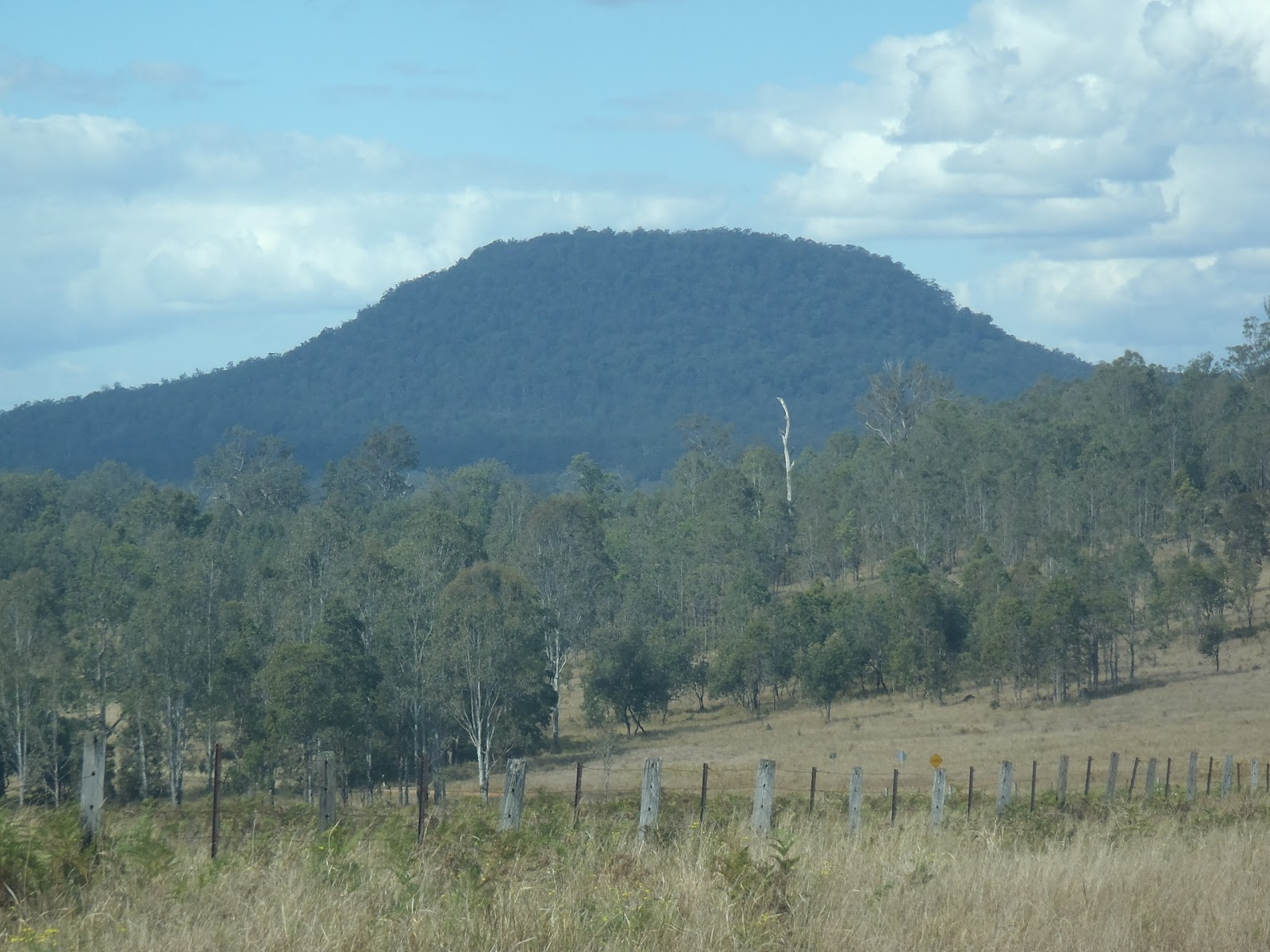 |
| Trachyte makes up Dome Mountain in the Fineflower area |
Most of the lavas have been eroded away but many eruptive sources for the volcano have been identified including plugs, pipes, dykes and possibly some sills. The lavas and intrusion preserved were erupted through the rocks of the Mesozoic aged Clarence-Moreton Basin which outcrop in the area as the Kangaroo Creek Sandstone and Walloon Coal Measures (probably including the MacLean Sandstone Member), but get older as you head west towards the edge of the Basin. The Mesozoic rocks in the area is actually quite deformed (as far as the Clarence-Moreton Basin goes) with large north-south trending folds and several faults nearby. The folds are visible as ridges and valleys (except those landforms associated with the more recent Belmore volcanics).
The Belmore Volcano is interesting because it shows the migration path of the hot-spot that formed the volcanoes that occur along the northern rivers area. There are actually four recognised volcanoes/volcanic provinces. These are all evenly spaced both in distance and time of eruption. From north to south these are the Tweed (23Ma), Belmore (21Ma), Ebor (19Ma) and Comboyne (16Ma) with the migratory trail of the hot-spot lost after this point. Sutherland et al. (2005) demonstrates that the Belmore Volcano is also curious because of the lava type erupted, whereas the other volcanoes erupted mainly more mafic volcanics (basalts and andesites) with later minor more felsic phase (rhyolite, dacite and trachyte ), the Belmore had very little basalt but lots of trachyte. But Isotope analysis by Sutherland et al (2005) has shown that the Belmore Volcanics were associated with the same mantle plume that generated the other volcanoes listed above.
Like most other recognised volcanoes in the region there is an earlier basalt type rock which occurs in the area which appears to have little to do with the most recent volcanic rocks. This is no exception in the Belmore area, where a basalt (dated at 31Ma) is present just to the north of the main eruptive area. Very little is known about this earlier volcanism and how it ties in with the geological history of the region.
References/Bibliography:
*Sutherland, F.L., Graham, I.T., Zwingmann, H., Pogson, R.E. & Barron, B.J. 2005. Belmore Volcanic Province, northeastern New South Wales, and some implications for plume variations along Cenozoic migratory trails. Australian Journal of Earth Sciences V52.
Thursday, 30 August 2012
What to do with a rock collection?
I am in the process of moving into a new house at the moment but because I have developed a bit of a collection of rocks in the last few years I have developed some peculiar problems. These are the dilemma of whether something that looks boring and would not be of any use to anyone else should be kept? What do you do with the garden once it has become overloaded with broken pieces of rock? How do you transport large quantities of rock without overloading boxes and earning the ire of removalists and friends?
I have a special collection of important rocks that I have labelled and wish to use further in future such as producing thin-sections or undertaking geochemical analysis. But there is so much that is just, well, miscellaneous. Rocks from overseas that look interesting but I can’t remember where they are from, or rocks from around Australia illustrating some salient point (that I can’t remember either), or just some vaguely pretty cobble picked up from a beach. Do I hold on to them hoping to remember what they were important for or just throw them out?... and how do you dispose of rocks anyway?
Some other problems arise with some broken up bits of metal ores, the minerals that make them up can soluble and when this is the case they can be toxic to plants. Speaking of toxic, how do I transport my samples of chrysotile (asbestos)? I’ve got a great piece with a ‘fibrous vein’ of chrysotile through other green serpentine minerals, it would be a shame to triple wrap it in plastic and notify the local council landfill that I intend to dispose of it. If it were not asbestos I’d put it on a shelf for display since it looks so cool.
Oh well, back to packing. I’ll figure it out somehow.
Friday, 24 August 2012
Disappearing sand from the North Coast
I was interested to read an article in my areas 'local rag' The Northern Star. It was a thoughtful piece by someone who loves the regions beaches. It was also a controversial one as it implied a man-made cause for the erosion of many of the regions beaches. You can read the article here: http://www.northernstar.com.au/story/2012/08/24/is-our-sand-on-goldy-beaches/. It actually, provides a good follow on from my last post on the matter.
In this article the author (Ben Bennick) suggests that although the mechanism of northward long-shore drift of sand is recognised as a significant driver for the erosion of many beaches, it raises the question of whether the Tweed River sand bypass scheme actually affects beaches further to the south. It is suggested that this is as far south at beaches such as Kingscliff or even those at Byron Bay. The Tweed River sand bypass scheme was introduced to stop the mouth of the Tweed river from being constantly dammed by sand deposited at the mouth. The closing of the mouth of the river would adversely affect water quality in the esturine reaches of the river. It has been operating for more than a decade now and Ben is worried that this might be affecting more than the Tweed River. The bypass scheme has been active since approximately 2001.
Ben suggests that during some times of the year sand would actually migrate to the south, contrary to the potentially simplistic concept of inexorable northward sand migration. As discussed in my previous post about long-shore sand drift, the action of the East Australia Current travelling south actually does not have the effect of causing sand to drift along the coast instead currents generated by the prevailing wind direction means that there are smaller coastal currents which tend to travel in a northward direction.
But Ben does raise an interesting question and rightfully this questions the absolute nature of the eastern Australian coastal currents. Maybe the situation does arise where sand can actually be transported from north to south from time to time. I wonder if such a phenomenon would be great enough to transport sand from the Tweed as far as Byron Bay and beyond? This would find a culprit in the Tweed River sand bypass scheme and would show us that the coastal strip is even more fragile than is already assumed.
In addition to the above comments I also suggest that local knowledge is very important to reconstruct the recent history of our area. Sometimes it is the bloke who has visited the holiday camp at Broken Head for the last 40 years who has some important observations to share. Local knowledge might be pointing to something we are missing. But, and a big but, there are also times where local knowledge is actually completely flawed! Tibby et al. (2007) demonstrated that the recollection of the behaviour of the sand bar at Lake Ainsworth near Ballina was often quite different to what was revealed in aerial photographs, indeed many anecdotal observations which were considered high reliability were in fact impossible when compared with historical photographs.
So, what does this mean? I think it requires someone with a good coastal management background to put us straight. Southern Cross University, despite its shortcomings has an excellent coastal management school. Maybe the answer is not known at the moment, in which case maybe this knowledge gap can be filled. It might just be that Frazer Island is indeed made from 100% Kingscliff and Byron Bay sand, and that is the way it always was. The sand dunes along the coast hide many a change to the coastline in the last 100 000 years, we can't claim to know what caused more than one or two of the many changes during this period and they are generally natural things like extended storm systems... but you never know.
References/Bibliography:
*Tibby, J., Lane, M.B. & Gell, P.A. 2007. Local knowledge and environmental management: a cautionary tale from Lake Ainsworth, New South Wales, Australia. Environmental Conservation V34.
*White, M. E., 2000. Running Down, Water in a Changing Land. Kangaroo Press.
 |
| Waves, wind, currents and a thin strip of sandy beach One of the regions typical beaches near Ballina |
Ben suggests that during some times of the year sand would actually migrate to the south, contrary to the potentially simplistic concept of inexorable northward sand migration. As discussed in my previous post about long-shore sand drift, the action of the East Australia Current travelling south actually does not have the effect of causing sand to drift along the coast instead currents generated by the prevailing wind direction means that there are smaller coastal currents which tend to travel in a northward direction.
But Ben does raise an interesting question and rightfully this questions the absolute nature of the eastern Australian coastal currents. Maybe the situation does arise where sand can actually be transported from north to south from time to time. I wonder if such a phenomenon would be great enough to transport sand from the Tweed as far as Byron Bay and beyond? This would find a culprit in the Tweed River sand bypass scheme and would show us that the coastal strip is even more fragile than is already assumed.
In addition to the above comments I also suggest that local knowledge is very important to reconstruct the recent history of our area. Sometimes it is the bloke who has visited the holiday camp at Broken Head for the last 40 years who has some important observations to share. Local knowledge might be pointing to something we are missing. But, and a big but, there are also times where local knowledge is actually completely flawed! Tibby et al. (2007) demonstrated that the recollection of the behaviour of the sand bar at Lake Ainsworth near Ballina was often quite different to what was revealed in aerial photographs, indeed many anecdotal observations which were considered high reliability were in fact impossible when compared with historical photographs.
So, what does this mean? I think it requires someone with a good coastal management background to put us straight. Southern Cross University, despite its shortcomings has an excellent coastal management school. Maybe the answer is not known at the moment, in which case maybe this knowledge gap can be filled. It might just be that Frazer Island is indeed made from 100% Kingscliff and Byron Bay sand, and that is the way it always was. The sand dunes along the coast hide many a change to the coastline in the last 100 000 years, we can't claim to know what caused more than one or two of the many changes during this period and they are generally natural things like extended storm systems... but you never know.
References/Bibliography:
*Tibby, J., Lane, M.B. & Gell, P.A. 2007. Local knowledge and environmental management: a cautionary tale from Lake Ainsworth, New South Wales, Australia. Environmental Conservation V34.
*White, M. E., 2000. Running Down, Water in a Changing Land. Kangaroo Press.
Subscribe to:
Posts (Atom)