Tuesday 26 June 2012

Mythical geology at the mouth of the Tweed River


My knowledge of Gaelic mythology is a bit limited but it is interesting to see where geology, Gaelic mythology, Captain Cook and Tweed heads have something in common. I’ve not been to Ireland or Scotland but I’ve experienced a feature that is quite famous in these countries that is also present on the northern rivers.

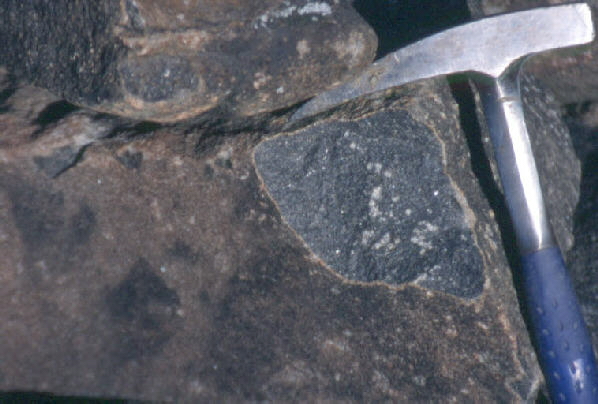
Fingal Head, clearly showing the basalt columns
Just to the south of the Tweed River mouth lies Fingal Head and Cook Island. Cook Island, is of course named after then-Lieutenant Cook who sailed along the section of coast in 1770. Fingal Head, however, is named after Fingal, a mythological Gaelic hero from Scotland, who never came to this part of Australia! So why is it named so?
To understand the name of Fingal Head you need to know about the story of the Giants Causeway in Ireland and Fingal’s Cave in Scotland. I’m not a good story teller so here is a link (if this link is still not working try this one instead). My summing up of the story is that one of the two warring giants built a causeway to the other side of the Irish Sea so that he could fight the other. The other giant tore it down so that only each side of the causeway remains, one in Northern Ireland the other, Western Scotland. Local tourist information says that Fingal Head is named after the Irish hero. This is actually incorrect, the Irish hero is named Finn MacCool. The name Tweed River should hint that it is actually the Scottish hero that Fingal Head is named after. So, where does the geology come in?

The giants causeway is made from basalt. The volume and thickness of the basalt lava flows means that different parts of the lava flow usually cool at different rates (though, as pointed out by Goehring et al. 2006, the actual mechanism is completely unknown). However, the general idea is that in the case of Fingal Head the lava flow has cooled quite quickly, resulting in contraction of the rock and cooling joints being formed. The incredible thing about nature is that these cooling joints forms columns of rock that are of similar thickness and cross sectional shape, usually hexagons. This formation style is called columnar basalt. Indeed the rock that makes up the causeway has been shown to extend under the sea all the way from Ireland to Scotland. While the scale is not as great as in the British Isles, Cook Island just a short distance off the coast is part of the same lava flow at Fingal Head. This area, therefore has very similar features as the Giants Causeway and in my opinion the name Fingal Head is very appropriate.

The lava at Fingal Head is apparently derived from the Tweed Volcano (classified as Lismore or Beechmont Basalt, depending on what side you are of the Queensland border). Whether it is a lava flow erupted from the original central vent or vents on the northern flank of the volcano is not known. It is worth knowing that columnar volcanic rock is actually fairly common. Indeed, even better columnar formations can be seen elsewhere in the region. If you travel inland from Bellingen up to Ebor and visit the waterfall there (Ebor Falls) you will be able to see some spectacular formations. Columnar jointing is not restricted to basalt lavas either, some rhyolite cliffs around the Tweed Volcano also show this feature too.

References/Bibliography:

*Goehring, L, Morris, S.W. &  Lin, Z. 2006. Experimental investigation of the scaling of columnar joints. Physical Review. V64.
*Stevens, N.C., Knutson, J., Ewart, A. & Duggan, M.B. 1989. Tweed. In Johnson, R.W. (ed). Intraplate Volcanism in Eastern Australia and New Zealand. Cambridge University Press.

Monday 18 June 2012

Professor Bruce Chappell

Prof. Chappell at Macquarie University
(X-ray fluorescence laboratory) - photo from Macquarie University
Just a quick post following news that Professor Bruce Chappell from Macquarie University died in Canberra on the 22nd of April.

Prof. Bruce Chappell was a well known and respected member of the geological community. He undertook a great deal of geology and geochemistry research on many areas of Eastern Australia, but particularly igneous, metamorphic and volcanic terrains. He even had a symposium named after him in 1998! You know you've made a contribution when that happens!

Prof. Bruce Chappell was born in Armidale, New England in 1936. There he was educated including attendance at the University of New England. During his time at UNE he obtained the university medal, an honours degree in science and a masters degree. He was responsible for mapping a large portion of the Palaeozoic aged New England Orogen. Later he obtained a PhD from the Australian National University. He worked in academic fields for the remainder of his life at the ANU and at Macquarie University. He was also a fellow of the Australian Academy of Science and the Australian Geological Society.

I met Bruce Chappell only once, but I have encountered his work again and again and it is clear Australia has lost a person that has contributed so much to our understanding of this country.

I understand that an obituary will be published by the Geological Society of Australia in the coming month. I will post a link to this once it is published.

Wednesday 13 June 2012

At Nashua where chert should not be

In an earlier post, Booyong not in the Clarence Moreton Basin? I indicated that I had been informed that there was evidence of Palaeozoic sedimentary rocks near Booyong, and that if this is the case there is significant implications on the morphology of the Mesozoic aged Clarence Moreton Basin in the area between Byron Bay and Lismore. It therefore has implications for the exploration for coal seam methane too.

Well, I can confirm that after much searching, I came across an ephemeral creek north of Booyong near the Casino to Murwillimbah Railway line at Nashua that clearly contained much chert. Additionally, a railway cutting appeared to have significant folding, but was very weathered so identification of the parent rock and indeed even whether it was folding was not clear.

Chert at a location between Nashua and Booyong
Chert is a rock that is essentially absent from the Clarence Moreton Basin, however, it is common in the underlying rock of the Beenleigh Block, known as the Naranleigh-Fernvale Group. This group of rocks formed in a deep marine environment. It consists of turbidite sediments that occur when parts of the undersea continental slope erode and some slates and chert. The Chert is formed on the ocean floor where chemical and biological material settles over a long period of time. All of this rock was then transported and accreted onto the edge of the Australian Continent before the Devonian or Carboniferous period which was around 333-343 million years ago during the formation of the New England Orogen. This process of accretion has caused folding and low grade regional metamorphism to be common place in this geological unit. By comparison, the sediments of the Clarence-Moreton Basin are dominately continental derived and are un-metamorphosed. They were mainly deposited in river systems, lakes or at best shallow marine environments. Chert does not form very well in these environments.

But, what is so exciting about this outcrop? The Neranleigh Fernvale Group occur along the edge of the hills above the coastal plain south of Ballina and are exposed just about everywhere from the Gold Coast to Byron Bay. If you follow the line of outcrop from near Ballina you will find it is overlain between Byron Bay by the Clarence Moreton Basin which extends all the way to the Tabulum in the west. But because the outcrop occurs at Nashua this shows us that the area to the east is probably a different basin from the main part of the Clarence Moreton to the west. This has significant implications for understanding the structure of the earth here and also affects where resources such as gas can be explored for. For those that were worried about coal seam gas, you won't find any at Nashua.

Saturday 9 June 2012

Using a hammer to obtain rock samples in the field


I came across these environmental guidelines for the use of hammers to obtain samples at rock exposures. It is a reminder that sometimes it is just not necessary to take samples as doing so can destroy the area you are looking at. When I was an undergraduate student I remember bashing away at outcrops to see if there was anything different in one part or another. It was quite a waste.

Another great use for a hammer - scale
Remember too that using hammers can also be dangerous and the correct equipment and techniques should be applied to minimise or eliminate the risk of injury to yourself and to others. Make sure you always have eye protection as splinters of rock can cause injury. I still have a chip off a metal hammer embedded in my left leg that flew off at high velocity straight into my flesh!

Geologists may carry hammers for two primary reasons - to break a piece of rock to get a look at a fresh surface for description or identification, or to collect samples for further work.
  • Generally the advice is to use a hammer as little as possible. Most exposures don't require the use of a hammer, as there are often raw surfaces already exposed. If a sample is to be taken, you should first try to use fragments that have clearly fallen off the exposure.
  • But before you do use a hammer to break a piece of rock at a specific location you must consider if you really need to. You should ask yourself is it appropriate and is there sufficient reason to do so. Whether it is correct to do depends on context.
  • As a participant on an organized fieldtrip, whether you are a professional or a student, you should always ask the fieldtrip leader if hammer usage is permitted at each stop or outcrop.
  • If you are engaged in project or research work, the decision to use a hammer lies squarely with you. Here are some things to think about: in general, avoid hammering near residences or immediately adjacent hiking trails. Near hiking trails, one can probably find other suitable outcrops tens or hundreds of meters off the trail, which would be invisible to passers-by. If the land is private, you may need to get permission to sample. If the site is protected it may be illegal to use a hammer and you must not use a hammer at all.
  • Many times a weathered surface is more informative than a fresh surface for identifying the minerals present – because the weathering has picked out mineralogical differences. Wherever you do choose to take a sample, always choose a place on the outcrop where the hammer scar will be least visible. Best practice is to attempt to inflict the minimum amount of damage on the outcrop.
  • Outcrops of rocks and minerals are a finite resource. Worldwide, there are countless cases of localities that have been used for decades to teach and train students which have essentially been ruined or rendered useless by the acts of a few unthinking individuals.
  • Hammering is potentially dangerous to both the person yielding the hammer and to people in the area. Tiny detached rock fragments or particles of metal can easily become projectiles and travel considerable distances causing serious injury. This is especially important when groups of people are gathered around outcrops.
Be part of the solution instead of part of the problem in the field, and preserve the outcrops for others to view in the future.
Committee of Heads of University Geoscience Departments
March 2012

Tuesday 5 June 2012

Rocks and Landscapes of the Gold Coast Hinterland

Since rocks tend not to follow political boundaries but our understanding of them often does it is good to know about what is north of the Northern Rivers/New England Border in southern Queensland. Last year I was going to do a post on the Focal Peak Volcano but then I remembered that the Queensland Division of the Geological Society had produced some excellent publications on the subject and recommended one in particular, so the post was essentially a recommendation for the Book the Rocks and Landscapes of the National Parks of Southern Queensland. But I deliberately omitted from the post comments on another brilliant book that had recently been fully revised so that I could deal with is separately.

The other book is called Rocks and Landscapes of the Gold Coast Hinterland by Warwick Willmott. I enjoy this book very much because it is simple to understand but goes into a good amount of detail. It also shows you exactly where to go to see a feature of interest just like a self guided tour.

However, the detailed knowledge of the northern part of the Tweed Volcano may have skewed research and our understanding of the volcano in general. For instance, although the Tweed Volcano has been assumed to be centred around the site of present day Mount Warning in New South Wales most of our understanding including the detailed research of PhD and MSc level on the volcano actually comes from the University of Queensland. The University of Queensland has been the driving institution for decades in research on these northern flanks by exceptional researchers like Professor Anthony Ewart and Dr Jan Knutson.

As I have discussed in numerous other posts on the Tweed Volcano, the model of what the volcano looked like and how it was formed has recently been questioned by authors such as Cotter (1998). In my mind this raises some questions about elaborating the northern side of the volcano to the remainder in New South Wales. While I have nothing to question the good work on the northern side of the border, including the wonderful books produced by the Australian Geological Society's Queensland Division, it appears that the model of volcanism of the Tweed Volcano has been interpreted to fit into a Queensland model. This has occurred ever since authors like Duggan & Mason (1978) and continued to Stevens et al (1989) and most recently by Howden (2009). I do not question to model of rock formation to the north of the border (it works for what is there) but according to Cotter (1998) south of the border pre-volcanic geological conditions seemed to be different and this had a significant effect on the mode of volcanism in the area. This however, does not mean that the Rocks and Landscapes of the Gold Coast Hinterland is incorrect in any way on its description of Queensland geology, it is just important to note that interpreting the geology south of the border can sometimes be problematic even if a cursory look means that it appears reasonable.

But I have digressed a great deal. Back to the Book! The Rocks and Landscapes of the Gold Coast Hinterland is formatted in a way that makes it a geological tour. If you end up traveling through the Gold Coast area, do get a copy of this book. It is only about $12 including postage and is quite large and detailed for its price. In fact I'm surprised that the cost is so low, but I think that all the time that Warwick Willmott has put into writing it has been for free. As I have said in other posts, Warwick is one of the great science educators in Australia, and the book really helps understand the Gold Coast area a lot.

References/Bibliography:

*Cotter, S. 1998. A Geochemical, Palaeomagnetic and Geomorphological Investigation of the Tertiary Volcanic Sequence of North Eastern New South Wales. Masters Thesis, Southern Cross University.
*Duggan, P.B., Mason, D.R. 1978. Stratigraphy of the Lamington Volcanics in Far Northeastern New South Wales. Australian Journal of Earth Sciences V25.
*Howden, S. 2009. An Evaluation of Mafic Extrusives Spatially Assoicated with the South-Western Aspect of the Tweed Shield Volcano, BSc(Hons.) thesis, University of New England, Armidale.
*Stevens, N.C., Knutson, J., Ewart, A. & Duggan, M.B. 1989. Tweed. In Johnson, R.W. (ed). Intraplate Volcanism in Eastern Australia and New Zealand. Cambridge University Press.

Friday 1 June 2012

A warning about Mount Warning

Here are some common quotes about Mount Warning:


"World Heritage listed Mount Warning (Wollumbin) is the remnant central plug of an ancient volcano." 
"The Mount Warning volcano was a huge shield volcano."
"Considered the central magma plug, Mt Warning and a system of ring dykes, being extremely hard rock, have resisted erosion, and dominate the valley landscape."
"Mt Warning, Wollumbin, the cloud catcher, is the basalt plug of the world's largest and oldest extinct volcano. "
"Now, Mt. Warning is the first place that that the sun hits at sunrise… the highest point in New South Wales….almost the highest in Australia!"

These are quotes typical of tourist and even educational resources. They are quite definite and the comments makes sense, mostly. There are also some points of view that I espoused for a long time... Except aspects of each of the quotes are technically wrong and in some cases completely wrong. Like my post on the "erosion caldera" something that is technically incorrect has become general knowledge. It is a little pedantic of me, but it is one of my hobby horses... so what is technically wrong with the quotes above?

Western face of Mount Warning (composed of syenite).
One of the ring dykes is visible in the foreground
and Mount Uki and the Pacific Ocean in the background

Interestingly, Stevens et al (1989) and earlier authors noted that the rock composition of the intrusions that make up Mount Warning (the Mount Warning Complex) is different from most of the lavas (The Lamington Volcanics) that exist in the region. It is also slightly older than most of the lavas. Geologically speaking the age difference is not huge at only about 2-3 million years, but still significant enough.

It is apparent from Smith & Houston (1995) and other authors that much of the rhyolite lavas that remain of the Lamington Volcanics were not erupted from the central area now the site of Mount Warning but from vents on the flanks. Given the coverage of the mafic components (the Lismore Basalt, for example) it is more difficult to identify any vents.  

An idea has been raised by Cotter (1998) which questions the volume of lava that was erupted from the Tweed Volcano. It is known that the Palaeozoic aged meta-sedimentary rocks of the Beenleigh Block, called the Neranleigh Fernvale Beds and the Mesozoic aged Chillingham Volcanics and Clarence Moreton Basin were not domed upwards by the underlying magma except a little around the Mount Warning Complex itself. However, other areas such as the nearby slightly older Focal Peak Volcano have been lifted by the Cenozoic aged volcanism. But in the case of Mount Warning, Cotter (1998) felt that lithology, the remnants of the rhyolitic lavas, the pre-existing Chillingham and Alstonville Volcanics was the main control on the geomorphology, not as suggested by others the volcanism that formed the shield volcano itself.

The idea suggested by Cotter (1998) has significant implications for the size of the Tweed Volcano. The volcano is considered the biggest by far of its age in eastern Australia. It appears likely that the extent of the shield volcano is not as great as originally thought. The underlying Chillingham Volcanics would have been an existing mountain range and therefore reduced the thickness of the Tweed volcanic pile and the Alstonville Basalts would have reduced the southerly extent. I think that when you add to this the idea that the rhyolite units have erupted away from Mount Warning, but instead from flanks on the volcano, the volume of lavas from the Tweed Volcano may actually be more in keeping with the other intra-plate volcanoes in Eastern Australia. It was also possible that before it was eroded into the present shape (which implies a central shield type volcano) it may have looked more irregular than we imagined...

But don't get me started on the comments about the biggest volcano in the world and the highest point in New South Wales!!! What were these people thinking?!

...but does any one want to talk down something that was presumed to be huge, just to something large? Emotionally, many (including myself) have an emotional attachment to the beauty and wonder of the Tweed Volcano, sometimes it is hard to take a step back and consider it is not quite as fabulous as originally thought, but what we see is still stunning... and it is still very, very big. To put that in perspective I think that even the small volcanoes in the region are stunning. We don't need to exaggerate something for it to inspire us.

Bibliography/References:

*Cotter, S. 1998. A Geochemical, Palaeomagnetic and Geomorphological Investigation of the Tertiary Volcanic Sequence of North Eastern New South Wales. Masters Thesis, Southern Cross University. 
*Smith, J.V. , Houston, E.C. 1995. Structure of lava flows of the Nimbin Rhyolite, northeast New South Wales. Australian Journal of Earth Sciences V42(1) p69-74.
*Stevens, N.C., Knutson, J., Ewart, A. & Duggan, M.B. 1989. Tweed. In Johnson, R.W. (ed). Intraplate Volcanism in Eastern Australia and New Zealand. Cambridge University Press.