Saturday 29 September 2012

The Dummy you'll find north of Armidale

One of the imposing landscape features on the north side of Armidale is the 1400m high Mount Duval. Some of my secondary education was in Armidale and I remember that the logo of my school actually had Mount Duval in it. Mount Duval is part of granite-like pluton called the Mount Duval Monzogranite. It was previously called the Mount Duval Adamellite; however the term Adamellite is no longer formally recognised. The intrusion actually extends in a crescent shape further to the west and includes Little Mount Duval which is roughly were the watershed for the Great Dividing Range sits, draining to the east all the way to the Macleay River. The monzogranite is considered to be middle Permian in age and intrudes several different complex rock units, one of these is a relatively small unit called the Dummy Creek Conglomerate.

Dummy Creek Conglomerate in the Sunnside area
metamorphosed by the Highlands Igneous Complex
The Dummy Creek Conglomerate is situated to the north of Mount Duval and extends to the east to the area of Puddledock, the northern side is intruded by the Highlands Igneous Complex. The Dummy Creek Conglomerate is comprised mainly of conglomerate but not exclusively. Lithic sandstone is a major component and it is actually what is in these sandstones that allow us to determine when the unit was formed, but more of that later. The abundance of conglomerate as well as sandstone and rarity of fine grained sediments like mudstones shows us that the sediments, gravels, etc that made up the Dummy Creek Conglomerate have not travelled far from their source. The clasts in the conglomerate show that the source rock was the underlying Carboniferous aged Sandon Beds (part of the Texas-Woolomin Block).

Korsch (1982) concludes that the original Sandon Beds was domed and uplifted by the intrusion of granite bodies of the New England Batholith such as the Mount Duval Monzogranite and the Highlands Igneous Complex. The hills formed from the deformation of the Sandon Beds began shedding rock, eroding and the sediments were deposited a short distance from these new hills. The intrusions continued to intrude shortly after the sediments were deposited which according to Holland (2001) created a complex system of overlapping zones of contact metamorphism. The intrusions were therefore emplaced in a very shallow crustal situation and volcanism was abundant and the Dummy Creek Conglomerate was quickly covered and preserved by a volcanic unit that is called the Annalee Pyroclastics which includes lavas, pyroclastic deposits and the like. It is worth noting that other models of formation by various other authors were summarized by Holland (2001) for instance some authors suggest that rock fabric studies may show a source only from the south.

A lot was happening in the Mount Duval-Tilbuster-Puddledock area during a relatively short period of geological time, indeed even during this time of change a substantial forest must have been growing in the area. The sandstone layers in the Dummy Creek Conglomerate preserve fairly common plant fossils. Most of the fossil remnants are fragments but there is enough to identify many plants with certainty. The most common fossil identified was the deciduous plant Gangopteris, a relative of the more commonly known Glossopteris, the main plant that formed the coal of the Sydney Basin. This plant existed abundantly in the middle of the Permian and so given that many of the rocks appeared to be forming at the same time these can be assumed to be close to this age too.

References/bibliography:

Holland, R. 2001. South western Margin and Contact Rocks of the Highlands Igneous Complex near Orana Falls, North of Armidale, NSW. Unpublished undergraduate research thesis, University of New England.
Korsch, R.J. 1982. The Dummy Creek Association: Rim Syncline Deposits. Journal and Proceedings of the Royal Society of New South Wales. V115.

Saturday 22 September 2012

Weirdly Wonderful Wongwibinda


I finally found them, photos of some of the strange metamorphic rock at Wongwibinda. I recently moved house and in the process I’ve lost many things but also found some things. Early this year I did a post on what were the broader conditions that lead to the geology of this area between Guyra and Ebor, namely thinning of the continental crust leading to increased heat flow and corresponding thermal metamorphism. I mentioned a rock type called migmatite and since I found my photos of the Wongwibinda migmatite, I thought I should go into a little more detail on this curious metamorphic feature.

Close angular folds in the Girakool Beds, Rockvale
The migmatites are strongly metamorphosed rocks of the Girrakool beds. The Girrakool beds are Carboniferous in age and were deposited in a marine environment. These beds were then accreted onto the edge of the Australian continent as part of the New England Orogen, much deformation occurred during this time. During or following this stage of tectonic forces that affected the New England region the Girrakool beds were subjected to a period of intense metamorphism. This affected one end of the beds more than the other. The western most part of the Girrakool beds in the Rockvale area remained relatively ‘uncooked’ but further to the east the effects of thermal metamorphism became greater creating schists known as the Ramspeck Schist and finally the zone of migmatites. The migmatites are faulted off by the Wongwibinda fault on the eastern side or are intruded by the Abroi Granodiorite which itself has been later metamorphosed into Gneiss.

Migmatite in the Aberfoyle-Wongwibinda area.
Note the ptygmatic folds and dyke on the left
The odd thing about the Wongwibinda migmatites generally is that they are actually three rocks in one: metamorphic sedimentary rocks becoming igneous at the same time. Usually rocks fit into the igneous and sedimentary categories neatly and then metamorphism can affect these rocks. In the case of migmatite the metamorphism is so great that the rock actually begins to melt, that is, it becomes an igneous rock with some of the sedimentary rock remaining unmelted. A characteristic of migmatite is ptygmatic folding, which is intense small scale folding with alternating light and dark bands. The dark bands are called the palaeosome which is the remains of the sedimentary rock and the lighter bands is insitu accumulation of melted rock called the Leucosome,. The leucosome is here comprised mainly of the minerals quartz, feldspar, mica and some garnet. Sometimes the leucosome can ‘break free’ from the ptygmatic folds and create dyke like structures. All of these features are visible in the picture opposite. 

What can be seen at Wongwibinda is essentially the formation of a granite, specifically a S-type (sedimentary derived), frozen in time. Craven et al 2012 demonstrated that this time was very close to the Carboniferous-Permian age boundary, probably just in the Permian, that is around 297 million years ago. There are some fancy geological features in the New England highlands and in my mind this is one of them. If you travel up that way and see some rocks by the side of the road be sure to stop and look closely, there are so many unusual things to find.

References/bibliography:
*Danis, C.R., Daczko, N.R., Lackie, M.A. and Craven, S.J. 2010. Retrograde metamorphism of the Wongwibinda Complex, New England Fold Belt and the implications of 2.5D subsurface geophysical structure for the metamorphic history. Australian Journal of Earth Sciences V57.
*Craven, S.J. Daczko, N.R. and Halpin, J.A., 2012. Thermal gradient and timing of high-T-low-P metamorphism in the Wongwibinda Metamorphic Complex, southern New England Orogen, Australia. Journal of Metamorphic Geology V30.
*Wilkinson, J.F.G. 1969 The New England Batholith - introduction. IN Packham G.H.(ed) - The geology of New South Wales. Geological Society of Australia. Journal V16.

Friday 14 September 2012

Walloon Coal Measures of the Southern Clarence-Morton Basin

In previous posts I’ve briefly discussed the upper most layers of the Clarence-Moreton Basin. The Grafton Formation which overlies the Kangaroo Creek Sandstone which in turn overlies the Woodenbong Beds/MacLean Sandstone Member. The MacLean Sandstone Member is a member of a larger unit called the Walloon Coal Measures and it is this unit that I will briefly comment on now.

I’ve often heard people mistakenly say that the Walloon Coal Measures is a coal seam. This is not correct because the balance of the unit is actually made up of mixed rocks. According to Wells & O’Brien (1994) the coal measures include sandstones (made from volcanic rock fragments), carbonaceous siltstone, shale, mudstone, coal and clayey siltstones. Also clayey ironstone and infrequently oil shale and limestone can be found. Apparently tree stumps remaining in their growth position have also been found, though these have become carbonised (coal). The coal layers themselves are thin (millimetre scale) to occasionally thick (30-40cm) in the Southern Basin but the whole unit of all the different rock types that make up the Walloon Coal Measures totals at least 200 metres of thickness and is variable from location to location.

The coal in the measures is formed from peat that grew in a moist but temperate environment during the early to middle Jurassic in this area (smack in the middle of the age of the dinosaurs). The depositional environment appears to have been mainly flood-plain and meandering stream environments. Boggy mires forming the peat were common, but layers of volcanic ash from occasional volcanic eruptions from close by are preserved. This makes some of the coal seams high in ash content which reduces the quality of the coal. The environment was thought to be reflective of a period of high sea level.

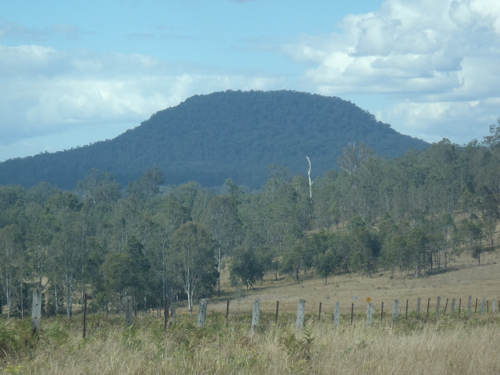
The Walloon Coal Measures in Bexhill Brick Pit at Bexhill
Interestingly, the Walloon Coal Measures are some of the most extensive and continuous sedimentary rock formations in eastern Australia. They are correlated with almost identical units in the Surat Basin and the Maryborough Basin making the potential spatial extent of the unit huge. The outcrop of the Walloon Coal Measures is fairly limited with much obscured by the Grafton Formation, Kangaroo Creek Sandstone and Woodenbong Beds as well as Cenozoic aged volcanic rock especially associated with the Focal Peak and Tweed Volcanic areas. In our region the best exposures are in the Nimbin area and further north but also at Coaldale where the Clarence-Moreton Basin has been deformed creating a bulge which has been eroded exposing the Walloon Coal Measures. Areas to the south of MacLean show some outcrop and on the other side of the Basin, the Kangaroo Creek and areas near Tabulam show good exposures. Other places have exposures of the Walloon Coal Measures because of local faulting and folding that has occurred in places like the Richmond Range.

I understand that coal mining was historically carried out near Tabulam, Kangaroo Creek and Nimbin but the size of the deposits was such that these were only small and fairly short lived enterprises, though Murwillimbah did have a power station earlier last century which was fueled on local coal transported from the area around Tyalgum. Of course now the Walloon Coal Measures has been frequently under discussion regarding its gas potential especially in the form of coal seam gas (CSG) also known as coal bed methane.

The presence of gas in the coal measures is a natural function of coal and the formation of coal when it was formed. As the rock is gently ‘cooked’ following its deposition as peat gases are given off. Peat is made from decayed plant and animal matter which when broken down into its elemental constituents is mainly hydrogen (H) and carbon (C) atoms. The hydrogen is bonded to the carbon in oxygen poor environments and forms methane (CH4) and sometimes more slightly moe complex organic molecules such as C2H6, C3H10 etc, or if conditions are right the molecules are big enough and complex enough to form oils. In the case of the Southern Clarence-Moreton Basin Walloon Coal Measures the conditions were too hot for oil to be stable so the smaller gas molecules are formed. Gas may be trapped in the layers of coal within voids and cracks (called cleats) or they may sometimes migrate to other layers where they can be trapped. This is actually the difference between ‘conventional’ gas and coal seam gas, i.e. all conventional gas was once coal seam gas. Oil shale and shale gas are also present in some areas of the Walloon Coal Measures but these are very rare and are small deposits (I might do a post on these in the future but given their insignificance I might not get there). Russell 1994 noted that the best quality gas, mature or 'dry gas' was likely to be found abundantly in the eastern portion of the basin, whereas wetter gas and oils were likely to be more prevalent in the west. Interestnigly it is thought that the maturity is a response to the thermal changes in the Earths crust during the formation of the Tasman Sea.

The Walloon Coal Measures contains both conventional and coal seam gas and very little oil. Indeed, I understand that substantial amounts of conventional gas was first discovered in the Hogarth Ranges about 40 years ago and that more recently Metgasco have discovered significant amounts at Kingfisher which I think is to the south of Casino. As far as coal seam gas goes, if Walloon Coal Measures are present there is coal and so there is also a chance that gas may also be present.

References/bibliography:

*O’Brien, P.E., Korsch, R.J., Wells, A.T., Sexton, M.J. Wake-Dyster, K. (1994) Structure and Tectonics of the Clarence-Morton Basin. In Wells, A.T. and O'Brien, P.E. (eds.) Geology and Petroleum Potential of the Clarence-Moreton Basin, New South Wales and Queensland. Australian Geological Survey Organisation. Bulletin 241.
*O'Brien, P.E., Powell, T.G. & Wells, A.T. (1994). Petroleum Potential of the Clarence-Moreton Basin in Wells, A.T. and O'Brien, P.E. (eds.) Geology and Petroleum Potential of the Clarence-Moreton Basin, New South Wales and Queensland. Australian Geological Survey Organisation. Bulletin 241.
*Russell, N.J. 1994. A Palaeogeothermal study of the Southern Clarence Moreton Basin in Wells, A.T. and O'Brien, P.E. (eds.) Geology and Petroleum Potential of the Clarence-Moreton Basin, New South Wales and Queensland. Australian Geological Survey Organisation. Bulletin 241.
*Wells, A.T. and O'Brien, P.E. 1994. Lithostratigraphic framework of the Clarence-Moreton Basin. In Wells, A.T. and O'Brien, P.E. (eds.) Geology and Petroleum Potential of the Clarence-Moreton Basin, New South Wales and Queensland. Australian Geological Survey Organisation. Bulletin 241.

Sunday 9 September 2012

A big pluton cut by the Clarence River

Yulgibar Bridge on the Clarence River
It has been some time since I spent a lot of time in the Clarence River area but occasionally I’ve got back there. Not too long ago I travelled along the Clarence Way. I took a quick detour down Lionsville Road when I came to the village of Baryulgil. Only a few kilometres down the road there is a quaint long low thin bridge over the Clarence. Just on the opposite side is a spot reguarly used as a swimming spot, there is also a tourist attraction for geologists (A road cutting).

The road cutting and the stream bank expose boulders of ‘granite’ rock which make up part of the New England Batholith. Right there at the bridge is a great spot to see one of rocks that make up what is called the Clarence Supersuite, a suite of ‘granites’ that have been derived from the melting of older igneous rocks. According to Bryant et al (1997) the Clarence River Supersuite for which this rock is a member is a type of ‘granite’ called an I-type. The ‘I’ stands for melted igneous in origin (as apposed to S-type for melted sedimentary). There is a lot to say about the New England batholith, its different granite types and its models of formation, such that I will do several blog posts in the future to cover this topic better.

The actual pluton in this area is called the Dumbudgery Granodiorite and it extends a few more kilometres to the north and for many kilometres to the south. Good outcrops can be seen in the hills on the southern side of Lionsville Road if you continue to the west a bit further. Indeed quartz veins in this area also contain small amounts of cinnabar (mercury ore), others contain some gold. If you want to take a sample or have a look at a fresh piece, a hammer (preferably a big one) with appropriate safety goggles is required. It is hard rock! But a fresh piece of granodiorite reveals a lovely white, pink and black speckled appearance. It can be so pretty that is is worth going on display.

Dumbudgery Granodiorite, fresh samples are very bright coloured
The colours of the rock reflect the mineral composition. Normal granite has a large proportion of alkali feldspar (sodium and potassium rich) relative to the amount of plagioclase (calcium and sodium rich) feldspar. A granodiorite like the Dumbudgery Granodiorite contains more plagioclase than alkali feldspar but still enough to be common in the rock. In the specimens at the Clarence River the plagioclase is a cloudy grey colour, sometimes difficult to distinguish from the quartz (tends to clearer) but the other alkali feldspar is a lovely bright pink colour. The lighter colours are contrasted by the two black minerals which are hornblende and biotite. The hornblende is identified by its hardness relative to the biotite which is a form of mica and therefore very easy to scratch. The Dumbudgery Granodiorite has been previously dated at 249 million years (very early Triassic period which is part of the mesozoic era).

Oddly the mass of granodiorite is actually bisected by the Clarence River. This is surprising given the prominent hills (and very hard rock) that the Dumbudgery Granodiorite is made from compared with the relative softness of the Clarence-Moreton Basin sedimentary rocks a short distance to the east. I’ve discussed why it is likely and surprising that the river has created this route in a previous post. Additonally, I’ve quickly discussed in another post the nearby unusual rock called the Gordonbrook Serpentinite which was mined at Baryulgil for asbestos. The Gordonbrook Serpentinite forms the eastern contact with the Dumbugery Granodiorite in Baryulgil area.

The Clarence river here is quite wide with large sand and gravel deposits moving every time it floods and altering its course. Historically some gold was found in this sand and gravel and is thought to be mainly sourced from gold in mineralised granitic rocks further up the river and in its tributaries. Some of the little deposits in the hills and much of the river itself was mined by the old timers, around the end of the 19th Century.

The area around Baryulgil is off the beaten track and Baryulgil itself is a bit of a delapidated little community but the area is worth a visit for its wonderful scenery and geological significance given its location at the edge of the mountainous New England region and the edge of the Clarence-Moreton Basin. Apparently the swimming and fishing are lovely too.

References/bibliography:

*Bryant, C.J., Arculus, R.J., & Chappell, B.W. 1997. Clarence River Supersuite: 250Ma Cordilleran Tonalitic I-type Intrusions in Eastern Australia. Journal of Petrology V38.

Saturday 1 September 2012

Who has heard of the Belmore Volcano?

Most of us know about the two large remnants of volcanic provinces in the region, one the Tweed Volcano and the other the Ebor Volcano. Many too will know that the Tweed Volcano erupted first (23 million years old) and as the Earths crust moved over the mantle the probable hot-spot that caused this volcano migrated further south and formed the Ebor Volcano (19 million years old). Few people will have heard of the Belmore Volcano, this is a volcanic area that is located roughly midway between the Tweed and Ebor volcanic provinces and it also erupted in the interval between the other two (21 million years).

Before I go on I should point out that the term volcano is used very loosely here as it may also consist of many active cones and vents which erupted at a similar time period and are related to each other. Indeed the definition of what a volcano is defined as (such as the terms central volcano and volcanic province) has been an on-going argument for a long period of time anyway!


Trachyte makes up Dome Mountain in the Fineflower area
The area of the Belmore Volcano is away from the main travelled routes and for that reason it has probably been relatively unnoticed for a period of time. It lies to the east of the village of Baryulgil in the southern areas of the Belmore State Forest and Mount Neville Nature Reserve which is about halfway to Coaldale as you head towards Grafton. It is near the southern extents of the Richmond Range. The volcanics have produced some very interesting and rugged landforms such as Dobie Mountain, Mount Mookima, Mount Neville and Dome Mountain.

Most of the lavas have been eroded away but many eruptive sources for the volcano have been identified including plugs, pipes, dykes and possibly some sills. The lavas and intrusion preserved were erupted through the rocks of the Mesozoic aged Clarence-Moreton Basin which outcrop in the area as the Kangaroo Creek Sandstone and Walloon Coal Measures (probably including the MacLean Sandstone Member), but get older as you head west towards the edge of the Basin. The Mesozoic rocks in the area is actually quite deformed (as far as the Clarence-Moreton Basin goes) with large north-south trending folds and several faults nearby. The folds are visible as ridges and valleys (except those landforms associated with the more recent Belmore volcanics).

The Belmore Volcano is interesting because it shows the migration path of the hot-spot that formed the volcanoes that occur along the northern rivers area. There are actually four recognised volcanoes/volcanic provinces. These are all evenly spaced both in distance and time of eruption. From north to south these are the Tweed (23Ma), Belmore (21Ma), Ebor (19Ma) and Comboyne (16Ma) with the migratory trail of the hot-spot lost after this point. Sutherland et al. (2005) demonstrates that the Belmore Volcano is also curious because of the lava type erupted, whereas the other volcanoes erupted mainly more mafic volcanics (basalts and andesites) with later minor more felsic phase (rhyolite, dacite and trachyte ), the Belmore had very little basalt but lots of trachyte. But Isotope analysis by Sutherland et al (2005) has shown that the Belmore Volcanics were associated with the same mantle plume that generated the other volcanoes listed above.

Like most other recognised volcanoes in the region there is an earlier basalt type rock which occurs in the area which appears to have little to do with the most recent volcanic rocks. This is no exception in the Belmore area, where a basalt (dated at 31Ma) is present just to the north of the main eruptive area. Very little is known about this earlier volcanism and how it ties in with the geological history of the region.

References/Bibliography:

*Sutherland, F.L., Graham, I.T., Zwingmann, H., Pogson, R.E. & Barron, B.J. 2005. Belmore Volcanic Province, northeastern New South Wales, and some implications for plume variations along Cenozoic migratory trails. Australian Journal of Earth Sciences V52.