Showing posts with label cenozoic. Show all posts

Friday, 8 August 2014

Crystals or No Crystals?

The landscapes of the mountains surrounding the Tweed Valley are very spectacular. I have discussed some of the facets of the Tweed Volcano and Mount Warning area in previous posts. However, I have not covered much on the main rock type that is mainly responsible for the rugged steep cliffs and valleys of the Nightcap National Park World Heritage Area. This rock is the Nimbin Rhyolite, a quartz rich lava that was dominant in the final phases of the Tweed Volcano. Because of its resistance to weathering it results in inspiring cliffs and rugged ranges.

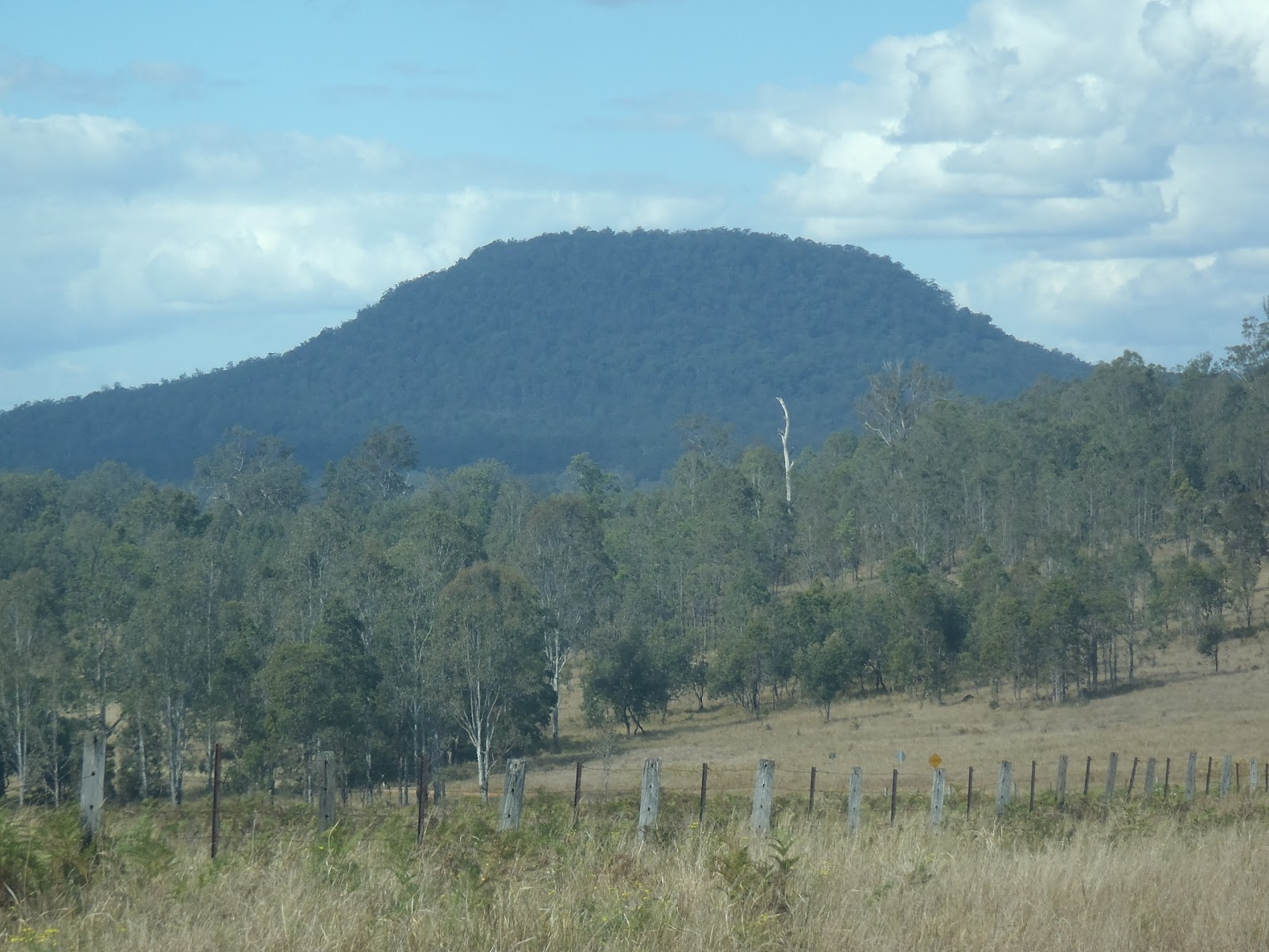
Rhyolite is a volcanic rock that contains a high volume of silica (quartz) in it. Because of the silica content rhyolite lavas tend to be “sticky” and slow moving. This also causes gases to be trapped in the lava or magma chamber feeding the lava flows. The release of trapped gases can cause explosive eruptions. Therefore, accompanying the lava flows there are also deposits of volcanic ash and glass caused by the rapid cooling of lava during explosive eruptions. All of these features are present in the Nightcap Ranges and surrounding areas.

In a future post I will show a picture of a Nimbin Rhyolite lava which exhibits flow banding. There are many examples of flow banding in lava near Minyon Falls. It is a tricky lava to look at in hand specimen because it is very fine grained. You can only see occasional tiny specks that are crystals but most of the time it is just a grey mass. In outcrop you might see some flow structures like the one pictured, but generally it is a boring looking rock! The same rock is in the Mount Matheson area. Smith and Houston (1995) referred to this rhyolite as crystal-poor rhyolite. It compares very differently to the crystal-rich rhyolite identified elsewhere in the area.

As for the crystal rich rhyolite, I was lucky enough to go for a walk in a property that has just been purchased by the NSW National Parks and Wildlife Service. It is located in the valley between the Goonengerry and Nightcap National Parks. While inspecting the excellent work done to remove exotic weeds from this property and celebrate the inclusion of an important vegetative link between National Parks. I came across some good examples of the crystal-rich rhyolite. In these samples the rock contains large quartz crystals which are very evident (see the picture below). The more crystalline form of rhyolite occurs in about a third of the total area mapped as rhyolite. This includes the area from the Koonyum and Goonengerry ranges in the east to Whian Whian in the west.

Quartz crystals in Nimbin Rhyolite - upper Coopers Creek area
Smith and Houston (1995) observe the crystal abundance is related to the vent (or group of vents) from which the lava was erupted. Only occasionally do crystal rich and crystal poor varieties occur on top or under each other indicating a high degree of lava mixing. The relationship between specific vents and crystal richness shows the vents must have been tapping different magma sources (different magma chambers). Alternatively the vents may have erupted magma from a single, somewhat heterogeneous magma chamber.

However, it is worth noting there is a third major form of rhyolite in the area and is known as the volcanic glass, obsidian. This volcanic glass occurs around the bases of the major lava flows and is often referred to as perlite. The glass is rarely a massive unit but tends to appear brecciated and as an agglomerate. I will discuss this obsidian further in a future post as many interesting features and textures are preserved showing the way that rhyolite lavas move across the lands surface. In the mean time, it is worth remembering that lavas ain’t just lavas. There can be many differences which provide a window into how the landscape was formed.

Friday, 14 March 2014

Armidale submerged

Armidale is well known for its height above sea level, with some areas above 1000m it is at a relatively high altitude by Australian standards. The city is located in the New England, ‘Northern Tablelands’ which provides an indication of the landscape in which it is situated. The area resembles a very large plateau with comparatively light rolling hills compared with the nearby escarpment and edges of the tablelands. In fact, Armidale is just a tiny bit to the east of the crest of the Great Dividing Range. Surprisingly, this area was in part inundated by a lake, or lakes.

Examples of some rocks that make up the Armidale beds
The big sample at the front has been partially turned into silcrete.
One of the headwaters of the Macleay River, Dumaresq Creek flows through Armidale. In places this creek, as well as other creeks in the area, have cut through the basalt rock that covered the area. A description of this process was covered in an earlier post. In this post I’d like to describe the sediments that lie under the basalt. These are Eocene (or earlier) sediments named by Voisey (1942) the Armidale Series, now known as the Armidale beds.

The Armidale beds are comprised of fluvial (river) and lacustrine (lake) deposited sediments. These are principally conglomerates, siltstones, sandstones and shale. Interestingly, the shales are laminated possibly as a result of seasonal deposition in a lake. They also contain abundant plant fossils. The material that makes up the sediments is particularly obvious in the conglomerate. The conglomerate clasts are derived from the older underlying geology, for example clasts of jasper, quartzite and granites.

The Armidale beds occur in small remnant areas (the balance of the beds having been eroded away). These remnants occur throughout the Armidale area but almost as far away as Wollomombi to the west, near Dangars Falls to the south-east and Kellys Plains to the south-west. Voisey 1942 named this area Armidale Lake which is a palaeo-lake that only exists now in the sediments that it left. The formation of Armidale Lake occurred either before or during the volcanism that ended up covering a majority of the Armidale region in blankets of basalt lava (lavas of the Central Volcanic Province). In fact, the Armidale beds were preserved by this blanket of basalt both directly and through metamorphism beds in the area of contact. This metamorphism of the Armidale beds created a layer of hard silcrete (once known as greybilly) which itself was resistant to erosion and helped preserve the underlying un-silcretized sediment from being washed away.

The picture above is an example of the Armidale Beds that occur near the Armidale garbage disposal centre. A very accessible example is located on Madgwick Drive on the way to the University. It is actually one of the best remaining exposures of the unit and has been used for years by local schools and the university. Indeed, Banaghan & Packham 2000 have the road cutting as a stop on their Armidale-Yarowych geological tour.

References/bibliography:

*Branagan,, D.F. & Packham, G.H. 2000. Field Geology of New South Wales. Department of Mineral Resources.
*Fitzpatrick, K.R. 1979 The Armidale area. Geological Survey of New South Wales. Geological Excursion Handbook 1
*Voisey, A.H. 1938. The Geology of the Armidale District. Proceedings of the Linnean Society of New South Wales.
*Voisey, A.H. 1942. The Geology of the County of Sandon, NSW. Proceedings of the Linnean Society of New South Wales. V67.

Saturday, 23 November 2013

A non textbook example

Text books are wonderful. They always have excellent ‘text-book’ examples! These show how a scenario can be interpreted and what information is used in that interpretation. As you get to know the textbook you get a feel for most or all of the information you can obtain to give you an answer. However, in geology many of the techniques are rarely all applicable to every field situation; or if they are they are applicable, they are unreasonably difficult to use.I have recently experienced one such example in an area south-west of Byron Bay. There is very little information available to interpret and therefore the possibility of misinterpretation can be high.

Byron Shire Council recently did some road works along a section of road between the village of Newrybar and the coast. This work refreshed some small road cuttings (road cuttings are geological tourist attractions). I took a close look at one of the road cuttings on the very edge of the Alstonville Plateau. The rock in this cutting was clearly different from the overlying and dominant Cenozoic aged basaltic lavas that make up the plateau. The exposure was made up of conglomerate.

Conglomerate is a sedimentary rock most often associated with high energy river environments. In this case the conglomerate contained clasts made from other older rocks that occur elsewhere in the region. This included chert, quartzite and fine to medium grained sedimentary rocks such as sandstones and siltstones. The rock though had been quite weathered and the sedimentary clasts had become quite broken down even though they retained their shape insitu.

Conglomerate near Newrybar on the road to Broken Head and Byron Bay
note the different clast types and sizes - typical of the Laytons Range Conglomerate
There is nothing particularly special about this conglomerate. Here the mapping indicates that I was at the very edge of the Clarence-Moreton basin and therefore the oldest rocks of the basin would be likely to outcrop. Indeed, the oldest rock in the basin is known as the Laytons Range Conglomerate. This outcrop looks very much like it. But… further to the east (for example on Broken Head road) are rocks of the Ripley Road Sandstone. These are younger rocks of the Clarence-Moreton basin than the Laytons Range Conglomerate. The Ripley Road Sandstone contains small layers of pebble conglomerate but nothing compared to that exposed in the road cutting. Weirdly this means that the current mapping of the basin indicates that the Ripley Road Sandstone should be older than the road cutting rocks. This is the opposite of the known sequence of the area. To make the road cutting conglomerate fit there is several hypotheses:

  1. The conglomerate in the cutting is actually not part of the Clarence-moreton basin but was deposited more recently and then covered by basalt. Maybe it was a pre-volcanic river system,
  2. The conglomerate in the cutting is actually part of a younger Clarence-Moreton basin unit that has needs to be redefined to include this particular type of conglomerate.
  3. The depositional structure of the Clarence-Moreton Basin is different in this area to the current model e.g. the road cutting is on the western side of a small sub basin.
  4. Faulting or folding has up-thrown the conglomerate in this area giving the impression that it is stratigraphically higher
  5. Other reasons I cannot think of at the moment

The only trouble is there seems to be inadequate information and field exposure to narrow down the possibilities. I’d love to get a drill rig and core a 200m interval but who has a spare hundred thousand dollars to do that?!

For the time being all I can do is assume the conglomerate was deposited sometime during the formation of the Clarence-Moreton Basin maybe as long as 250million years ago or deposited sometime before the Cenozoic basalts of the Alstonville Plateau possibly 40million years ago.

Alas, there is not enough information available to interpret this situation. But this is normal! We rarely are lucky enough to get a text-book example. In science the examples we are most confronted with are incomplete and generally frustrating. We can’t lie to ourselves that we can answer every question and know everything.

To the lady that stopped, looked at me curiously, and then asked me if I was “alright?” when I was examining the road cutting: Yes, I’m alright. But I still want to know the answer.

Saturday, 6 April 2013

More climate clues on the Northern Tablelands

In January last year I did a post called How Cold Was It? Glaciers in New England? that showed evidence of peri-glacial features in the Northern Tablelands of New England, specifically in the area just to the east of Guyra. Bob H, gave me a tip-off for these interesting features which went unnoticed for a long time – including by me. I’d even taken a photograph of a solifluction lobe and not identified its true nature! It is important to know that Solifluction lobes and other peri-glacial features such as cirques are not glacial features per se. However, Bob did mention a probable moraine elsewhere in the New England, specifically, near Ebor in the vicinity of Duttons Trout Hatchery. A moraine IS a glacial feature. Because of these interesting features and because that part of the country is wonderfully beautiful I have wanted to do a road trip into the area but as yet have not been able to. The best I’ve been able to do is look at Google Maps but at least even consulting Google you can find some little gems.

A Google Earth image of the area to the North of Wollomombi
While looking at Google Maps I recognised more evidence of peri-glacial features in the Wollomombi area, which is about 20km to the south east of where the above-mentioned features were identified near Guyra. Here too was evidence of solifluction (movement of soil due to the partial thawing of summer permafrost). I’ve not been able to identify with certainty any other evidence of solifluction or related features even in the higher (and therefore colder) parts such as Ebor. Maybe, it was the case that during the last glacial maximum (about ten to twelve thousand years ago) only isolated areas formed permafrost - seemingly small areas of south facing hills.

However, when noticing the places where periglacial features are present such as east of Guyra at Malpas Dam and those I just noticed north of Wollomombi, I thought that they seemed only to be present on hills that looked like they had soils derived from basalt rock. Indeed, upon inspection of the geological maps it became apparent that the only places where I can see these peri-glacial features are mapped as being on Cenozoic aged basalts. The map shows the south facing hills that are derived from other rock types such as granites and meta-sediments do not show the same evidence of being affected by permafrost or related processes. This is interesting because there are two possible reasons for this:
  1. There was only isolated areas that were cold enough to maintain permafrost during the last glacial maximum; or
  2. The soils derived from granites and meta-sediments did not preserve evidence of permafrost
Given that the solifluction lobes evident at both Wollomombi and Guyra are about 20km from each other I would suggest that it is unlikely that the effects would only occur in these two areas and not in the area in between, so option 2 is the most likely. This may have the following implications:
  • Zones of permafrost (peri-glacial environments) and maybe small glacial environments probably existed in frequent patches on south facing slopes all the way between Guyra and Wollomombi and maybe even further to Ebor an area 60km long;
  • The soils in this area are derived from three major types consisting of Carboniferous aged Meta-sediments of the Girrakool Beds and Sandon Beds, Permian and Triassic aged New England Batholith ‘granites’ of the Abroi Granodiorite, Rockvale Monzogranite and Round Mountain Leucomonzogranite and finally Cenozoic aged ‘basalts’ including the Doughboy Volcanics and others which are unnamed;
  • Only the soils derived from the basalts have properties available to behave in a manner which produces and or preserve the evidence of permafrost in features such as cirques and solifluction lobes.
A Google Earth image of a spot next to Malpas Dam near Guyra.
Here the solifluction lobes are comparatively big
So, what does this mean? Well, it means that it was very cold over a large area in the New England. So much, that during the last glacial maximum, water was permanently frozen in the soil in south facing topographic areas over a widespread region extending at least from Guyra to Ebor. But, evidence for this was only preserved in the soils derived from basalts (I need to consult a pedologist (soil scientist) to figure out exactly why this might be the case).

So, if you are shivering and experiencing snow flurries in the area during winter, know that you would have been shivering harder had you been there about 20 000 years ago. It makes me wonder if the indigenous people of the region experienced that cold or whether the land was too cold and marginal for them to live there at that time.

Friday, 22 February 2013

Into the Parrots Nest

At least 3 lava flows are evident from the different 'steps'
I had the opportunity a few weeks back to visit a quarry near the locality called Canaiba situated mid way between Casino and Lismore. The quarry is an operating variable quality rock quarry probably excavating Miocene aged basalt lavas from the geological unit known as the Lismore Basalt or possibly the earlier Eocene aged Alstonville Basalt. It was a site I'd wanted to visit for quite a while because the quarry is located at the lower side of a long ridge with an old abandoned quarry located at the top of the ridge on the way to a locality called Parrots Nest. In my mind having two quarries could give an interesting perspective on the any variations in lava flows.  But even before I visited the old quarry, while I was driving along the road to visit the operating one I noticed an interesting feature in the shape of a spur from the main ridge. Visible were several 'steps' in the spur. These steps create what is referred to, unsurprisingly, a stepped topography.

The steps are caused by the erosion of different lava flows. The flows are up to 20 metres of so thick which according to Duggan and Mason (1978) is a bit uncharacteristic for the Lismore Basalt (thin 2-3 thick flows). Looking back along the ridge it is pretty evident that the flows are of consistent thickness through the whole area.  They are probably from the Lismore Basalt that are related to the formation of the Tweed Volcano which was centered around present day Mount Warning. I wonder if there were closer vents that could be the source of the lavas but there is little evidence of any in the immediate vicinity. Indeed authors such as Cotter (1998) feel that the pre-existing topography was such that the area through Blakebrook Quarry (another site north of the quarry I was visiting) through to places like Parrots Nest may have been a valley. The swift flowing basaltic lavas flowed down these valleys filling them and creating thick sequences of rock.

The red layer overlain by another basalt lava flow
indicates the presence of a fossil soil horizon
The operating quarry cuts several of the lava flows that make up the ridge, the boundaries of the lava flows were very easy to make out because of the weathered zones especially the presence of palaeosols, that is, fossil soil horizons. The palaeosol gives an idea of the nature of the eruptions of lava too. Obviously enough time needs to have passed for the formation of a soil profile to occur on the earlier lava flow before the next lava flows over the top of it. Depending on the climatic conditions this could be many decades between flows or even thousands of years.

Anyway, a good trip even if it was just for the palaeosol or the stepped topography alone. But I'd like to do another blog on some of the macro scale igneous textures that are present in the lava including dykes, vesicles, voids and veins and I've still not got to the top abandoned quarry but when time allows I'll get there. I took some samples at the operating quarry to examine under the microscope to see if there were any microscopic textures that are of interest too, but once again, time does not seem to be on my side... though I will get to these tasks sometime!

References/bibliography:

*Cotter, S. 1998. A Geochemical, Palaeomagnetic and Geomorphological Investigation of the Tertiary Volcanic Sequence of North Eastern New South Wales. Masters Thesis, Southern Cross University.
*Duggan, P.B., Mason, D.R. 1978. Stratigraphy of the Lamington Volcanics in Far Northeastern New South Wales. Australian Journal of Earth Sciences V25.

Thursday, 1 November 2012

Softer sediments in the Wilsons River Valley

I’ve recently been observing an interesting environmental restoration programme on the Wilsons River upstream of Lismore. During this programme I started to think about the flood plain of the river and ‘recent’ geological history of the area. Cotter 1998 and in his earlier undergraduate work developed a concept of the geomorphology due to the lava flows associated with the Tweed Volcano and the earlier Alstonville Basalt. I did an earlier post on the flow direction of the Wilsons River as related to the volcanic history of the area but I’ve done just about nothing on the post volcanic sequences.

The best work done on the ‘recent’ sedimentary formations of the Wilsons River valley was a PhD thesis, Drury 1982. This was done as part of the then Water Resources Commission (now State Water) back when NSW government departments actually collected new information to guide future decision making (oops, there is a political comment in there). Drury 1982 was a huge thesis that provides a vast amount of information on the development of the Richmond Valley based mainly on the groundwater bores operating at the time supplemented by some (then) new drilling and geophysical techniques. To my knowledge no significant further published scientific assessment of the Quaternary sequences has occurred since Drury's thesis was written.

Cenozoic Stratigraphy of the Lismore area
It is probably hard to follow the stratigraphy very easily so hopefully my sketch to the left which is based on Drury’s work helps. Drury 1982 indicates that the upper most layer of sediment in the Wilsons River and Leycester Creek valleys upstream from Lismore was unsurprisingly, flood plain sands, silts and clays which continue to be deposited today following floods. Conformably underlying this flood plain sediment the material encountered is called the Green Ridge formation. This formation appears to be a delta system being built at the end of the Upper Pleistocene (~12,000 years ago). Often the top of the Green Ridge Formation is cut by the Wilsons River and its tributaries, for instance at Boat Harbour Nature Reserve the lower banks of the river seem to be quite deep maybe even cutting into the even older formations (e.g. the Gundurimba Clay). Drury (1982) demonstrated that the Green Ridge formation is both contemporary with and overlies the Gundurimba Clay, which is made from estuarine clays.

The Gundurimba Clay is a unit was formed during a period of relatively high sea level (higher than the present day) and warmer conditions. Shells were common but coral was found maybe indicating the idea that the area where the Gundarimba Clay was being deposited went through a warmer spell than we experience now.  Drury 1982 identified pollen spores indicating the surrounding area was dominated by rainforest with some eucalypt forest too, in my mind this creates a picture that it was possibly a proto-‘Big Scrub’ low-land rainforest with the ‘Big Scrub’ proper forming after the next cold period at the beginning of the Holocene. However worth noting that the Upper Pleistocene is recognised around the world as starting off in a warm period turning into a glacial period with the last glacial maximum occurring around 22,000 years ago.

Drury 1982 demonstrated that preceding the deposition of the Gundurimba Clay there was a period of erosion meaning that the Gundurimba Clay unconformably overlies the South Casino Gravel. The South Casino gravel in turn uncomformably overlies the Cenozoic volcanic rocks of the Lismore and/or Alstonville Basalt. The South Casino gravel is at least Middle Pleistocene in age and is derived from the erosion of the underlying volcanics. Given its coarse nature it is highly permeable and is considered a good source of groundwater in other parts of the Richmond Valley but to my knowledge is rarely used in the Wilsons River area.

I'm probably trying to combine a lot into this one post so I'll have to tease out the details a bit more in future posts, especially that relating to the Gundurimba Clay and palaeo-environmental conditions which I know at least some of my blog readers have a keen interest in. At least I hope that this provides a starting point.

References/bibliography:

*Drury, L.W. 1982. Hydrogeology and Quaternary Stratigraphy of the Richmond River Valley, New South Wales: In Two Volumes. PhD thesis, University of New South Wales.
*Cotter, S. 1997. A Geochemical, Palaeomagnetic and Geomorphological Investigation of the Tertiary Volcanic Sequence of north eastern New South Wales. MSc thesis, Southern Cross University.

Thursday, 11 October 2012

How to emigrate from the Northern Rivers


Most people will be surprised that once, the Northern Rivers area was not east of the Great Dividing Range. It seems likely that there was a range which Ollier & Pain (1994) refer to as the Tasman Divide. This divide was originally speculated by Jones & Veevers (1983). This divide probably meant that rivers such as the modern day Clarence actually flowed to the west, indeed, if you had of stood on Cape Byron or looked out from the headlands of Port Macquarie you’d not see the wonderful blue ocean but land and possibly hills with the sea located possibly many hundreds of kilometres further away than today. I guess a good question to ask is where did all that land go?

Looking out to the Tasman Sea may have
been looking out to another mountain range
The short answer is the sea floor around one of Australia’s offshore territories, Lord Howe Island. Lord Howe Island was actually formed during the Cenozoic from volcanoes but these volcanoes were situated on what we call the Lord Howe Rise which despite being submerged in the ocean (where you’d expect to find oceanic crust) is actually made from continental crust, like the Australian landmass. This is a mostly huge submerged continent called Zealandia which extends from New Zealand to New Caledonia. Some of this old continental crust is visible in the North of the South Island of New Zealand for which the rocks are related to the Lachlan Fold Belt in Southern New South Wales and Victoria.

In short, the Australian continent was much bigger than it currently is with Zealandia being the eastern edge. Approximately greater than 80 million years ago (beginning in the Cretaceous period) something happened deep below the crust under the Tasman Divide, it seems that the convecting mantle was pulling the east coast of Australia in two different directions. The area of the future Australian Continent seemed to remain fairly stable but the west, the future Zealandia, was dragged to the east. This process split the continent in two and created a mid ocean spreading ridge. The Lord Howe Rise part of Zelandia was dragged and stretched, creating huge Horst and Graben fault systems and consequently many basins. The effect of stretching and faulting thinned the Lord Howe Rises Continental Crust which meant that it began to sink below sea level.

It is unknown whether the action of the convecting mantle may have been directly associated with the hotspot/hotspots associated with the Cenozoic volcanics such as those of the Tweed Volcano and Ebor Volcano as well as Lord Howe Island itself. One thing is clear though, is that as crust thinned it would increase the ability for molten rock to approach the surface and create volcanoes. Many of the areas in the Northern Rivers such as the Central Volcanic Province, Alstonville Basalt, Maybole Volcanics etc are seem to be in some way related to this episode of rifting instead of the later hotspot volcanoes. Indeed even the latest research such as Sutherland et al (2012) can't easily fit the ages of this volcanism into a traditional hotspot model.

If you look at a bathymetric map of our coastline you will see that the continental shelf is very thin in comparison to the rest of the world. It is also very abrupt, and this structure also points to the process of rifting that occurred during the late Cretaceous and early Cenozoic. The Tasman sea was the result of all this rifting and turmoil. It seems that the Zealandia just wanted to emigrate from the Australian continent. Sometimes I feel the same with our region including the wonderful New England region, I often think that we’d be better off if we were not part of New South Wales but a separate state but hopefully we don’t need to the extreme of rifting this part of the continent away to do it. A new state is, of course, politics and so I should probably end there.

References/Bibliography:

*Jones, J.G. & Veevers, J.J. 1983. Mesozoic origins & antecedents of Australias eastern highlands. Journal of the Geological Society of Australia V30.
*Ollier, C.D. & Pain, C.F. 1994. Landscape evolution and tectonics in southeastern Australia. AGSO Journal of Geology & Geophysics V15.
*Sutherland, F.L., Graham, I.T., Meffre, S., Zwingmann, H. & Pogson, R.E. 2012. Passive-margin prolonged volcanism, Eastern Australian Plate: Outbursts, progressions, plate controls and suggested causes. Australian Journal of Earth Sciences V59.

Saturday, 6 October 2012

The New England tablelands seem to be upside down

The geomorphology of the Northern Rivers and New England region can be quite complex. There are many features around the region that have developed as a direct result of the underlying geology. Whether it be the great escarpment, the Ebor Volcano, the backward Clarence River or various other situations, there is always a geological reason for the landscape we see today. In a previous post on the Maybole Volcano near Guyra I quickly mentioned that there is an “inverted topography” which has been created following the deposition of the lava from this volcanic area. Maybole is not isolated in this situation, indeed according to Coenraads & Ollier (1992) much of the basalts in the New England region from Armidale, Walcha, Llangothlin and even places on the other side of the watershed and great dividing range of the Northern Rivers such as Nundle or Inverell show what is technically referred to as relief inversion.

The area around Armidale is actually a good example of the relief inversion, as most hills actually demonstrate the situation nicely. Take, for example, the hill that the University of New England is situated on. The Hill is capped with Cenozoic (Miocene) aged calc-alkaline olivine basalt (part of the Central Volcanic Province) just to the east of the hill (in the paddock below the university carparks) below the level of the lowest basalt flow is a fossil soil horizon, known as a palaeosol. This palaeosol has been affected by lava being deposited on it and has been turned into a material known as silcrete (soil which has been cemented with silica). The old soil was developed on rocks of the Carboniferous aged Sandon Beds. The Sandon Beds outcrop on the lower slopes and in the valleys in and around Armidale but once they were the hills themselves.

The basalts were erupted to the surface the chemical composition of the lava meant that they were quite low in viscosity, that is it was very liquid and consequently the lavas flowed down the valleys that existed at the time. The valleys tended to fill up to varying degrees, leaving only a thin layer of volcanic rock on the existing hill crests of the Sandon Beds or none at all. In the following millions of years the process of erosion would be more effective on the non-volcanic rock and the hills would eventually become incised, turning into gullies and eventually larger valleys. The basalt in the old valleys would remain relatively un-eroded and be become the modern hills.

Evidence of this process can be seen from historic mining of some of the gold around Armidale. The ‘old timers’ would dig under the basalt along ‘deep leads’ which were originally gravel and sand deposits associated with old creeks and rivers. These deep leads had been alluvial gold deposits preserved by the basalt flows. Many of these were mined in the 1800’s and early 1900’s in many areas of the New England district including one quite recently in the Tilbuster area (Ashley & Cook 1988). The silcrete deposits mentioned previously are also examples of the process.

References/bibliography:

*Ashley, P.M. & Cook, N.D.J. 1988. Geology of the Whybatong gold prospect and associated Tertiary deep lead, Puddledock, Armidale District. New England Orogen - Tectonics and Metallogenesis. Conference Papers presented at the University of New England.
*Coenraads, R.R. & Ollier, C.D. 1992. Tectonics and Landforms of the New England Region. 1992 Field Conference - New England District. Geological Society of Australia Queensland Division.

Saturday, 1 September 2012

Who has heard of the Belmore Volcano?

Most of us know about the two large remnants of volcanic provinces in the region, one the Tweed Volcano and the other the Ebor Volcano. Many too will know that the Tweed Volcano erupted first (23 million years old) and as the Earths crust moved over the mantle the probable hot-spot that caused this volcano migrated further south and formed the Ebor Volcano (19 million years old). Few people will have heard of the Belmore Volcano, this is a volcanic area that is located roughly midway between the Tweed and Ebor volcanic provinces and it also erupted in the interval between the other two (21 million years).

Before I go on I should point out that the term volcano is used very loosely here as it may also consist of many active cones and vents which erupted at a similar time period and are related to each other. Indeed the definition of what a volcano is defined as (such as the terms central volcano and volcanic province) has been an on-going argument for a long period of time anyway!


Trachyte makes up Dome Mountain in the Fineflower area
The area of the Belmore Volcano is away from the main travelled routes and for that reason it has probably been relatively unnoticed for a period of time. It lies to the east of the village of Baryulgil in the southern areas of the Belmore State Forest and Mount Neville Nature Reserve which is about halfway to Coaldale as you head towards Grafton. It is near the southern extents of the Richmond Range. The volcanics have produced some very interesting and rugged landforms such as Dobie Mountain, Mount Mookima, Mount Neville and Dome Mountain.

Most of the lavas have been eroded away but many eruptive sources for the volcano have been identified including plugs, pipes, dykes and possibly some sills. The lavas and intrusion preserved were erupted through the rocks of the Mesozoic aged Clarence-Moreton Basin which outcrop in the area as the Kangaroo Creek Sandstone and Walloon Coal Measures (probably including the MacLean Sandstone Member), but get older as you head west towards the edge of the Basin. The Mesozoic rocks in the area is actually quite deformed (as far as the Clarence-Moreton Basin goes) with large north-south trending folds and several faults nearby. The folds are visible as ridges and valleys (except those landforms associated with the more recent Belmore volcanics).

The Belmore Volcano is interesting because it shows the migration path of the hot-spot that formed the volcanoes that occur along the northern rivers area. There are actually four recognised volcanoes/volcanic provinces. These are all evenly spaced both in distance and time of eruption. From north to south these are the Tweed (23Ma), Belmore (21Ma), Ebor (19Ma) and Comboyne (16Ma) with the migratory trail of the hot-spot lost after this point. Sutherland et al. (2005) demonstrates that the Belmore Volcano is also curious because of the lava type erupted, whereas the other volcanoes erupted mainly more mafic volcanics (basalts and andesites) with later minor more felsic phase (rhyolite, dacite and trachyte ), the Belmore had very little basalt but lots of trachyte. But Isotope analysis by Sutherland et al (2005) has shown that the Belmore Volcanics were associated with the same mantle plume that generated the other volcanoes listed above.

Like most other recognised volcanoes in the region there is an earlier basalt type rock which occurs in the area which appears to have little to do with the most recent volcanic rocks. This is no exception in the Belmore area, where a basalt (dated at 31Ma) is present just to the north of the main eruptive area. Very little is known about this earlier volcanism and how it ties in with the geological history of the region.

References/Bibliography:

*Sutherland, F.L., Graham, I.T., Zwingmann, H., Pogson, R.E. & Barron, B.J. 2005. Belmore Volcanic Province, northeastern New South Wales, and some implications for plume variations along Cenozoic migratory trails. Australian Journal of Earth Sciences V52.

Wednesday, 1 August 2012

A magma chamber under Cabarita Beach

Again and again, I am amazed at how little we know about what is under our feet. It often takes an unexpected source of information to reveal some incredible knowledge of our region. The lastest information that has recently come to hand has been the preliminary geophysical survey results for the Grafton to Tenterfield survey. There are many results that may indicate some strange goings on, from some inconsistent features in the Mount Warning area (possibly indicating that the Tweed Shield Volcano might actually be a myth! More of this in a future post or two), to strange lineaments and responses showing hidden intrusions. This post is about just such a possible hidden intrusion in the Cabarita area.

Smith (1999), curiously reported that within the Neranleigh-Fernvale Beds at Norries Head, Cabarita (located on the coast midway between Tweed Heads and Mullumbimby) there appeared to be evidence of thermal metamorphism in the rocks there, but no evidence of what caused the heating. Metamorphism is a characteristic of the Neranleigh-Fernvale Beds, but the style of metamorphism is pressure related due to the formation being accreted (squashed) onto the Australian continent during a period of subduction during the Palaeozoic period. Not much heat was generated in this formation and based on the minerals identified in the rocks it is possible to estimate the pressure and temperature when these rocks were squashed. The feature that Smith (1999) identified was biotite crystallisation (a variety of the mica mineral group). This mineral is indicative of heating of rocks to a medium to high grade but the lack of a preferred orientation of this platy shaped mineral shows us that the metamorphism postdates the accretion period. ie. the heating of the rock has occurred some time after the pressure, meaning at least two periods of metamorphism.

As discussed in a previous post, the New South Wales Geological Survey has been collecting geophysical data over the region. One measurement has been the intensity of magnetism (related to the iron content of rocks). Magnetic results can display what is happening under the earths surface, not just on top. It is known to show a characteristic feature where intrusions are known, either a strong negative or strong positive anomaly, depending on the rock type. The picture to the left shows the total magnetic intensity map (courtesy of the 2012 preliminary data package from the geological survey) for the area around Cabarita. I’m sure you can pick out the obvious red and blue anomaly. the pattern is consistent with intrusions, indeed exactly the same feature can be seen in the Mount Warning area (and others that I will discuss in future). As such, I suggest that this anomaly is actually good evidence of an intrusion hidden below the heat affected surface rocks. Smith (1999) thinks that the biotite grade metamorphism occurred during the Mesozoic period (well before the Cenozoic aged Lamington Volcanics) and that there was once a body of molten rock below the ground in this area.

I’m so pleased to be able to see the preliminary dataset, it is obvious that there are many features that can be better understood.


References/bibliography:

*Smith, J.V. 1999. Structure of the Beenleigh Block, northeastern New South Wales. New England Orogen: Regional Geology, Tectonics and Metallogenesis. Papers presented at a conference at the University of New England.
*Geological Survey of New South Wales. 2012. Grafton Tenterfield Airborne Geophysical Survey: Gridded and imagery data. Preliminary package from the Department of Trade and Investment: Resources and Energy.

Monday, 23 July 2012

Geological diversity of the Toonumbar Dam area

Toonumbar Dam is a lovely area that, like so many other places, wish I could visit often. It would be lovely to relax around the dam, maybe stay the night camping or in a cabin. When I last visited, I was rather pathetic... I was looking at the rip-rap on the dam wall and trying to figure out where it was likely to have been quarried! I later found out and visited the quarry to obtain samples and look for structures. But that is a story for another day. As I was saying, the dam is a lovely place and like many beautiful places owes itself to the geological conditions of the area.

The oldest rocks (Mesozoic aged Clarence-Moreton Basin) exposed in the area are actually exposed downstream from the dam itself. Several hundred metres downstream are poor exposures of what appears to be rocks of the Jurassic Walloon Coal Measures, immediately downstream (and all around the dam) is the Kangaroo Creek Sandstone which is obvious to identify up close. The rocks which are apparently of the Walloon Coal Measures are a little harder to distinguish. It is possible that they are members of the MacLean Sandstone (which are considered part of the Walloon Coal Measures) or maybe Woodenbong Beds or even the underlying Bundamba Group but they are certainly younger than the Kangaroo Creek Sandstone.

Inclined bedding in Kangaroo Creek Sandstone
In Iron Pot Creek below the dam. Cross-bedding is also evident
It is worth noting the bedding plains in the sedimentary rocks if you are downstream of the dam. The plains are actually inclined to the west in this area and the further you go down stream the flatter the beds become, then they tilt back the other way (eastward) for a short distance. This is actually a large basin structure called the Toonumbar Anticline (the top of a fold in the rock layers). Another structure, much bigger and of regional significance is located only another couple of kilometres to the east. This is the East Richmond Fault which extends into southern Queensland and down almost to Grafton. I have actually never seen evidence of this fault in the field, but there is geophysical evidence for it and I'm assured it is there. Apparently the fault is much more evident further south between the villages of Mummelgum and Mallanganee.

The large rugged hill and ridge about 5km north of the dam is made from basalt lava, I'm not sure of the exact composition of this rock but it is likely to be part of the Kyogle Basalt which is associated with the Focal Peak Volcano. Interestingly, I think that the basalt is likely not to have been sourced from the actual peak of the volcano but from a distant vent on the side. This is because a few kilometres to the north west just on the north side of the lake is actually one of at least two intrusions of gabbro (the intrusive equivalent of basalt) near Toonumbar, one of these is crossed by Murrays Scrub Road. It is possible that these intrusions were the feeder systems for vents which erupted the Kyogle basalt in this area. This probably demonstrates the nature of volcanism in the area during the Cenozoic period. It seems apparent that the central volcano models of the Focal Peak and even the Tweed Volcanoes appears to be a bit too simplistic.

But, whether you are interested in geology or just enjoy the forests of the Northern Rivers, a trip to Toonumbar Dam is worth while.

Note that the stratigraphy of the Kangaroo Creek Sandstone has been revised since this blog post. See the this post for details.

References/Bibliography:

*O’Brien, P.E., Korsch, R.J., Wells, A.T., Sexton, M.J. Wake-Dyster, K. (1994) Structure and Tectonics of the Clarence-Morton Basin in Wells, A.T. and O'Brien, P.E. (eds.) Geology and Petroleum Potential of the Clarence-Moreton Basin, New South Wales and Queensland. Australian Geological Survey Organisation. Bulletin 241.
*Bell, A.D.M. (1968). Report on the geology of Toonumbar Dam and Appurtenant Works. Water Conservation and Irrigation Commission.

Tuesday, 26 June 2012

Mythical geology at the mouth of the Tweed River


My knowledge of Gaelic mythology is a bit limited but it is interesting to see where geology, Gaelic mythology, Captain Cook and Tweed heads have something in common. I’ve not been to Ireland or Scotland but I’ve experienced a feature that is quite famous in these countries that is also present on the northern rivers.

Fingal Head, clearly showing the basalt columns
Just to the south of the Tweed River mouth lies Fingal Head and Cook Island. Cook Island, is of course named after then-Lieutenant Cook who sailed along the section of coast in 1770. Fingal Head, however, is named after Fingal, a mythological Gaelic hero from Scotland, who never came to this part of Australia! So why is it named so?
To understand the name of Fingal Head you need to know about the story of the Giants Causeway in Ireland and Fingal’s Cave in Scotland. I’m not a good story teller so here is a link (if this link is still not working try this one instead). My summing up of the story is that one of the two warring giants built a causeway to the other side of the Irish Sea so that he could fight the other. The other giant tore it down so that only each side of the causeway remains, one in Northern Ireland the other, Western Scotland. Local tourist information says that Fingal Head is named after the Irish hero. This is actually incorrect, the Irish hero is named Finn MacCool. The name Tweed River should hint that it is actually the Scottish hero that Fingal Head is named after. So, where does the geology come in?

The giants causeway is made from basalt. The volume and thickness of the basalt lava flows means that different parts of the lava flow usually cool at different rates (though, as pointed out by Goehring et al. 2006, the actual mechanism is completely unknown). However, the general idea is that in the case of Fingal Head the lava flow has cooled quite quickly, resulting in contraction of the rock and cooling joints being formed. The incredible thing about nature is that these cooling joints forms columns of rock that are of similar thickness and cross sectional shape, usually hexagons. This formation style is called columnar basalt. Indeed the rock that makes up the causeway has been shown to extend under the sea all the way from Ireland to Scotland. While the scale is not as great as in the British Isles, Cook Island just a short distance off the coast is part of the same lava flow at Fingal Head. This area, therefore has very similar features as the Giants Causeway and in my opinion the name Fingal Head is very appropriate.

The lava at Fingal Head is apparently derived from the Tweed Volcano (classified as Lismore or Beechmont Basalt, depending on what side you are of the Queensland border). Whether it is a lava flow erupted from the original central vent or vents on the northern flank of the volcano is not known. It is worth knowing that columnar volcanic rock is actually fairly common. Indeed, even better columnar formations can be seen elsewhere in the region. If you travel inland from Bellingen up to Ebor and visit the waterfall there (Ebor Falls) you will be able to see some spectacular formations. Columnar jointing is not restricted to basalt lavas either, some rhyolite cliffs around the Tweed Volcano also show this feature too.

References/Bibliography:

*Goehring, L, Morris, S.W. &  Lin, Z. 2006. Experimental investigation of the scaling of columnar joints. Physical Review. V64.
*Stevens, N.C., Knutson, J., Ewart, A. & Duggan, M.B. 1989. Tweed. In Johnson, R.W. (ed). Intraplate Volcanism in Eastern Australia and New Zealand. Cambridge University Press.

Tuesday, 5 June 2012

Rocks and Landscapes of the Gold Coast Hinterland

Since rocks tend not to follow political boundaries but our understanding of them often does it is good to know about what is north of the Northern Rivers/New England Border in southern Queensland. Last year I was going to do a post on the Focal Peak Volcano but then I remembered that the Queensland Division of the Geological Society had produced some excellent publications on the subject and recommended one in particular, so the post was essentially a recommendation for the Book the Rocks and Landscapes of the National Parks of Southern Queensland. But I deliberately omitted from the post comments on another brilliant book that had recently been fully revised so that I could deal with is separately.

The other book is called Rocks and Landscapes of the Gold Coast Hinterland by Warwick Willmott. I enjoy this book very much because it is simple to understand but goes into a good amount of detail. It also shows you exactly where to go to see a feature of interest just like a self guided tour.

However, the detailed knowledge of the northern part of the Tweed Volcano may have skewed research and our understanding of the volcano in general. For instance, although the Tweed Volcano has been assumed to be centred around the site of present day Mount Warning in New South Wales most of our understanding including the detailed research of PhD and MSc level on the volcano actually comes from the University of Queensland. The University of Queensland has been the driving institution for decades in research on these northern flanks by exceptional researchers like Professor Anthony Ewart and Dr Jan Knutson.

As I have discussed in numerous other posts on the Tweed Volcano, the model of what the volcano looked like and how it was formed has recently been questioned by authors such as Cotter (1998). In my mind this raises some questions about elaborating the northern side of the volcano to the remainder in New South Wales. While I have nothing to question the good work on the northern side of the border, including the wonderful books produced by the Australian Geological Society's Queensland Division, it appears that the model of volcanism of the Tweed Volcano has been interpreted to fit into a Queensland model. This has occurred ever since authors like Duggan & Mason (1978) and continued to Stevens et al (1989) and most recently by Howden (2009). I do not question to model of rock formation to the north of the border (it works for what is there) but according to Cotter (1998) south of the border pre-volcanic geological conditions seemed to be different and this had a significant effect on the mode of volcanism in the area. This however, does not mean that the Rocks and Landscapes of the Gold Coast Hinterland is incorrect in any way on its description of Queensland geology, it is just important to note that interpreting the geology south of the border can sometimes be problematic even if a cursory look means that it appears reasonable.

But I have digressed a great deal. Back to the Book! The Rocks and Landscapes of the Gold Coast Hinterland is formatted in a way that makes it a geological tour. If you end up traveling through the Gold Coast area, do get a copy of this book. It is only about $12 including postage and is quite large and detailed for its price. In fact I'm surprised that the cost is so low, but I think that all the time that Warwick Willmott has put into writing it has been for free. As I have said in other posts, Warwick is one of the great science educators in Australia, and the book really helps understand the Gold Coast area a lot.

References/Bibliography:

*Cotter, S. 1998. A Geochemical, Palaeomagnetic and Geomorphological Investigation of the Tertiary Volcanic Sequence of North Eastern New South Wales. Masters Thesis, Southern Cross University.
*Duggan, P.B., Mason, D.R. 1978. Stratigraphy of the Lamington Volcanics in Far Northeastern New South Wales. Australian Journal of Earth Sciences V25.
*Howden, S. 2009. An Evaluation of Mafic Extrusives Spatially Assoicated with the South-Western Aspect of the Tweed Shield Volcano, BSc(Hons.) thesis, University of New England, Armidale.
*Stevens, N.C., Knutson, J., Ewart, A. & Duggan, M.B. 1989. Tweed. In Johnson, R.W. (ed). Intraplate Volcanism in Eastern Australia and New Zealand. Cambridge University Press.

Friday, 1 June 2012

A warning about Mount Warning

Here are some common quotes about Mount Warning:


"World Heritage listed Mount Warning (Wollumbin) is the remnant central plug of an ancient volcano." 
"The Mount Warning volcano was a huge shield volcano."
"Considered the central magma plug, Mt Warning and a system of ring dykes, being extremely hard rock, have resisted erosion, and dominate the valley landscape."
"Mt Warning, Wollumbin, the cloud catcher, is the basalt plug of the world's largest and oldest extinct volcano. "
"Now, Mt. Warning is the first place that that the sun hits at sunrise… the highest point in New South Wales….almost the highest in Australia!"

These are quotes typical of tourist and even educational resources. They are quite definite and the comments makes sense, mostly. There are also some points of view that I espoused for a long time... Except aspects of each of the quotes are technically wrong and in some cases completely wrong. Like my post on the "erosion caldera" something that is technically incorrect has become general knowledge. It is a little pedantic of me, but it is one of my hobby horses... so what is technically wrong with the quotes above?

Western face of Mount Warning (composed of syenite).
One of the ring dykes is visible in the foreground
and Mount Uki and the Pacific Ocean in the background

Interestingly, Stevens et al (1989) and earlier authors noted that the rock composition of the intrusions that make up Mount Warning (the Mount Warning Complex) is different from most of the lavas (The Lamington Volcanics) that exist in the region. It is also slightly older than most of the lavas. Geologically speaking the age difference is not huge at only about 2-3 million years, but still significant enough.

It is apparent from Smith & Houston (1995) and other authors that much of the rhyolite lavas that remain of the Lamington Volcanics were not erupted from the central area now the site of Mount Warning but from vents on the flanks. Given the coverage of the mafic components (the Lismore Basalt, for example) it is more difficult to identify any vents.  

An idea has been raised by Cotter (1998) which questions the volume of lava that was erupted from the Tweed Volcano. It is known that the Palaeozoic aged meta-sedimentary rocks of the Beenleigh Block, called the Neranleigh Fernvale Beds and the Mesozoic aged Chillingham Volcanics and Clarence Moreton Basin were not domed upwards by the underlying magma except a little around the Mount Warning Complex itself. However, other areas such as the nearby slightly older Focal Peak Volcano have been lifted by the Cenozoic aged volcanism. But in the case of Mount Warning, Cotter (1998) felt that lithology, the remnants of the rhyolitic lavas, the pre-existing Chillingham and Alstonville Volcanics was the main control on the geomorphology, not as suggested by others the volcanism that formed the shield volcano itself.

The idea suggested by Cotter (1998) has significant implications for the size of the Tweed Volcano. The volcano is considered the biggest by far of its age in eastern Australia. It appears likely that the extent of the shield volcano is not as great as originally thought. The underlying Chillingham Volcanics would have been an existing mountain range and therefore reduced the thickness of the Tweed volcanic pile and the Alstonville Basalts would have reduced the southerly extent. I think that when you add to this the idea that the rhyolite units have erupted away from Mount Warning, but instead from flanks on the volcano, the volume of lavas from the Tweed Volcano may actually be more in keeping with the other intra-plate volcanoes in Eastern Australia. It was also possible that before it was eroded into the present shape (which implies a central shield type volcano) it may have looked more irregular than we imagined...

But don't get me started on the comments about the biggest volcano in the world and the highest point in New South Wales!!! What were these people thinking?!

...but does any one want to talk down something that was presumed to be huge, just to something large? Emotionally, many (including myself) have an emotional attachment to the beauty and wonder of the Tweed Volcano, sometimes it is hard to take a step back and consider it is not quite as fabulous as originally thought, but what we see is still stunning... and it is still very, very big. To put that in perspective I think that even the small volcanoes in the region are stunning. We don't need to exaggerate something for it to inspire us.

Bibliography/References:

*Cotter, S. 1998. A Geochemical, Palaeomagnetic and Geomorphological Investigation of the Tertiary Volcanic Sequence of North Eastern New South Wales. Masters Thesis, Southern Cross University. 
*Smith, J.V. , Houston, E.C. 1995. Structure of lava flows of the Nimbin Rhyolite, northeast New South Wales. Australian Journal of Earth Sciences V42(1) p69-74.
*Stevens, N.C., Knutson, J., Ewart, A. & Duggan, M.B. 1989. Tweed. In Johnson, R.W. (ed). Intraplate Volcanism in Eastern Australia and New Zealand. Cambridge University Press.

Wednesday, 25 April 2012

A special volcano on the edge of the Northern Rivers

I have previously mentioned several volcanoes that have existed during the Cenozoic period in and around the Northern Rivers region of the New England. But, it is worth noting that there was once a period of significant volcanism earlier in the Cenozoic which defines the landscape of the Great Dividing Range south of Glen Innes, near the villages of Glencoe (with its excellent pub: The Red Lion Inn) and Ben Lomond. This area is the headwaters of many wild rivers found flowing down the rugged New England escarpment that are tributaries of the Clarence River. On the other side of the divide eventually join the Darling and then Murray River. The Maybole volcano was apparently centred at the modern day and generally unheard of locality, Maybole. It erupted lavas over a large area in every direction including large areas to the west, east and south east.

Maybole lies just on or just outside of the headwaters of the Northern Rivers but none-the-less is worth mentioning because of the extent of volcanic rock that appears to have originated from it. The rocks that have come from the Maybole Volcano are mostly basalt type rocks which were once referred to as the Eastern division of the Central Volcanic Province (Coenraads & Ollier 1992), now referred to as the Maybole Volcanics but still part of the Central Volcanic Province according to Vickery et al (2007). The Maybole Volcanics are comprised of alkali olivine basalt to slightly less silica undersaturated basalt and andesite and reworked volcanic material (epiclastic and volcaniclastic sedimentary rocks) and was erupted around 36-39 million years ago.

Coenraads & Ollier (1992) identified that Maybole was a significant volcano by determining the thickness of basalt that occurred in the region and noticing that at Maybole the thickness was significant at several hundred metres. There are also apparently some dykes and vents that are present. Additionally, they had a close look at drainage patterns and realised that they radiated like the spokes on a bicycle, a classical indication of volcanic geomorphology.

Since Coenraads & Ollier (1992), Vickery et al (2007) has undertaken a major review of the Central Volcanic Province and delineated several constituents of the province. The most significant along this part of the Great Divide is now known as the Maybole Volcanics, obviously directly associated with the Maybole volcano. The age of the Central Volcanic Province including the Maybole Volcanics shows that these rocks are too old to be associated with the Eastern Australian hotspot which formed many of the other major volcanic centres in the region (such as the Focal Peak, Tweed and Ebor Volcanoes). Some time after the end of volcanism from the Maybole Volcano  other volcanoes between about 14-24Ma erupted their lavas over the top of the Maybole Volcanic suite rocks.

Interestingly, it appears that the Maybole Volcanics had affected exactly where the Great Divide was situated because the nature of the existing range was such that the lavas filled the valleys creating thick volcanic piles while the existing hills were only covered with thin layers. This meant redirection of streams and when the rock was eroded the more erodible hills were turned into valleys and the valleys became hills caped with basalt. This is termed an inverted topography. But more about this in another post.

Interestingly, Coenraads & Ollier (1992) have observed that the the great divide has moved over time with some of the old basalt filled valleys showing that they used to flow to the west but with the streams now flowing to the east. It actually appears that the Northern Rivers region is getting bigger!

Red Lion Inn (from Flickr)
PS. Like lots of geologists I like pubs with a good atmosphere and The Red Lion Inn at Glencoe is just such a beautiful place. It is an exceptional location to stop for a meal, especially during the middle of winter while snow is coming down. Alternatively, during autumn while the trees turn bright yellow and red, or during spring while the new leaves are coming out, or even summer! i.e. I recommend it!

References/bibliography:

*Coenraads, R. R., Ollier, C.D. 1992. Tectonics and Landforms of the New England Region in 1992 Field Conference - New England District. Geological Society of Australia Queensland Division.
*Vickery, N. M., Dawson, M.W., Sivell, W.J., Malloch, K.R., Dunlap, W.J. 2007. Cainozoic igneous rocks in the Bingara to Inverell area, northeastern New South Wales. Geological Survey of New South Wales Quarterly Notes v123.

Thursday, 19 April 2012

The hiding peak at Glenugie forest

Some time ago Mark left a comment where he asked whether the basalt at Glenugie Peak (once known as Mount Elaine) was part of the Ebor Volcano. I didn't think it was likely but at that stage I did not know much about this peak, in fact I'd only glimpsed it through the trees while driving along the Pacific Highway to Grafton. Since then I've been trying to find out more about the peak, although I still have not had the chance to actually get there, staff from the New South Wales Geological Survey recently have reviewed the mapping of the area including the peak. What they observed reinforces my understanding that it is not related to the Ebor Volcano but the visit found out some very unusual things.

Glenugie Peak is hidden quite well by the forest all around as well as the lack of other hills to see it from. This means that it often goes unnoticed but if you have a look at a topographic map you will see that it is a very significant feature in the landscape. Before I learned what the rocks were here I thought it was likely to be an old flow of basalt from a period of volcanism that occurred before the chain of volcanoes from the East Australian Hot Spot. This is because there are many outliers of basalt that occur in the region that are too early for the hot spot volcanism. In addition, the old geological mapping of the area has Glenugie Peak being comprised of Tertiary aged extrusive Basalt. This contrasts with the surrounding rock which is the Grafton Formation of the Clarence Moreton basin.

I  came across Jopin (1968) who described a sample of the Glenugie Peak obtained from another authors petrographic analysis as Limbugite. I have heard of Limburgite before but I could not remember exactly what it was or the implications of such a rock type. I don't think I have ever even seen such a rock before. So, I had to look it up! Limburgite is essentially looks a like a basalt in hand specimen but contains no quartz and is so silica poor that not even feldspar is present in the rock.  Instead of feldspar (the most common rock forming mineral) other minerals called feldspathoids are present. This is termed silica under-saturation or ultramafic.

The NSW Geological Survey have now identified that the Glenugie Peak is intrusive and is a dyke, volcanic plug or similar. It has been intruded through the underlying sedimentary rocks of the Clarence Moreton Basin. Additionally, a review of mapping of the region that is being undertaken includes investigation of the rock composition at Glenugie Peak. The Investigation includes analysis of samples which identified two types of rock: Teschenite and Meltiegite. Teschenite and Meltiegite is quite consistent with the Limburgite classification by Joplin 1968. These two are also silica under-saturated rocks. The feldspathoid mineral in this rock is called nepheline.

So what, what does that mean? Well, these rocks are actually very unusual in the coastal region. Phonolite, a related but still not as silica-undersaturated (it is also higher in the elements sodium and potassium) as the rock found at Glenugie, occurs in the New England tablelands but this seems to be quite old in comparison to Glenugie Peak. These silica under-saturated rocks form where there is a significant thickness of continental crust allowing the bottom of the crust to partially melt (but not melt too much). The melted component then migrates and is emplaced either in more shallow crust or erupted to the surface. It is comparatively rare and unfortunately these rocks tend to weather easily making accurate chemical dating hard.

It seems that Glenugie Peak is made from a weird rock. I was very surprised (and excited) to see the unusual classifications that have been made. As far as I am aware this rock does not occur anywhere else nearby and even on an Australian scale is rare. When a fresh piece of rock is obtained the general appearance resembles basalt and therefore may be quickly passed over and forgotten. Luckily, the peak continues to be looked at and although nothing has been published yet it is exciting that more is being learnt about the geology of the region. Without the Geological Survey and university geology departments knowledge of our land would be so much less.

Knowing what I now do, the next time I'm spending some time in the Grafton area I'm going on a bushwalk to Glenugie Peak! Apparently it is within a flora reserve and is particularly good for bird spotting too.

Note: since writing the above post I have come across another early reference to Limbugite and Teschenite by Vallance et al (1969) who also refer to a 1919 description but unfortunately little extra information is given.

2nd note: since wrinting the above note I came accross a record from 1915 which includes analysis of apparently of one of the two types of rocks found at Mount Elaine. The geo-chemical classification of this rock (according to the TAS method) is a picro-basalt (essentiall a very low silica and very low sodium and potassium basalt).

References/bibliography:

Joplin, G. A., 1968, A Petrography of Australian Igneous Rocks, Angus and Robertson.
Valance, T.G., Wilkinson, J.F.G., Abbott, M.J., Faulks, I.G., Stewart, J.R., Bean, J.M., 1969, IX Mesozoic and Cainozoic Igneous Rocks, Journal of the Geological Society of Australia.V16.

Sunday, 8 April 2012

Lindesay and the volcano

I recently went to Woodenbong via Kyogle. The trip along this section of the Summerland Way is very pretty as you climb into the McPherson Ranges. It also provides many opportunities for good views of imposing Mount Lindesay which is around 1180m high, located right on the state border and is a reminder about mistakes that people make when seeing mountains that are shaped the way they are.

Mount Lindesay from the south
Mount Lindesay is often referred to as a volcanic plug. I've heard this from different people several times. This is not surprising as the shape does imply this, but this is a trick of nature. The upper parts and 'peak' are flows of what is called the Binna Burra Rhyolite (or Mount Gillies Volcanics in Queensland) and some basalt, below this is a layer of obsidian (rhyolitic glass) overlying a layer of rhyolitic ash and agglomerates. The lower parts of the mountain is made from another volcanic rock, basalt (Kyogle Basalt). This basalt however overlies sediments of the Clarence Moreton Basin.

Mount Lindesay gets its shape by the rhyolite that forms the top most layer. The rhyolite is hard, resistant to weathering and therefore remains relatively difficult to erode. It is for this reason that the rhyolite has protected the underlying softer rock at Mount Lindsay and you can see the same process for ridges to the east and south of the mountain too. The actual vents for the rhyolite and underlying basalt lavas is actually a little tricky to definitely locate but we do know that the main volcanic centre for these rocks was at the Focal Peak Volcano located in the vicinity of present day Mount Barney a significant distance to the north. Additionally, there are some real volcanic plugs further to the west which I mention below.

Rhyolite from focal peak was thought by Duggan and Mason (1978) and other authors to extend as far Nimbin to the east. However, recent work by Cotter (1998) has shown that this is not the case but the Binna Burra Rhyolite still extends a long way to the east past places like Wiangaree.

There are however, some clearly identifiable volcanic plugs in the region. A good one is sometimes referred to as the Nightcap Peak and is located half way between Woodenbong and Urbenville just a little to the west of the road. It stands out from the rolling hills, is difficult to miss and is made from the rock granophyre (fine grained granite-like rock). At Urbenville the Northern Obelisk is another example of a plug, a bit one! Additionally, large dykes exist to the south west of Urbenville too.

References/bibliography:

*Cotter, S. 1998. A Geochemical, Palaeomagnetic and Geomorphological Investigation of the Tertiary Volcanic Sequence of North Eastern New South Wales. Masters Thesis, Southern Cross University.
*Duggan, P.B., Mason, D.R. 1978. Stratigraphy of the Lamington Volcanics in Far Northeastern New South Wales. Australian Journal of Earth Sciences V25.

Saturday, 10 March 2012

Old lakes between lava

As some people have commented, I have not posted for some time, nearly a month in fact. Sorry for the delay. I have been affected by some unexpected (and some expected) health problems including some surgery (which was the expected part). I am still recovering and will be for a little while so posts will continue to be infrequent too.

In the mean time, this is a short post about some rock called diatomite which occurs in at least two locations on the Alstonville Plateau. The Alstonville Plateau is comprised mainly of basalts previously thought to be Lismore Basalt sourced from the Tweed Volcano/Mount Warning area but now according to Cotter (1998) should be referred to as the Alstonville Basalt from an earlier volcanic event during the Cenozoic. But there are at least two locations where the basalt created areas where lakes were formed by natural dams created by lava flows. These areas are Tintenbar and Wyrallah and there is possibly another one or two.


'Potch' opal from Tintenbar
Diatomite is formed from the preservation of silica from plant and animal remains and looks a lot like chalk. It is white, powdery and often retains impressions and fossils. It was formed in a fresh water environment, in other words a lake. This is referred to as a lacustrine environment.

The Wyrallah deposit was mined up to the 1950s (as diatomite can be used for anything from kitty litter to beer filtration) and is located just up the ridge heading towards the Rous area from Wyrallah. The Tintenbar deposit was also mined but also contained opal in lowest parts of the overlying basalt lava flow. not very good opal, a type called 'potch' but worth looking for at least for interest sake. This deposit was just to the west of Emigrant Creek just south of Tintenbar village. Both deposits are underlain by basalt and overlain by it showing that the lakes must have existed during the period of volcanism.

References/Bibliography:

*Cotter, S. 1998. A Geochemical, Palaeomagnetic and Geomorphological Investigation of the Tertiary Volcanic Sequence of North Eastern New South Wales. Masters Thesis, Southern Cross University.
*Herbert, C. 1968. The Tintenbar and Wyrallah Diatomite Deposits. Departmental Report. New South Wales Geological Survey.

Wednesday, 1 February 2012

The backward Clarence River

I’ve always wondered about a couple of the major rivers in our region and why the flow the direction they do. In particular I have been interested in the Richmond River and Wilsons River systems and also the Clarence Systems. I recently did a blog post on the Wilsons River and how along a large part of its length it seems to have flowed away from the sea for quite some time, maybe millions of years. In the comments on that post, Mark asked me why a tributary of the Clarence River seems to join that river in a peculiar way and that reminded me to do a post on the topic. So here it is.

From Ollier and Haworth (1995) The effect of uplift on a denritic drainage
If you have a look at a map of the Clarence River system and its tributaries you will observe that the shape of the catchment is unusual. The major tributaries of the Clarence such as the Mann River, Orara River, Timbarra River, Boonoo Boonoo River and Cataract River flow north into the south flowing Clarence River. Usually the dendritic shape of river tributaries means that tributaries join with the main river at an acute angle. The major tributaries above, however, join at an obtuse angle. They almost look like they are flowing backwards.

How did this come to be? Ollier and Haworth (1994) came up with a surprising solution. Essentially, they thought that the angles the tributaries were joining the Clarence would make sense if the Clarence River once flowed the opposite direction. Today this seems like a far fetched idea, I mean, water can’t run up hill, can it? But Ollier and Haworth (1994) thought that prior to the Cenozoic volcanoes that make up the Main Range, Focal Peak and Tweed Volcanoes the land surface would have been much flatter. Indeed the sediments closer to these volcanic centres has been uplifted by hundreds of metres. If there were no mountain ranges along the Queensland border it would be quite conceivable for a river to flow from the New England highlands northward into the Condamine River in Queensland and then into the Murray-Darling River system.

The current trace of the Clarence River is a little bit strange. In many places it crosses between hard Palaeozoic basement rock of the New England into the softer rock of the Clarence Morton Basin and then back again. Rivers usually cut river channels preferentially into softer rock and will rarely flow from gentle valleys in softer rock into steep hard valleys as the Clarence River does along its southward path. Combining this with the knowledge that parts of the Clarence Morton Basin have been shown through various seismic exploration techniques that is has been warped in various directions adds further to the argument.

I for one, am convinced. I think that the Clarence River once flowed north before the Macpherson Range came into existence and the River would probably have joined with an earlier Condamine River. Need to check for yourself? Have a look at the rivers of the region on a map, follow the route of the Clarence River from the Pacific ocean and observe the rivers that join in. Surprisingly, you might find it makes sense!

Postscript: Still can't picture the Clarence River flowing inland? This post discusses the location of the Great Australian Divide and where it would have been when the Clarence River flowed into the Murray-Darling/Condamine System.

References/Bibliography:

*Ollier, C., Haworth, R.J. (1994) Geomorphology of the Clarence-Moreton Basin. In Wells, A.T. & O’Brian, P.E. Geology and Petroleum Potential of the Clarence-Morton Basin. Australian Geological Survey Organisation, Bulletin 241.