Showing posts with label felsic rock. Show all posts

Monday, 16 January 2017

Blog Update #11 - More rocks in our region

Not a lot to mention as far as the blog goes at this point, except that I've added photographs of three more stratigraphic units to the Rocks of the Region page. These are three of the many 'granites' in the Armidale district:

Gara Monzogranite --- Fickr Photos --- Stratigraphic Names Database
Glenburnie Leucomonzogranite --- Flickr Photos --- Stratigraphic Names Database; and
Rockvale Monzogranite --- Flickr Photos --- Stratigraphic Names Database
Typical landscape and outcrop characteristics of the Rockvale Monzogranite, Wollomombi area

On another note, while visiting a friends property near Armidale I observed a brecciated jasper in the Sandon Beds. I was aware of an abundance of jasper beds (red chert) in the region ever since my university days, however, I'd never seen a brecciated type and this was quite attractive. More to come in a week or so.

Sunday, 21 August 2016

Cutting Through Mysterious Granite on a Country Highway

Australia is known for its remoteness. There are some quite remote areas in the Northern Rivers too. Along the escarpment there are rugged areas and visitors are rare. This means that sometimes rocks even though mapped broadly have geological units that have not been researched enough to relate them to surrounding units. It is a rare thing though, and rarely have rock units not been named, and categorised, even rarer is when a rock is found by the side of one of the national highways!

un-categorized granite on the New England Highway, Glencoe

The picture shows a granite that is currently mapped as "unassigned Permian intrusive - felsic". There may have been some investigations here in the past. I just can't believe some place so obvious like this one has not been investigated in detail.

Saturday, 9 January 2016

A Rock of Gibraltar Range National Park - Part 2

Dandahra Creek Leucogranite
This post is a follow-on from an earlier post which can be read here.

The Dandahra Creek Leucogranite is mainly composed of granite which is depleted in dark (mafic) minerals. The crystals are of very similar size and medium to coarse grained. The crystals are mainly quartz with feldspars and occasional biotite mica. The term Leuco- simply refers to the light colour and lack of mafic minerals. There are also small amounts of other minerals that are disseminated through the rock these include the mineral zircon which is used for dating.

The dating of the Dandahra Creek Leucogranite was only conducted in the last couple of years. It is an example of using multiple techniques together to get an answer. The mineral Zircon is formed in magma chambers of granite and granite-like composition. This is a very stable mineral. Zircon locks up uranium in small amounts and this uranium undergoes radioactive decay to lead. By measuring the proportions of uranium to lead it is possible to determine how long ago the zircon had formed. In the past in some cases the whole zircon crystal have been used to determine the ratio. However, this method has some complications.

Not all of the zircon crystals in rocks show the same age. In the case of the Dandahra Creek Leucogranite some seemingly having much older ages. These crystals are actually inherited from the parent rock. The stability of the zircons means that they have not fully melted in the magma chamber. Often a good way to determine if a zircon is older than the magma chamber is to look at the shape and determine whether there has been any melting of the edges of the crystal. However, sometimes it is very hard to tell because the zircon often builds itself up again with an old core and a new crystal face.

To overcome the problem of age zoning in zircon crystals an alternative method was developed measure the ratio of lead and uranium. A high accuracy ion beam is aimed at the different portions of crystal. The ion beam vaporises the elements in that tiny area. The vapour is then measured for the abundance of each element and then the ratio of elements can be calculated. This is called the Sensitive High Resolution Ion Micro Probe or SHRIMP.

SHRIMP was a method developed right here in Australia. It is regarded as one of the most reliable ways to analyse microscopic crystals to determine when and how they formed. The need for the special machine came from dating the Rocks that make up the oldest parts of Western Australia which are the oldest in the world. It has no become a recognised tool around the world (Ireland et al 2008). There are 20 SHRIMP analysers around the world with four built in the last couple of years in Japan, China and Poland. Like Wi-Fi, the Hills-Hoist and Pavlova it is another example of Australian scientific ingenuity.

The age of the intrusion given for the Dandahra Creek Leucogranite using the SHRIMP method is 237.6 Ma (plus or minus 1.8Ma). This makes it the youngest example of the Stanthorpe Suite of Granites (Chisholm et al 2014) and nearly the youngest in the whole Standthorpe Supersuite (Thanks for the correction rockdoc!).

References.Bibliography:

*Chisholm, E.I., Blevin, P.L. and Simpson, C.J. 2014. New SHRIMP U–Pb zircon ages from the New England Orogen, New South Wales: July 2012–June 2014. Record 2014/52. Geoscience Australia

*Clarke, Peter J. & Myerscough, Peter J. 2006. Introduction to the Biology and Ecology of Gibraltar Range National Park and Adjacent areas: Patterns, Processes and Prospects. Proceedings of the Linnean Society of New South Wales

*New South Wales National Parks and Wildlife Service 2005. Gibraltar Range Group of National Parks (Incorporating Barool, Capoompeta, Gibraltar Range, Nymboida and Washpool National Parks and Nymboida and Washpool State Conservation Areas) Plan of Management. February 2005. ISBN 0 7313 6861 4

*Ireland, T.R., Clement, S., Compston, W., Foster, J. J., Holden, P., Jenkins, B., Lanc, P., Schram, N. & Williams, I. S. (2008), "Development of SHRIMP", Australian Journal of Earth Sciences V55 p937–954

Saturday, 21 November 2015

A rock of Gibraltar Range National Park - Part 1.

A lookout on the Gwydir Highway
I was going to write a very long post on the Dandahra Creek Leucogranite but I think it lends itself to two posts. This post will focus on the amazing Gibraltar Range National Park and the second will focus on Australian ingenuity and dating of the Dandahra Creek Leucogranite.

A few months ago I travelled from Glen Innes to Grafton via the Gwydir Highway. The landscape in this area is wonderfully diverse and surprisingly contradictory. For example usually Sandy soils on the plateau give rise to swamps with peat. It is a special area because the link between the geology, vegetation and even bush fire patterns is quite obvious. I'd like to focus on one rock unit that makes up the balance of the Gibraltar Range National Park area, the Dandahra Creek Leucogranite.

The Dandahra Creek Leucogranite was often referred to as the Danhahra Granite (and still regularly called this in botanical circles). It is part of the New England Batholith and has recently been dated at at 237.6 Ma (Chisholm et al 2014). It is the youngest member of the Stanthorpe supersuite of granites. Outcrops are very frequent in the Mulligans Hut area and the Gwydir highway transverses the unit.

The spectacular tors which are major features of the landscape of Gibraltar Range National Park arise from weathering from the Dandahra Creek Leucogranite. These tors form through onion peel weathering (technically called exfoliation or spheroidal weathering). This weathering process is where water enters cracks in the rocks and then freezes over night. As water turns to ice it expands and sheets off rock just like an onion skin. This is usually a fairly slow process except with the last sloughing off of the onion peel occurring quite rapidly.

Tall open forest is a major feature of the landscape of the Dandahra Creek Leucogranite. These eucalyptus dominated forests can have an open, grassy understorey featuring grass-trees and/or tree-ferns. These landscapes are quite fire prone. Indeed their structure is dependent on multi-decadal scale fires.

There are also some more unusual vegetation communities on rock outcrops because the tor outcrops lend themselves to protecting some vegetation from fires. They are also very thin soils with low nutrient content so even carnivorous plants can be found.

Heathlands and grasslands occur around the rock outcrops and are particularly important as they contain the greatest concentration of rare, threatened or geographically restricted species, or species found at the limits of their distribution (NPWS 2005). The grass and heath land burns very frequently often with bush fires only every several years.

The shallow wide valleys that are formed on the sandy granitic derived soils result in common large peat swamps. The shape of the valleys slows down water and the underlying massive granite means that the water does not infiltrate. The swamps contain sedges and other water loving plants.

If you are interested in the bush or interested in rock the Gibraltar Range National Park is for you. If you are in to camping, bush walking, amazing views of rugged valleys the Gibraltar Range National Park is for you. If you are in to spectacular flowers, rainforests, exploring a rocky creek the Gibraltar Range National Park is for you. If you are in to staying in a lodge, want to see some snow, or bathe in a rock pool on a summers day the Gibraltar Range National Park is for you.

References/Bibliography:

*Chisholm, E.I., Blevin, P.L. and Simpson, C.J. 2014. New SHRIMP U–Pb zircon ages from the New England Orogen, New South Wales: July 2012–June 2014. Record 2014/52. Geoscience Australia

*Clarke, Peter J. & Myerscough, Peter J. 2006. Introduction to the Biology and Ecology of Gibraltar Range National Park and Adjacent areas: Patterns, Processes and Prospects. Proceedings of the Linnean Society of New South Wales

*New South Wales National Parks and Wildlife Service 2005. Gibraltar Range Group of National Parks (Incorporating Barool, Capoompeta, Gibraltar Range, Nymboida and Washpool National Parks and Nymboida and Washpool State Conservation Areas) Plan of Management. February 2005. ISBN 0 7313 6861 4

Monday, 21 September 2015

Cooking the rocks at Emerald Beach

I have always been interested in the little things in life. The things that don’t get the attention that everything else seems to get. This even applies to rocks and rock outcrops. It applies to a little headland that I visited on a trip to Coffs Harbour earlier this year. The headland has no name but lies on the northern side of Emerald Beach and the village of the same name. It is made from a granite-like rock of a poorly understood suite of intrusions in north eastern NSW.

Boulder on Emerald Beach. Note the xenolith at the bottom
The rock is formally called the Emerald Beach Monzogranite. It is the eastern most granite on the Australian continent is also one of the youngest rocks in the New England area. The Emerald Beach Monzogranite has been dated at 228.5Ma and part of an informally super suite of granites called the Coastal Supersuite (Chisholm et al 2014). Originally the unit was formerly defined as the Emerald Beach Adamellite (Korsch 1978) but has been renamed to reflect the most up-to-date nomenclature. However, the name Monzonite (and hence Adamellite) is misleading. The composition of the rock is consistent with the definition of Granodiorite (Plagioclase Feldspar abundance greater than that of Potassium Feldspar (Korsch 1971, Chisholm et al 2014). No reference to Monzogranite (or Adamellite) have been made and the samples I’ve seen were plagioclase feldspar dominant so the present classification appears erroneous. Maybe the name Emerald Beach Granodiorite might be more correct.

The dating of the Emerald Beach Monzogranite was only conducted in the last couple of years. It is an example of using multiple techniques together to get an answer. The mineral Zircon is formed in magma chambers of granite and granite-like composition. This is a very stable mineral. Zircon locks up uranium in small amounts and this uranium undergoes radioactive decay to lead. By measuring the proportions of uranium to lead it is possible to determine how long ago the zircon had formed. By this method Chisholm et al 2014 narrowed the age down to about 228.5 million years old. This is the Upper Triassic era which was the time of the best known dinosaurs.


Xenoliths of country rock are present in the rock (you can see an example in the picture above). These darker coloured xenoliths are inclusions of country rock which has been caught up in the magma chamber and have not quite been completely melted into the rest of the liquid rock. In the case of the Emerald Beach Monzonite the xenoliths are slightly elongated and display a preferred orientation. This orientation is probably caused by following the direction of intrusion of the molten rock (Korsch 1971).

The intrusion of the magma heated up the surrounding rock into which it had been emplaced. This heating up forms what is termed a contact metamorphic aureole (a metamorphic zone of effect). The Emerald Creek Monzonite had heated the muds in the surrounding deep sea Coramba Bed rocks to such an extent that new minerals were formed including very small but abundant crystals of biotite mica. Biotite mica forms at approximately 500 degrees Celsius (but varies by pressure) and disintegrates when hotter than about 800 degrees. Therefore the temperature of the molten rock was probably at least this. This type of contact metamorphic rock is referred to as hornfels.

It is an interesting example how little aspects again can tell a lot about how rock forms. Preferred orientation of xenolith inclusions and the formation of biotite in the surrounding rock show both the direction that the magma was moving and its temperature at the time. Have a look if you are in the area and see if you can spot some of the xenoliths. Those that are really in the know can say that the Emerald Creek Monzonite seems to have been incorrectly named.

References/Bibliography:

*Chisholm, E.I., Blevin, P.L. and Simpson, C.J. 2014. New SHRIMP U–Pb zircon ages from the New England Orogen, New South Wales: July 2012–June 2014. Record 2014/52. Geoscience Australia
*Korsch, R.J. 1971. Palaeozoic Sedimentology and Igneous Geology of the Woolgoolga District, North Coast, New South Wales. Journal and Proceedings of the Royal Society of New South Wales. Vol. 104.
*Korsch, R.J. 1978. Stratigraphic and Igneous Units in the Rockvale-Coffs Harbour Region, Northern New South Wales. Journal and Proceedings of the Royal Society of New South Wales. Vol. 111.

Monday, 6 October 2014

Rocks in the Rocky River

Rocky River Monzogranite (Bungulla Suite).
The Monzogranite here contains large crystals of twinned pink K-feldspar.
The Rocky River Road is a very quiet, scenic and out of the way route to travel. It is slow and windy, but a pretty alternative to the Bruxner Highway route between Drake and Tenterfield. I had the pleasure of a trip along Long Gully Road and Rocky River Road just last week. I enjoyed it very much for the scenery and the clear water of the Rocky River (also known as the Timbarra River). The area is also very interesting in a geological sense. The rock that is found along Rocky River Road (the Rocky River Monzogranite) is actually remnants of outer part of a very large batholith that makes up Timbarra Tableland.

Previously, understanding of the inner rocks of the Timbarra Tableland were incorrectly thought to be Moonbi Supersuite, while the outer rocks were correctly part of the Stanthorpe Supersuite. Having two parts of an intrusion being apparently related to different Suites was all quite confused. Mustard (2004) suggested an informal renaming of the Bungulla Monzogranite in the area of Rocky River to the Rocky River Monzogranite. The Rocky River Monzogranite would in turn be part of the Bungulla Suite. The Bungulla Suite being rocks that are I-type (derived from melted igneous rocks) of the Stanthorpe Supersuite.  Although the nomenclature by Mustard (2004) was suggested as informal it is quite reasonable to adopt the name of Rocky Creek Monzogranite as formal. The previous identification of some rocks in the Timbarra Tableland as Moonbi Supersuite has since been shown to be incorrect - they are all Stanthorpe Supersuite.

The Rocky River Monzogranite is in the extensive eastern edge of the Timbarra Tablelands. It is comprised mainly of the rock monzogranite. This rock is comprised of abundant quartz and roughly equal proportions of plagioclase feldspar (sodium and calcium feldspar) and potassium feldspar. There are also smaller amounts of dark biotite mica and amphibole in the rock. The Rocky River Monzogranite is quite a course grained and the crystals are very, very large. The monzonite is notable as it has many 'inclusions' called xenoliths. These are blobs of rock are of a less granitic composition. They are very, very common in some areas as the rock comprises of about 10% or more xenoliths. The xenoliths indicate that mixing of different composition magmas was occurring when the intrusion formed.

A monzogranite tor in the sandy bed of the Rocky River.
Note different sized irregular shaped xenoliths.
Along the very margin of the intrusion (I didn't get to see this) the crystals are smaller in size and the feldspars are even more potassium rich forming the rock syenite. The central area of the Timbarra tablelands is comprised of granitic rocks that were high in fluids when the rock was crystallizing. These fluids (formed by residual enrichment of the original magma chamber), has resulted in the concentration of metals, most notably gold (Mustard 2004). The Timbarra gold mine targeted this inner zone of the tablelands as the outer granite (Rocky Creek Monzogranite) do not contain nearly as much gold. The erosion of the gold has led to alluvial gold deposits in the Rocky River and Clarence Rivers but the gold is very fine grained so fossickers panning can be tricky.

The many components of the Timbarra tablelands intrusion were emplaced in the Triassic period. They intruded the Drake Volcanics. The size of the granite plutons has caused significant contact metamorphism, creating a large metamorphic aureole around the intrusion.

There is much more to say about the zones in the Timbarra tablelands intrusion described by Mustard (2004). This includes the neatness of the tablelands cross section, the way that the slightly different granites tapped different parts of a deeper magma chamber and the way that differentiation of granite types occurred are all worthy of a discussion. Though, this needs more than just a few paragraphs and so I will have to cover these matters in future posts. In the mean time I hope this post gives a taste for some of the 'granite'.

References/bibliography:
*Mustard, R. 2004. Textural, mineralogical and geochemical variation in the zoned Timbarra Tablelands pluton, New South Wales. Australian Journal of Earth Sciences, 51.

Friday, 8 August 2014

Crystals or No Crystals?

The landscapes of the mountains surrounding the Tweed Valley are very spectacular. I have discussed some of the facets of the Tweed Volcano and Mount Warning area in previous posts. However, I have not covered much on the main rock type that is mainly responsible for the rugged steep cliffs and valleys of the Nightcap National Park World Heritage Area. This rock is the Nimbin Rhyolite, a quartz rich lava that was dominant in the final phases of the Tweed Volcano. Because of its resistance to weathering it results in inspiring cliffs and rugged ranges.

Rhyolite is a volcanic rock that contains a high volume of silica (quartz) in it. Because of the silica content rhyolite lavas tend to be “sticky” and slow moving. This also causes gases to be trapped in the lava or magma chamber feeding the lava flows. The release of trapped gases can cause explosive eruptions. Therefore, accompanying the lava flows there are also deposits of volcanic ash and glass caused by the rapid cooling of lava during explosive eruptions. All of these features are present in the Nightcap Ranges and surrounding areas.

In a future post I will show a picture of a Nimbin Rhyolite lava which exhibits flow banding. There are many examples of flow banding in lava near Minyon Falls. It is a tricky lava to look at in hand specimen because it is very fine grained. You can only see occasional tiny specks that are crystals but most of the time it is just a grey mass. In outcrop you might see some flow structures like the one pictured, but generally it is a boring looking rock! The same rock is in the Mount Matheson area. Smith and Houston (1995) referred to this rhyolite as crystal-poor rhyolite. It compares very differently to the crystal-rich rhyolite identified elsewhere in the area.

As for the crystal rich rhyolite, I was lucky enough to go for a walk in a property that has just been purchased by the NSW National Parks and Wildlife Service. It is located in the valley between the Goonengerry and Nightcap National Parks. While inspecting the excellent work done to remove exotic weeds from this property and celebrate the inclusion of an important vegetative link between National Parks. I came across some good examples of the crystal-rich rhyolite. In these samples the rock contains large quartz crystals which are very evident (see the picture below). The more crystalline form of rhyolite occurs in about a third of the total area mapped as rhyolite. This includes the area from the Koonyum and Goonengerry ranges in the east to Whian Whian in the west.

Quartz crystals in Nimbin Rhyolite - upper Coopers Creek area
Smith and Houston (1995) observe the crystal abundance is related to the vent (or group of vents) from which the lava was erupted. Only occasionally do crystal rich and crystal poor varieties occur on top or under each other indicating a high degree of lava mixing. The relationship between specific vents and crystal richness shows the vents must have been tapping different magma sources (different magma chambers). Alternatively the vents may have erupted magma from a single, somewhat heterogeneous magma chamber.

However, it is worth noting there is a third major form of rhyolite in the area and is known as the volcanic glass, obsidian. This volcanic glass occurs around the bases of the major lava flows and is often referred to as perlite. The glass is rarely a massive unit but tends to appear brecciated and as an agglomerate. I will discuss this obsidian further in a future post as many interesting features and textures are preserved showing the way that rhyolite lavas move across the lands surface. In the mean time, it is worth remembering that lavas ain’t just lavas. There can be many differences which provide a window into how the landscape was formed.

Tuesday, 4 February 2014

The Road to The Gorge

Note that since this post was written the Towgon Grange Granodiorite has been renamed the Towgon Grange Tonalite.


Many people in the region know about “The Gorge”. It is a remote, yet popular area on the Clarence River. The road to The Gorge is interesting because of the change in geology that is experienced. The main route to The Gorge is via Grafton and Copmanhurst. By travelling west from Copmanhurst along the Clarence Way you move from the sedimentary rocks of the Clarence-Moreton Basin. First,  the rugged cliffs made from the Kangaroo Creek Sandstone give way to the rolling hills of the Walloon Coal Measures then Koukandowie Formation. Some road cuttings show weathered examples of these rocks. Turning off the Clarence Way and passing over the camping ground, swimming hole and bridge at Lilydale leads you to The Gorge turn-off. The Lilydale and Newbold areas have some of the oldest rocks of the Clarence-Moreton particularly the Laytons Range Conglomerate. But on the day I was there, I was not so interested in those rocks… because I was getting into the New England Orogen.

It is rare opportunity for me to explore the foot hills of the New England region. I love the feeling of the place, the wonderful landscape, climate, history and even culture. The place just seems to have a feeling of connection with the people who live there. Luckily, I managed to visit the edges of the New England escarpment for a little while on the weekend. While there I managed to experience more of the rocks that are the foundations of the landscape of New England.

Towgon Grange Tonalite - on The Grange Road, Middle Clarence River area
Driving along The Gorge road the rocks of the Silverwood Group are passed by. These are slightly enigmatic rocks of the New England Orogen, interpreted as subduction complex rocks (Van Noord 1999). Mainly outcropping in streams the rock of the Silverwood Group in this area are none the less quite hard and old metamorphosed marine sedimentary and volcanic rocks. The Silverwood Group is interesting because it also occurs near Texas in Southern Queensland and it is only partially understood in our region. But more about the Silverwood Group in a future post. 

Round tors appear by the road side near Table Creek about 15km south of The Gorge. These tors are a classical shape formed by the weathering and erosion of granite type rocks. Here are rocks that make up part of the New England Batholith. The batholith is numerous masses of intrusive igneous rocks plutons that were molten well before Australia was separate from Gondwana. The ‘granite’ here is called the Towgon Grange Granodiorite. Like the Dumbudgery Creek Granodiorite that occurs about 20-30km further north the pluton is bisected by the path of the Clarence River. This helps to illustrate the unusual behaviour of the Clarence river as it travels backward and forward over soft and hard rocks. In fact the other side of the pluton can be easily found on the other side of the river just off the Clarence Way.

The Towgon Grange Granodiorite intrudes into the Silverwood Group meta-sediments. The rock sample at Table Creek (pictured) is actually not a granodiorite. It is notionally similar in appearance but contains much less potassium-feldspar. The main minerals are light coloured plagioclase feldspar, quartz and darker clinopyroxene and amphibole. The rock sample shows that much of the clinopyroxene is mantled (surrounded) by amphibole. The lack of potassium-feldspar means that this particular sample is probably a Tonalite according to the most popular rock classification (QAPF). In fact Bryant et al (1997) actually notes that the Towgon Grange Granodiorite only contains small amounts of Granodiorite, with most being Tonalite or Quartz Diorite. This is a good example how stratigraphic names may be misleading to first time geologists!

Bryant et al (1997) classifies the Towgon Grange Granodiorite as an I-type granite of the Clarence River Supersuite. This means that the Towgon Grange Granodiorite is derived from the melting of other igneous rocks. The Towgon 
Grange Granodiorite is also comparatively low on silica (quartz) in comparison to other Clarence-River suite intrusions. It still contains enough quartz that it is generally visible in hand specimens. The age of the Towgon Grange Granodiorite is about 248-249Ma old. The younger sedimentary rocks of the Clarence-Moreton Basin overlie parts of the Towgon Grange Granodiorite and Silverwood Group.

The Towgon Grange Granodiorite is one of those rocks that just about no one in the general public has heard of. But, it is a good example of rocks that illustrate many points about the landscape evolution of the New England Orogen and the Clarence River. It occurs in a scenic area and is also a very attractive rock in its own right.


References/bibliography: 
*Bryan, C.J., Arculus, R.J. & Chappell, B.W. 1997. Clarence River Supersuite: 250Ma Cordilleran Tonalitic I-Type Intrusions in Eastern Australia. Journal of Petrology V.38 No. 8.

*van Noord, K.A.A. 1999. Basin development, geological evolution and tectonic setting of the Silverwood Group IN Flood, P. G. (ed.) Regional Geology Tectonics and Metallogenesis: New England Orogen - NEO '99 Conference University of New England.

Thursday, 1 August 2013

Bruxner Monzogranite on the Bruxner Highway

In a previous post, I discussed the metamorphism of limestone at an area north-west of Tabulam. I thought I’d take the opportunity to discuss the intrusion itself  that caused the metamorphism (a rock unit called the Bruxner Monzogranite). Also briefly, put it in the context of the formation of the broader New England Batholith.

Typical Bruxner Monzogranite monzogranite
The Bruxner Monzogranite is a geological unit that is composed of a series of ‘granite’ plutons (intrusions of molten magma). These occur in a hourglass shape between Drake and Tabulam. The biggest areas occurring north and south of the Bruxner Highway and the central thin part of the ‘hourglass’ occurring where the Bruxner Highway crosses it.

The Bruxner Monzogranite is part of the Clarence River Super Suite of granites which is an I-type granite (Bryant et al 1997). I-type granites are derived from melted igneous rock. It contains two different varieties of ‘granite’ (Thomson 1976). One variety is the rock type monzogranite which contains roughly equal amounts of the two main feldspar groups (plagioclase feldspar and alkali feldspar). It also includes quartz, amphibole and biotite mica.

The slightly less common variety is the granodiorite which contains more alkali feldspar than plagioclase. Therefore, it is richer in the elements sodium and potassium . It is worth noting that the granodiorite is often more altered and is more quartz rich. The easiest way to distinguish between the two Bruxner Monzogranite varieties in the field is their colour: The granodiorite usually has a pink colour and the monzogranite grey. The relationship between the two varieties of granite is not very clear to me. The following questions immediately spring into my mind:
  • Does one granite intrude the other? 
  • Were they both molten when they were emplaced? Or was one crystallised first? 
  • Was it fluids from the crystallising monzogranite that caused the alteration of the granodiorite?
Maybe, they are questions that someone knows about but has not published their work on, or maybe they are just one of the many geological questions unanswered.

Bryant et al (1997) gives the potassium-argon age of the Bruxner Monzogranite as 250Ma. This places it in the Triassic Era, the same age as the other nearby Clarence River Supersuite. Such as, the Jenny Lind Granite which occurs a few kilometres north of the Buxner Monzogranite. The Clarence River Supersuite ‘granites’ are a similar age to many other granites which occur throughout the New England. This was certainly a busy time for intrusions. Indeed, these granites probably represent the magma source for an eroded volcanic arc system. It was caused by a large west dipping subduction zone that was active during this time (Scheibner & Basden 1998).

The Bruxner Monzogranite was intruded into Emu Creek Formation which is Carboniferous to Permian aged (Bottomer 1986). It is comprised of mudstones, greywacke, siltstones, shale, sandstones, conglomerate and limestone. As mentioned in my earlier post on limestone in the area, metamorphism of these rocks has in places been quite pervasive with a distinct metamorphic aureole. This has created some interesting rocks and altered zones such as marble and iron rich skarn.

The Bruxner Monzogranite is overlain in some areas by sediments of the Clarence-Moreton Basin. In particular, the Woogaroo Subgroup of the Bundamba Group, mainly the Laytons Range Conglomerate. Weathered exposures of the Laytons Range Conglomerate can be seen in road cuttings on the Paddys Flat Road.

The Bruxner Monzogranite was once called the Bruxner Adamellite (the term adamellite is no longer recognised). It is named after the Bruxner Highway which passes right through the unit.  Adjacent to the Bruxner Highway, approximately 2-3km west of Plumbago Creek, is one of the best places to see the outcrops of both the monzogranite and granodiorite. A good place to see the monzogranite is along the ridges along Sugarbag Road which is in the northern part of the unit, off Paddys Flat Road.


References/bibliography:

*Bottomer, L.R. (1986), Epithermal silver‐gold mineralization in the Drake area, northeastern New South Wales, Australian Journal of Earth Sciences. V33.
*Bryant, C.J., Arculus, R.J. & Chappell, B.W. 1997. Clarence River Supersuite: 250Ma Cirdilleran Tonalitic I-type Intrusions in Eastern Australia. Journal of Petrology. V38.
Scheibner, E. & Basden, H. 1998 Geology of New South Wales – Synthesis. Volume 2 – Geological Evolution. Geological Survey of New South Wales, Memoir Geology 13.
*Thomson, J. 1976 Geology of the Drake 1:100 000 sheet, 9340. Geological Survey of New South Wales 1v.

Monday, 1 April 2013

A Volcanic Sedimentary Rock

My Wife and I have been in South Brisbane for a few weeks while my daughter has received treatment in a hospital there so I have not compiled any posts on the geology of the Northern Rivers during this time. However, I thought it might be worthwhile to tell you about an interesting rock I found in Brisbane that is of a type that can occasionally be found in the Northern Rivers especially in the New England Tablelands.

One morning while walking to the hospital, down the driveway of the apartment I was staying at I caught a glimpse of a rock fragment that was different to what I had previously seen in this area. The driveway was cut into weathered old Paleozoic aged rock called the Bunya Phyllite. But the rock fragment that I saw of interest because it was quite different from the phyllite as it had a large quartz cobble in it. Later when walking back to the apartment I had a closer glimpse. It appeared that this rock had fallen down the slope and there were other rocks inconsistent with the phyllite. I picked the piece up that first got my attention and washed it clean. It was a conglomerate, with large rounded clasts of quartzite and basalt and an angular clast of the aforementioned phyllite. The clasts were cemented together with a grey material with small angular crystal fragments. All of this was a surprise until I remembered that I was close to Kangaroo Point which is a cliff line made from a volcanic rock called the Brisbane Tuff part of a Triassic aged volcanic terrain.

It was apparent that what I had was conglomerate formed in the throws of the volcanic eruptions that created the Brisbane Tuff. The Roach (1997) and earlier authors interpreted the Brisbane Tuff as series of pyroclastic flows, surges and air falls that were deposited in pre-existing valleys formed during the Triassic. The valleys probably have had rocky streams evident from the rounded nature of the clasts in the conglomerate. After or during an eruption of the volcano combined with a lots of rain or the failure of a natural dam or lake a mud flow probably ran down the valley mixing all the rock, debris, mud and what ever got in its way stopping after the energy had been spent. The conglomerate would then have been covered and preserved by material from subsequent eruptions.

The sort of volcanic related mud flow described above is called a lahar. They are actually quite common in modern volcanic terrains but are often quickly eroded away so tend to be a little less common than would be expected in older volcanic terrains. Lahars are part of a larger group of volcanic-sedimentary rocks called volcaniclastic rocks. Volcaniclastic rocks are found in the Northern Rivers areas, particularly in the areas of the escarpment and tablelands where the Permian (pre-Brisbane Tuff) Wandsworth Vocanic Group is present (Barnes et at 1991), (The Wandsworth Volcanic Group includes such diverse units as the Annalee Pyroclasics near Armidale to the Drake Volcanics near Drake). The group is very extensive and deserves to be considered in several future posts. It is also worth noting that the Brisbane Tuff was deposited at the same time in a similar way as the Chillingham Volcanics which filled the bottom of the Ipswich Basin and now outcrops in the Tweed and lower Richmond River Valleys.

References/bibliography:

*Barnes, R., Brown, R.E., Brownlow, J.W. & Stroud, W.J. 1991. Late Permian Volcanics in the New England - The Wandsworth Volcanic Group. Quarterly Notes of the New South Wales Geological Survey.
NSW geosurvey quarterly notes, 84.
*Roach, A. 1997. Late Triassic Volcanism of the Ipswich Basin. Macquarie University, PhD Thesis.

Sunday, 11 November 2012

In the hills of Valla and Nambucca Heads

The Valla Adamellite now termed the Valla Monzogranite to reflect modern naming conventions is an interesting small to medium sized intrusion about 10km north east of Nambucca Heads. It is one of the suites of coastal granites which are mostly I-Types (melted igneous material), this means that the coastal granites show abundances of ore minerals within the granite or in the surrounding metamorphosed country rocks. A monzogranite is a granite with roughly equal proportions of (alkali-feldspar (potassium and sodium rich) and plagioclase feldspar (calcium rich)). The monzogranite is thought to have formed during the Triassic period.

The metamorphic aureole for the Valla Monzogranite is actually quite interesting as it shows a classic zonation of metamorphism (high grade at the contact grading to low grade further away) and also excellent examples of mineral zonation associated with metasomatism (hot-water or fluid alteration of rock). The Valla Monzogranite has been shown to be associated with gold, silver, arsenic and molybdenum mineralisation (as well as others). The rock that the monzogranite has been intruded into is called the Nambucca Beds which are part of the Nambucca Block. The Nambucca Beds are Permian to Carboniferous in age and are mainly comprised of the regionally metamorphic rock type called phyllite which was originally deposited on the sea floor. The Nambucca Block was accreted onto the Australian continent in the New England Orogen and this caused the regional metamorphism of the beds.

The Nambucca Beds are intruded by the Monzogranite. The Beds are extensive and
extend far into the rugged Nambucca Hinterland. This photo is west of Bowraville.
The Valla Monzogranite seems to be a Climax Molybdenum Deposit named after the Climax Mine in North America. This means that when the Monzogranite was cooling the upper portion of the pluton became residually enriched with fluids, metals and silica. These fluids cause alteration of the upper portion of the pluton forming what is called greisen and also are injected into the surrounding rock through veins and sometimes aggressively through breccia pipes. One of the first minerals to form in these veins is silica, quartz with metal sulphide such as molybdenite (molybdenum ore) and wolframite (tungsten ore). Further away from the intrusion the degree of alteration becomes less grading through potassic through to argillic which are defined alteration zones based on the changes in the rock forming minerals. As the degree of alteration becomes less so the types of metal ores change with increasing amounts or arsenic, gold and silver. Further out in the alteration zone minerals such as galena form (lead ore) and finally stibnite (antimony ore). These ore deposits seem to be fairly common in the New England area with Glen Eden being the most studied (Somarin 2001, Somarin & Ashley 2004) and have in some areas been extensively explored such as Kingsgate east of Glen Innes.

Some attempts of mining have occurred in the Valla Monzogranite in the past, the most significant being the Valla Gold mine which was located just to the north of Valla Beach. The mine was abandoned with very little rehabilitation and therefore has become an environmental problem for the local creek. However, rehabilitation efforts have recently been undertaken, though these will need another post to discuss in more detail.

References/bibliography:

*Somarin, A.K. 2011. Petrography, Geochemistry, and Petrogenesis of Late-Stage Granites: An Example from the Glen Eden Area, New South Wales, Australia. Earth and Environmental Sciences.
*Somarin, A.K. & Ashley, P.M. 2004. Hydrothermal Alteration and Mineralisation of the Glen Eden Mo-W-Sn deposit: A Leucogranite related hydrothermal system, southern New England Orogen, NSW, Australia. Mineralium Deposita.

Sunday, 9 September 2012

A big pluton cut by the Clarence River

Yulgibar Bridge on the Clarence River
It has been some time since I spent a lot of time in the Clarence River area but occasionally I’ve got back there. Not too long ago I travelled along the Clarence Way. I took a quick detour down Lionsville Road when I came to the village of Baryulgil. Only a few kilometres down the road there is a quaint long low thin bridge over the Clarence. Just on the opposite side is a spot reguarly used as a swimming spot, there is also a tourist attraction for geologists (A road cutting).

The road cutting and the stream bank expose boulders of ‘granite’ rock which make up part of the New England Batholith. Right there at the bridge is a great spot to see one of rocks that make up what is called the Clarence Supersuite, a suite of ‘granites’ that have been derived from the melting of older igneous rocks. According to Bryant et al (1997) the Clarence River Supersuite for which this rock is a member is a type of ‘granite’ called an I-type. The ‘I’ stands for melted igneous in origin (as apposed to S-type for melted sedimentary). There is a lot to say about the New England batholith, its different granite types and its models of formation, such that I will do several blog posts in the future to cover this topic better.

The actual pluton in this area is called the Dumbudgery Granodiorite and it extends a few more kilometres to the north and for many kilometres to the south. Good outcrops can be seen in the hills on the southern side of Lionsville Road if you continue to the west a bit further. Indeed quartz veins in this area also contain small amounts of cinnabar (mercury ore), others contain some gold. If you want to take a sample or have a look at a fresh piece, a hammer (preferably a big one) with appropriate safety goggles is required. It is hard rock! But a fresh piece of granodiorite reveals a lovely white, pink and black speckled appearance. It can be so pretty that is is worth going on display.

Dumbudgery Granodiorite, fresh samples are very bright coloured
The colours of the rock reflect the mineral composition. Normal granite has a large proportion of alkali feldspar (sodium and potassium rich) relative to the amount of plagioclase (calcium and sodium rich) feldspar. A granodiorite like the Dumbudgery Granodiorite contains more plagioclase than alkali feldspar but still enough to be common in the rock. In the specimens at the Clarence River the plagioclase is a cloudy grey colour, sometimes difficult to distinguish from the quartz (tends to clearer) but the other alkali feldspar is a lovely bright pink colour. The lighter colours are contrasted by the two black minerals which are hornblende and biotite. The hornblende is identified by its hardness relative to the biotite which is a form of mica and therefore very easy to scratch. The Dumbudgery Granodiorite has been previously dated at 249 million years (very early Triassic period which is part of the mesozoic era).

Oddly the mass of granodiorite is actually bisected by the Clarence River. This is surprising given the prominent hills (and very hard rock) that the Dumbudgery Granodiorite is made from compared with the relative softness of the Clarence-Moreton Basin sedimentary rocks a short distance to the east. I’ve discussed why it is likely and surprising that the river has created this route in a previous post. Additonally, I’ve quickly discussed in another post the nearby unusual rock called the Gordonbrook Serpentinite which was mined at Baryulgil for asbestos. The Gordonbrook Serpentinite forms the eastern contact with the Dumbugery Granodiorite in Baryulgil area.

The Clarence river here is quite wide with large sand and gravel deposits moving every time it floods and altering its course. Historically some gold was found in this sand and gravel and is thought to be mainly sourced from gold in mineralised granitic rocks further up the river and in its tributaries. Some of the little deposits in the hills and much of the river itself was mined by the old timers, around the end of the 19th Century.

The area around Baryulgil is off the beaten track and Baryulgil itself is a bit of a delapidated little community but the area is worth a visit for its wonderful scenery and geological significance given its location at the edge of the mountainous New England region and the edge of the Clarence-Moreton Basin. Apparently the swimming and fishing are lovely too.

References/bibliography:

*Bryant, C.J., Arculus, R.J., & Chappell, B.W. 1997. Clarence River Supersuite: 250Ma Cordilleran Tonalitic I-type Intrusions in Eastern Australia. Journal of Petrology V38.

Saturday, 1 September 2012

Who has heard of the Belmore Volcano?

Most of us know about the two large remnants of volcanic provinces in the region, one the Tweed Volcano and the other the Ebor Volcano. Many too will know that the Tweed Volcano erupted first (23 million years old) and as the Earths crust moved over the mantle the probable hot-spot that caused this volcano migrated further south and formed the Ebor Volcano (19 million years old). Few people will have heard of the Belmore Volcano, this is a volcanic area that is located roughly midway between the Tweed and Ebor volcanic provinces and it also erupted in the interval between the other two (21 million years).

Before I go on I should point out that the term volcano is used very loosely here as it may also consist of many active cones and vents which erupted at a similar time period and are related to each other. Indeed the definition of what a volcano is defined as (such as the terms central volcano and volcanic province) has been an on-going argument for a long period of time anyway!


Trachyte makes up Dome Mountain in the Fineflower area
The area of the Belmore Volcano is away from the main travelled routes and for that reason it has probably been relatively unnoticed for a period of time. It lies to the east of the village of Baryulgil in the southern areas of the Belmore State Forest and Mount Neville Nature Reserve which is about halfway to Coaldale as you head towards Grafton. It is near the southern extents of the Richmond Range. The volcanics have produced some very interesting and rugged landforms such as Dobie Mountain, Mount Mookima, Mount Neville and Dome Mountain.

Most of the lavas have been eroded away but many eruptive sources for the volcano have been identified including plugs, pipes, dykes and possibly some sills. The lavas and intrusion preserved were erupted through the rocks of the Mesozoic aged Clarence-Moreton Basin which outcrop in the area as the Kangaroo Creek Sandstone and Walloon Coal Measures (probably including the MacLean Sandstone Member), but get older as you head west towards the edge of the Basin. The Mesozoic rocks in the area is actually quite deformed (as far as the Clarence-Moreton Basin goes) with large north-south trending folds and several faults nearby. The folds are visible as ridges and valleys (except those landforms associated with the more recent Belmore volcanics).

The Belmore Volcano is interesting because it shows the migration path of the hot-spot that formed the volcanoes that occur along the northern rivers area. There are actually four recognised volcanoes/volcanic provinces. These are all evenly spaced both in distance and time of eruption. From north to south these are the Tweed (23Ma), Belmore (21Ma), Ebor (19Ma) and Comboyne (16Ma) with the migratory trail of the hot-spot lost after this point. Sutherland et al. (2005) demonstrates that the Belmore Volcano is also curious because of the lava type erupted, whereas the other volcanoes erupted mainly more mafic volcanics (basalts and andesites) with later minor more felsic phase (rhyolite, dacite and trachyte ), the Belmore had very little basalt but lots of trachyte. But Isotope analysis by Sutherland et al (2005) has shown that the Belmore Volcanics were associated with the same mantle plume that generated the other volcanoes listed above.

Like most other recognised volcanoes in the region there is an earlier basalt type rock which occurs in the area which appears to have little to do with the most recent volcanic rocks. This is no exception in the Belmore area, where a basalt (dated at 31Ma) is present just to the north of the main eruptive area. Very little is known about this earlier volcanism and how it ties in with the geological history of the region.

References/Bibliography:

*Sutherland, F.L., Graham, I.T., Zwingmann, H., Pogson, R.E. & Barron, B.J. 2005. Belmore Volcanic Province, northeastern New South Wales, and some implications for plume variations along Cenozoic migratory trails. Australian Journal of Earth Sciences V52.

Sunday, 8 July 2012

The 'older' Rhyolite in the North East

In some of my earlier posts I mentioned that there are many areas in the mountains around the Tweed Valley that are comprised of rhyolite. I mentioned that this rhyolite was formed during eruptions associated with the Tweed Volcano during the Cenozoic era. This rhyolite is called the Nimbin Rhyolite or the Binna Burra Rhyolite (depending what side of the state border you are on). However, there is actually another large distribution of rhyolite not associated with the Tweed Volcano, erupting much earlier, during part of the Mesozoic known as the Triassic. These older mainly rhyolitic rocks are called the Chillingham Volcanics with the type location unsurprisingly located at Chillingham, a village west of Murwillimbah. Those of you who have seen my earlier posts will recognise that I have briefly mentioned the Chillingham Volcanics before, but in this post I intend to go into it further.

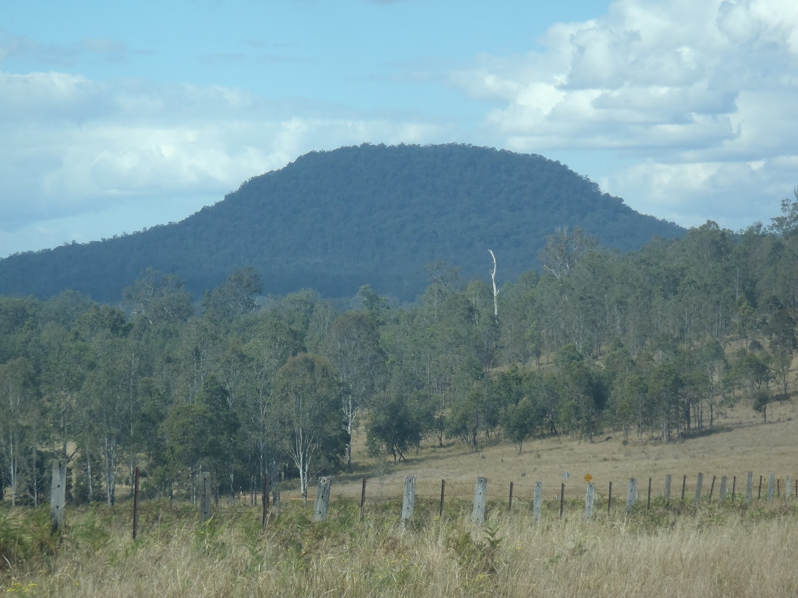
Layers of pyroclastics and volcaniclastic of the Chillingham Volcanics
(Murwillimbah - Kyogle Road)


The Chillingham Volcanics have been studied in a fair amount of detail by Roach (1997) in his thesis. This included all of the Triassic volcanic rocks from Brisbane to Uki. So, obviously there is a relationship with the rocks of the southern Queensland, Indeed Roach (1997) indicates that the Brisbane Tuff is a deposit of volcanic rock of rhyolitic composition. The Brisbane Tuff is most well known by the Kangaroo Point Cliffs opposite the Brisbane River in Brisbane City and was erupted during the same general period of time as the Chillingham Volcanics.

The Brisbane Tuff provides a miniature version of the Chillingham Volcanics and is well known because the volcanic centre can be identified in the northern suburbs of Brisbane and the tuff was laid down in the valleys that existed in the Palaeozoic aged basement. The situation which lead to the formation of the Brisbane Tuff also developed further west and south where a larger valley now known as the Ipswich Basin was forming. The eruptions occurred in and around the basin as the crust in this area was subsiding during thermal fluctuations and as the basin filled up with volcanic rocks subsidence continued leading to a very thick unit of mostly rhyolite and reworked volcanic rocks (actually a sedimentary rock known as a volcaniclastic rock). So the Chillingham Volcanics are actually the lower most stratigraphic unit in the Ipswich Basin.

The Chillingham volcanics are mainly comprised of rhyolite in the form of lavas, pyroclastic, ash and tuff deposits as well as the above mentioned volcaniclastics. Many volcanic vents are recognised from structural characteristics of the rocks, however, only one area really shows an obvious modern geomorphological character. This area is around Uki and Clarie Hall Dam where eruptions formed a large mass due to the slow moving nature of the lava. Interestingly the northern most parts of the Chillingham Volcanics in Queensland shows us that there was not just rhyolite but also some andesite and even basalt, but in the area between Chillingham and Uki it is pretty much all rhyolite.

Outcrops of the Chillingham volcanics occur over a long distance with the eastern most side of the Ipswich Basin exposed in New South Wales meaning that a band of the Chillingham Volcanics is visible within the eroded valleys of the Tweed Volcano. The band is actually interupted by the Mount Warning Complex which appears to have intruded right along the line of the pre-existing Chillingham Volcanics. Also the volcanics are covered by the Lamington Volcanics of the Tweed Volcano too, both along the Queensland Border and between Clarie Hall Dam and Evans Head. Indeed the Chillingham Volcanics appears to change composition through this area with authors such as Smith et al 1997 and Cotter 1998 identifying andestite and basalt at Evans Head and an area near Wardell.

The Chillingham Volcanics overlie palaeozoic aged rocks of the Beenleigh Block, mainly rocks of the Neranleigh-Fernvale Group. The overlying rocks are more components of the Ipswich Basin such as the Ipswich Coal Measures and its equivalent (such as the Evans Head Coal Measures).

Although I have said that the Chillingham Volcanics contain the older rhyolitic rock in this area, there are actually still older rhyolites in the region... But I'll talk about those rocks in a future post.

References/Bibliography:

*Cotter, S. 1998. A Geochemical, Palaeomagnetic and Geomorphological Investigation of the Tertiary Volcanic Sequence of North Eastern New South Wales. Masters Thesis, Southern Cross University.
*Roach, A. 1998. Late Triassic Volcanism of the Ipswich Basin, Masters Thesis, Macquarie University.
*Smith, J.V., Miyake, J., Houston, E.C. 1998. Mesozoic age for volcanic rocks at Evans Head, Northeastern New South Wales. Australian Journal of Earth Sciences V45

Monday, 17 October 2011

'Recent' rhyolite: The Nimbin Rhyolite at Minyon Falls

The rhyolite forms a rugged range around the valley
If you are familiar with the northern rivers you would be aware of grand waterfalls in Nightcap National Park. The grandest (in my opinion) are the Minyon Falls which drop Repentance Creek around 100metres into the gorge below. I remember when you used to be able to stand at the very top and jump over the streams to cross but the National Parks and Wildlife Service of N.S.W. have stopped access (for obvious safety reasons) except at a constructed viewing platform.

Minyon Falls are spectacular. Geologically they represent thick units of rhyolite known as the Nimbin Rhyolite erupted during the later phases of the tweed volcano during the period known as the Cenozoic which was centred on the nearby Mount Warning. Underlying the rhyolite is basalt and andesite of the Lismore Basalt which appears to be from the earlier main phase of eruption from the volcano. At Minyon Falls the Nimbin Rhyolite is greater in thickness than the height of the falls themselves. It mainly shows massive units of rhyolite lava inter-collated with units of volcanic glass (obsidian) darker, but still of similar composition to the rhyolite.

Rhyolite is the volcanic equivalent of granite (which forms underground). It is fine grained due to quick cooling due to its volcanic nature which stops crystals from becoming very large. Rhyolite is silica rich which means that minerals like quartz and feldspar are abundant and other minerals such as olivine that is commonly be present in some of the basalts nearby are absent. The high silica content makes the lava thick and viscus and therefore gas bubbles are commonly trapped in the lava and banding of the lava flows becomes more frequently observed. The composition of rhyolite often leads to violent eruptions which are represented by ash and volcanic glass which can form thick layers themselves (some of these glass layers are present at Minyon Falls too).

If you are fit enough for a big walk at the base of the Minyon Falls are unusual structures which show how viscus the lava can be. Brittle-ductile structures are evident to the trained eye in this area. Smith (1996) identified these as essentially these are structures which show that when the lava was flowing the lava had become almost solid with many small faults mixed in with folding and flow banding of the lava.

Minyon Falls with the rhyolite cliff visible
Fresh rhyolite lava is a hard, erosion resistant rock and for this reason is why we have rugged ranges surrounding the central core of the Tweed Volcano at Mount Warning. The highest portions of the volcano including the rhyolite have been eroded away from the area now occupied by the Tweed Valley. Most of the volcanic rock in the valley has been eroded right down to the much older Paleozoic aged rocks of the Neranleigh Fernvale Group. The creeks that start in the ranges such as Repentance Creek have slowly cut back the face of the rhyolite cliffs as the velocity and power of the waterfalls slowly breaks grains from the rocks and creates cracks that break off in large rock falls.

Are you in Northern Rivers? It might be worth climbing Mount Warning to see the shape of the Tweed Valley and the remnants of the shield volcano in the cliffs seen all around the edge of the valley. Or maybe a trip into the Nightcap Ranges to Minyon Falls. Have a look at rocky creek beds to see exposed rock and many structures.

Note: There are two large areas of rhyolite in the Northern Rivers. These are the Nimbin Rhyolite of Cenozoic age discussed in this post but there is also rhyolites within the Chillingham Volcanics which are much older and are probably the basal units of the Mesozoic Ipswich Basin.

References/Bibliography:

*Duggan, P.B., Mason, D.R. 1978. Stratigraphy of the Lamington Volcanics in Far Northeastern New South Wales. Australian Journal of Earth Sciences V25.
*Smith, J.V. 1996.Ductile-brittle transition structures in the basal shear zone of a rhyolite lava flow, eastern Australia. Journal of Volcanology and Geothermal Research V72
*Smith, J.V. , Houston, E.C. 1995. Structure of lava flows of the Nimbin Rhyolite, northeast New South Wales. Australian Journal of Earth Sciences V42(1) p69-74.